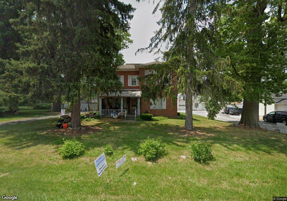
2064 S State Route 53 Tiffin, OH 44883
Estimated Value: $234,000 - $322,000
4
Beds
3
Baths
2,401
Sq Ft
$114/Sq Ft
Est. Value
About This Home
This home is located at 2064 S State Route 53, Tiffin, OH 44883 and is currently estimated at $274,895, approximately $114 per square foot. 2064 S State Route 53 is a home with nearby schools including Hopewell-Loudon Local Elementary School, North Central Academy - Fremont, and Calvert Catholic Elementary School.
Ownership History
Date
Name
Owned For
Owner Type
Purchase Details
Closed on
Sep 16, 2003
Sold by
Borkosky Sharon Rose
Bought by
R Investments Llc
Current Estimated Value
Purchase Details
Closed on
Aug 28, 2003
Sold by
Behm Edward G
Bought by
Borkosky Sharon Rose
Purchase Details
Closed on
Feb 18, 1998
Sold by
Behm Edward G
Bought by
Behm Edward G
Purchase Details
Closed on
Jul 24, 1996
Sold by
Staib Paul D
Bought by
Behm Edward G
Purchase Details
Closed on
Feb 1, 1989
Purchase Details
Closed on
Aug 1, 1986
Create a Home Valuation Report for This Property
The Home Valuation Report is an in-depth analysis detailing your home's value as well as a comparison with similar homes in the area
Home Values in the Area
Average Home Value in this Area
Purchase History
| Date | Buyer | Sale Price | Title Company |
|---|---|---|---|
| R Investments Llc | $194,000 | -- | |
| Borkosky Sharon Rose | -- | -- | |
| Behm Edward G | -- | -- | |
| Behm Edward G | $5,500 | -- | |
| -- | $11,000 | -- | |
| -- | $6,000 | -- |
Source: Public Records
Tax History Compared to Growth
Tax History
| Year | Tax Paid | Tax Assessment Tax Assessment Total Assessment is a certain percentage of the fair market value that is determined by local assessors to be the total taxable value of land and additions on the property. | Land | Improvement |
|---|---|---|---|---|
| 2024 | $2,297 | $60,340 | $12,090 | $48,250 |
| 2023 | $2,298 | $60,340 | $12,090 | $48,250 |
| 2022 | $1,862 | $45,070 | $8,340 | $36,730 |
| 2021 | $1,872 | $45,070 | $8,340 | $36,730 |
| 2020 | $1,881 | $45,070 | $8,341 | $36,729 |
| 2019 | $1,719 | $40,779 | $9,671 | $31,108 |
| 2018 | $1,761 | $40,779 | $9,671 | $31,108 |
| 2017 | $1,529 | $40,779 | $9,671 | $31,108 |
| 2016 | $1,285 | $31,949 | $8,957 | $22,992 |
| 2015 | $1,268 | $31,949 | $8,957 | $22,992 |
| 2014 | $1,204 | $31,949 | $8,957 | $22,992 |
| 2013 | $1,263 | $30,776 | $8,957 | $21,819 |
Source: Public Records
Map
Nearby Homes
- 1590 Meadowlake Dr
- 2351 S State Route 53
- 841 S Sandusky St
- 185 Longfellow Dr
- 0 County Road 54 Unit 225023228
- 0 County Road 54 Unit 20242258
- 153 Longfellow Dr
- 2050 W County Road 52
- 2465 S County Road 19
- 2483 W County Road 52
- 106 Sycamore Woods Ln
- 2031 W County Road 52
- 378 Lelar St
- 269 Lelar St
- 137 Hampden Park
- 0 W Market St
- 115 Lindsay Ave
- 0 Shaffer Park Dr Unit 20251435
- 314 S Sandusky St
- 221 Beechwood Dr
- 2044 Ohio 53
- 2044 S State Route 53
- 2010 S State Route 53
- 2051 S State Route 53
- 2065 S State Route 53
- 1857 S State Route 53
- 0 S State Route 53
- 2085 S State Route 53
- 2017 S State Route 53
- 2119 S State Route 53
- 1720 Meadowlake Dr
- 1740 Meadowlake Dr
- 1750 Meadowlake Dr
- 1700 Meadowlake Dr
- 1680 Meadowlake Dr
- 1760 Meadowlake Dr
- 1600 Meadowlake Dr
- 1927 S State Route 53
- 2153 S State Route 53
- 1741 Meadowlake Dr