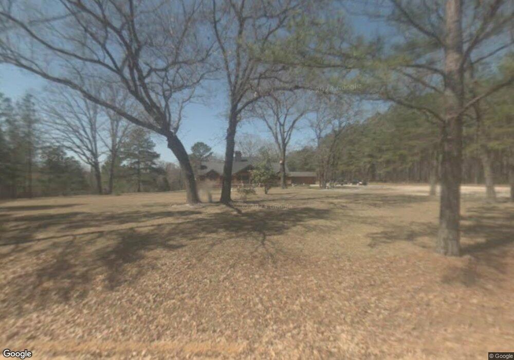
2064 Stoopto Rd Sylvania, GA 30467
Estimated Value: $441,934 - $546,000
7
Beds
4
Baths
6,194
Sq Ft
$77/Sq Ft
Est. Value
About This Home
This home is located at 2064 Stoopto Rd, Sylvania, GA 30467 and is currently estimated at $479,484, approximately $77 per square foot. 2064 Stoopto Rd is a home located in Screven County with nearby schools including Screven County Elementary School, Screven County Middle School, and Screven County High School.
Ownership History
Date
Name
Owned For
Owner Type
Purchase Details
Closed on
Mar 8, 2019
Sold by
Sheley William
Bought by
Mock Ralph Nicholus and Mock Amber Crosby
Current Estimated Value
Home Financials for this Owner
Home Financials are based on the most recent Mortgage that was taken out on this home.
Original Mortgage
$229,500
Interest Rate
4.4%
Mortgage Type
Commercial
Purchase Details
Closed on
Oct 5, 2007
Sold by
Sommers Cecil Franklin
Bought by
Sheley Anna and Sheley William
Purchase Details
Closed on
Oct 10, 1994
Sold by
Sommers Cecil Franklin
Bought by
Sommers Cecil Frankl
Create a Home Valuation Report for This Property
The Home Valuation Report is an in-depth analysis detailing your home's value as well as a comparison with similar homes in the area
Home Values in the Area
Average Home Value in this Area
Purchase History
| Date | Buyer | Sale Price | Title Company |
|---|---|---|---|
| Mock Ralph Nicholus | $255,000 | -- | |
| Sheley Anna | $300,000 | -- | |
| Sommers Cecil Frankl | -- | -- |
Source: Public Records
Mortgage History
| Date | Status | Borrower | Loan Amount |
|---|---|---|---|
| Closed | Mock Ralph Nicholus | $229,500 |
Source: Public Records
Tax History Compared to Growth
Tax History
| Year | Tax Paid | Tax Assessment Tax Assessment Total Assessment is a certain percentage of the fair market value that is determined by local assessors to be the total taxable value of land and additions on the property. | Land | Improvement |
|---|---|---|---|---|
| 2025 | $3,757 | $200,960 | $12,240 | $188,720 |
| 2024 | $3,757 | $135,144 | $9,280 | $125,864 |
| 2023 | $3,921 | $135,144 | $9,280 | $125,864 |
| 2022 | $3,433 | $117,664 | $8,920 | $108,744 |
| 2021 | $3,280 | $107,024 | $8,920 | $98,104 |
| 2020 | $3,228 | $103,556 | $8,520 | $95,036 |
| 2019 | $3,165 | $102,000 | $8,520 | $93,480 |
| 2018 | $3,205 | $111,920 | $8,520 | $103,400 |
| 2017 | $3,205 | $111,920 | $8,520 | $103,400 |
| 2016 | $2,761 | $91,800 | $8,520 | $83,280 |
| 2015 | -- | $88,840 | $8,520 | $80,320 |
| 2014 | -- | $89,000 | $8,520 | $80,480 |
| 2013 | -- | $91,120 | $8,520 | $82,600 |
Source: Public Records
Map
Nearby Homes
- 0 Honey Rd Unit 10510039
- 0 S Fork Rd
- 731 Deer Run Rd
- 0 Ford Rd Unit 10638265
- 336 Jenk Hill Rd
- 372 Pye Rd
- 711 Scrub Oak Rd
- 596 Arnett School Rd
- 736 Arnett School Rd
- 455 Best Bridge Rd
- 208 Oak Grove Ln
- 480 Best Bridge Rd
- 0 Best Bridge Rd Unit 10585900
- 0 Best Bridge Rd Unit SA336787
- 125 Main St
- 149 Main St
- 4273 Millen Hwy
- 0 Industrial Park Rd Unit 19161353
- 211 Camelia Dr
- 104 Wildwood St