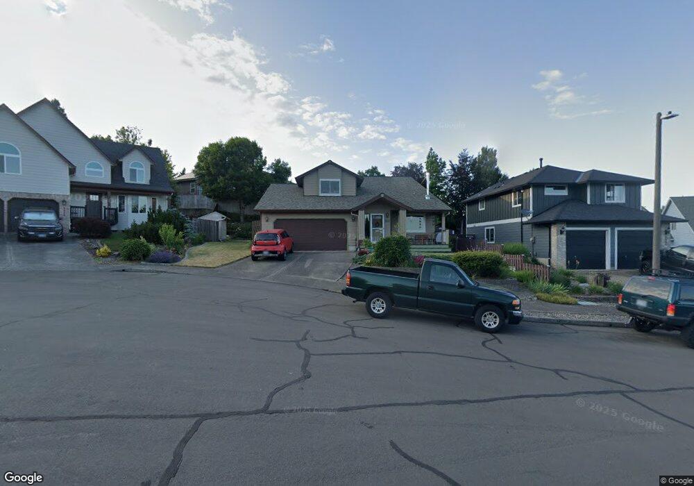
2064 SW Sunrise Cir Troutdale, OR 97060
Sunrise NeighborhoodEstimated Value: $503,000 - $599,000
3
Beds
3
Baths
2,063
Sq Ft
$265/Sq Ft
Est. Value
About This Home
This home is located at 2064 SW Sunrise Cir, Troutdale, OR 97060 and is currently estimated at $547,478, approximately $265 per square foot. 2064 SW Sunrise Cir is a home located in Multnomah County with nearby schools including Sweetbriar Elementary School, Walt Morey Middle School, and Reynolds High School.
Ownership History
Date
Name
Owned For
Owner Type
Purchase Details
Closed on
Apr 29, 2025
Sold by
Nelson Robert E
Bought by
Robert E Nelson Family Trust and Nelson
Current Estimated Value
Purchase Details
Closed on
Nov 22, 2011
Sold by
Blanchard Timothy D
Bought by
Nelson Robert E
Home Financials for this Owner
Home Financials are based on the most recent Mortgage that was taken out on this home.
Original Mortgage
$213,150
Interest Rate
4.09%
Mortgage Type
VA
Purchase Details
Closed on
Oct 27, 1995
Sold by
Cordell Construction Inc
Bought by
Blanchard Timothy D and Blanchard Shelly R
Home Financials for this Owner
Home Financials are based on the most recent Mortgage that was taken out on this home.
Original Mortgage
$170,340
Interest Rate
7.59%
Mortgage Type
Assumption
Create a Home Valuation Report for This Property
The Home Valuation Report is an in-depth analysis detailing your home's value as well as a comparison with similar homes in the area
Home Values in the Area
Average Home Value in this Area
Purchase History
| Date | Buyer | Sale Price | Title Company |
|---|---|---|---|
| Robert E Nelson Family Trust | -- | None Listed On Document | |
| Robert E Nelson Family Trust | -- | None Listed On Document | |
| Nelson Robert E | $230,000 | Wfg Title | |
| Blanchard Timothy D | $167,000 | First American Title Ins Co |
Source: Public Records
Mortgage History
| Date | Status | Borrower | Loan Amount |
|---|---|---|---|
| Previous Owner | Nelson Robert E | $213,150 | |
| Previous Owner | Blanchard Timothy D | $170,340 |
Source: Public Records
Tax History Compared to Growth
Tax History
| Year | Tax Paid | Tax Assessment Tax Assessment Total Assessment is a certain percentage of the fair market value that is determined by local assessors to be the total taxable value of land and additions on the property. | Land | Improvement |
|---|---|---|---|---|
| 2025 | $5,519 | $299,470 | -- | -- |
| 2024 | $5,215 | $290,750 | -- | -- |
| 2023 | $5,215 | $282,290 | $0 | $0 |
| 2022 | $4,956 | $274,070 | $0 | $0 |
| 2021 | $4,841 | $266,090 | $0 | $0 |
| 2020 | $4,528 | $258,340 | $0 | $0 |
| 2019 | $4,346 | $250,820 | $0 | $0 |
| 2018 | $4,317 | $243,520 | $0 | $0 |
| 2017 | $4,307 | $236,430 | $0 | $0 |
| 2016 | $4,163 | $229,550 | $0 | $0 |
| 2015 | $4,059 | $222,870 | $0 | $0 |
| 2014 | $3,946 | $216,380 | $0 | $0 |
Source: Public Records
Map
Nearby Homes
- 2020 SW Laura Ct
- 2154 SE Sandy Ct
- 665 SW 24th St
- 839 SW Grant Way
- 1226 SW Hensley Rd
- 2511 S Troutdale Rd
- 1021 SW 24th St
- 821 SW 14th St
- 724 SW 28th St
- 809 SW Crestview Way
- 735 SW Sunset Way
- 2505 SE Clark Ct
- 621 SE 11th Cir
- 1427 SW 24th St
- 2521 SE Clark Ct
- 1212 SW Edgefield Ave
- 2846 SW Faith Ct
- 1019 SE 27th St
- 2326 SW Mcginnis Ave
- 1648 SE Lewellyn Ave
- 2052 SW Sunrise Cir
- 2076 SW Sunrise Cir
- 1884 SW Haskins Ct
- 1872 SW Haskins Ct
- 2088 SW Sunrise Cir
- 2040 SW Sunrise Cir
- 1860 SW Haskins Ct
- 2057 SW Sunrise Cir
- 1896 SW Haskins Ct
- 384 SW 19th Place
- 2075 SW Sunrise Cir
- 2038 SW Sunrise Cir
- 2069 SW Sunrise Cir
- 2069 SW Sunrise Cr
- 1858 SW Haskins Ct
- 2026 SW Sunrise Cir
- 1860 SW Kings Byway
- 1899 SW Haskins Ct
- 2005 SW Sunrise Cir
- 1899 SW Haskins Ct Reduced