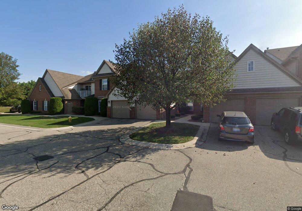
20640 Dunham Rd Clinton Township, MI 48038
Estimated Value: $248,000 - $278,000
3
Beds
2
Baths
1,751
Sq Ft
$150/Sq Ft
Est. Value
About This Home
This home is located at 20640 Dunham Rd, Clinton Township, MI 48038 and is currently estimated at $261,984, approximately $149 per square foot. 20640 Dunham Rd is a home located in Macomb County with nearby schools including Erie Elementary School, Wyandot Middle School, and Chippewa Valley High School.
Ownership History
Date
Name
Owned For
Owner Type
Purchase Details
Closed on
Jan 28, 2020
Sold by
Longo Paolo and Paolo Longo Revocable Trust
Bought by
Brown Shawndy Ann
Current Estimated Value
Purchase Details
Closed on
Apr 29, 2019
Sold by
Ettore And Gabriela Longo Revocable Tr
Bought by
Paolo Longo Revocable Trust and Ettore & Gabriela Longo Revocable Trust
Purchase Details
Closed on
Dec 30, 2014
Sold by
Lango Ettore
Bought by
Ettore And Gabriela Longo Revocable Trus and Longo Ada Gabriela
Purchase Details
Closed on
Oct 7, 2010
Sold by
Longo Building Company
Bought by
Longo Paolo and Longo Ettore
Purchase Details
Closed on
Oct 31, 2002
Sold by
Valley Ridge Llc
Bought by
Longo Paolo
Create a Home Valuation Report for This Property
The Home Valuation Report is an in-depth analysis detailing your home's value as well as a comparison with similar homes in the area
Home Values in the Area
Average Home Value in this Area
Purchase History
| Date | Buyer | Sale Price | Title Company |
|---|---|---|---|
| Brown Shawndy Ann | $175,000 | Michigan Title Ins Agcy Inc | |
| Paolo Longo Revocable Trust | -- | None Available | |
| Ettore And Gabriela Longo Revocable Trus | -- | None Available | |
| Longo Paolo | -- | Greco | |
| Longo Paolo | $130,000 | -- |
Source: Public Records
Mortgage History
| Date | Status | Borrower | Loan Amount |
|---|---|---|---|
| Closed | Longo Paolo | -- |
Source: Public Records
Tax History Compared to Growth
Tax History
| Year | Tax Paid | Tax Assessment Tax Assessment Total Assessment is a certain percentage of the fair market value that is determined by local assessors to be the total taxable value of land and additions on the property. | Land | Improvement |
|---|---|---|---|---|
| 2025 | $4,069 | $124,300 | $0 | $0 |
| 2024 | $2,424 | $111,700 | $0 | $0 |
| 2023 | $2,299 | $98,600 | $0 | $0 |
| 2022 | $3,686 | $87,600 | $0 | $0 |
| 2021 | $3,674 | $86,900 | $0 | $0 |
| 2020 | $1,242 | $80,000 | $0 | $0 |
| 2019 | $2,835 | $77,200 | $0 | $0 |
| 2018 | $2,775 | $75,800 | $0 | $0 |
| 2017 | $2,740 | $58,900 | $10,000 | $48,900 |
| 2016 | $2,720 | $58,900 | $0 | $0 |
| 2015 | -- | $50,700 | $0 | $0 |
| 2014 | -- | $49,500 | $0 | $0 |
| 2011 | -- | $47,900 | $0 | $47,900 |
Source: Public Records
Map
Nearby Homes
- 20654 Dunham Rd Unit 24
- 20561 Longwood Dr Unit 64
- 20757 Cueter Ln
- 44000 Dunham Ct
- 20465 Saint Laurence Dr
- 20784 Cannon Dr
- 44130 Cadburry Dr
- 43440 Riverbend Blvd
- 0 Clinton River Rd Unit 20251013874
- 43378 Riverbend Blvd
- 43377 Rivergate Dr
- 20387 Villa Grande Cir Unit 19
- 43363 Herring Dr
- 20445 Villa Grande Cir Unit 48
- 19790 Westchester Dr Unit 11
- 43373 Brooks Dr
- 20194 Calumet Dr
- 42680 Chippewa Dr Unit 28
- 43274 Hillsboro Dr
- 42328 Sheridan Ct
- 20630 Dunham Rd Unit 36
- 20626 Dunham Rd Unit 35
- 20644 Dunham Rd
- 20648 Dunham Rd
- 20632 Dunham Rd Unit 30
- 20628 Dunham Rd
- 20636 Dunham Rd
- 20638 Dunham Rd
- 20642 Dunham Rd
- 20646 Dunham Rd
- 20644 Dunham Rd Unit 32 BLDG C
- 20644 Dunham Rd Unit C 32
- 20636 Dunham Rd Unit 28
- 20644 Dunham Rd
- 20644 Dunham Rd Unit 32 BLDG C
- 20634 Dunham Rd Unit C34
- 20668 Dunham Rd
- 20656 Dunham Unit 18 Rd Unit 18
- 20656 Dunham Unit 18 Rd
- 20618 Dunham Rd