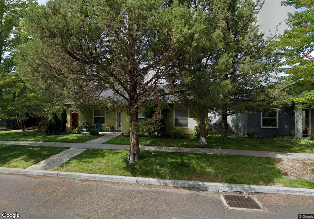
20646 Wild Rose Ln Bend, OR 97702
Old Farm District NeighborhoodEstimated Value: $498,356 - $505,000
3
Beds
2
Baths
1,200
Sq Ft
$417/Sq Ft
Est. Value
About This Home
This home is located at 20646 Wild Rose Ln, Bend, OR 97702 and is currently estimated at $500,339, approximately $416 per square foot. 20646 Wild Rose Ln is a home located in Deschutes County with nearby schools including R.E. Jewell Elementary School, High Desert Middle School, and Deschutes River Montessori School.
Ownership History
Date
Name
Owned For
Owner Type
Purchase Details
Closed on
Feb 4, 2021
Sold by
Craig Michael W
Bought by
Craig Michael W and Craig Barbara Lee
Current Estimated Value
Purchase Details
Closed on
Apr 19, 2005
Sold by
Thayer Shirley K
Bought by
Craig Michael W
Home Financials for this Owner
Home Financials are based on the most recent Mortgage that was taken out on this home.
Original Mortgage
$172,690
Outstanding Balance
$88,880
Interest Rate
5.84%
Mortgage Type
FHA
Estimated Equity
$411,459
Create a Home Valuation Report for This Property
The Home Valuation Report is an in-depth analysis detailing your home's value as well as a comparison with similar homes in the area
Home Values in the Area
Average Home Value in this Area
Purchase History
| Date | Buyer | Sale Price | Title Company |
|---|---|---|---|
| Craig Michael W | -- | None Available | |
| Craig Michael W | $175,400 | Deschutes County Title Co |
Source: Public Records
Mortgage History
| Date | Status | Borrower | Loan Amount |
|---|---|---|---|
| Open | Craig Michael W | $172,690 |
Source: Public Records
Tax History Compared to Growth
Tax History
| Year | Tax Paid | Tax Assessment Tax Assessment Total Assessment is a certain percentage of the fair market value that is determined by local assessors to be the total taxable value of land and additions on the property. | Land | Improvement |
|---|---|---|---|---|
| 2025 | $2,956 | $174,970 | -- | -- |
| 2024 | $2,844 | $169,880 | -- | -- |
| 2023 | $2,637 | $164,940 | $0 | $0 |
| 2022 | $2,460 | $155,480 | $0 | $0 |
| 2021 | $2,464 | $150,960 | $0 | $0 |
| 2020 | $2,338 | $150,960 | $0 | $0 |
| 2019 | $2,273 | $146,570 | $0 | $0 |
| 2018 | $2,209 | $142,310 | $0 | $0 |
| 2017 | $2,210 | $138,170 | $0 | $0 |
| 2016 | $2,111 | $134,150 | $0 | $0 |
| 2015 | $2,054 | $130,250 | $0 | $0 |
| 2014 | $1,996 | $126,460 | $0 | $0 |
Source: Public Records
Map
Nearby Homes
- 20650 Honeysuckle Ln
- 61142 Brookhollow Dr
- 20653 Songbird Ln
- Hawthorne Plan at Monrovia
- Pacific Plan at Monrovia
- 20592 Button Brush Ave
- Ballard Plan at Monrovia
- Porter Plan at Monrovia
- 61089 SE Echo Lake Ct
- 20663 Jayhawk Ln
- 61058 SE Marble Mountain Ln
- 61147 Splendor Ln
- 61151 Splendor Ln
- 61160 Splendor Ln
- 61159 Splendor Ln
- 61172 Splendor Ln
- 20743 Blacksmith Cir
- 61174 SE Berkshire Way Unit Lot 109
- 61178 SE Berkshire Way Unit Lot 110
- 20580 Klahani Dr
- 20640 Wild Rose Ln
- 20652 Wild Rose Ln
- 20643 Honeysuckle Ln
- 20649 Honeysuckle Ln
- 20637 Honeysuckle Ln
- 20634 Wild Rose Ln
- 20658 Wild Rose Ln
- 20655 Honeysuckle Ln
- 20631 Honeysuckle Ln
- 20645 Wild Rose Ln
- 20639 Wild Rose Ln
- 20651 Wild Rose Ln
- 20664 Wild Rose Ln
- 20628 Wild Rose Ln
- 20633 Wild Rose Ln
- 20657 Wild Rose Ln
- 20625 Honeysuckle Ln
- 20663 Wild Rose Ln
- 20627 Wild Rose Ln