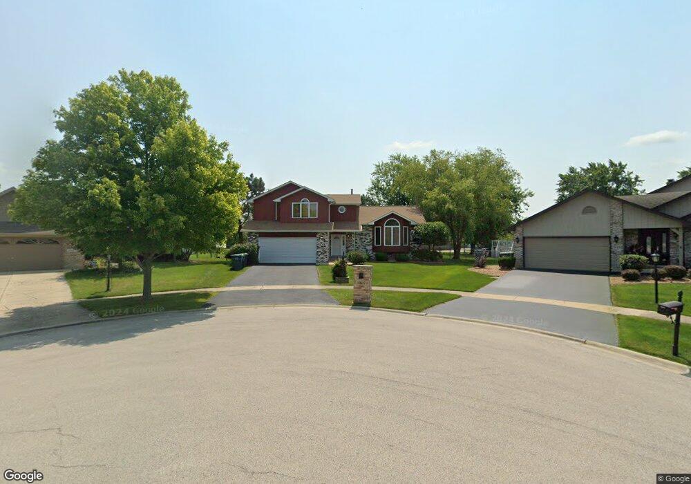
20647 S Ivy Path Frankfort, IL 60423
Frankfort Square NeighborhoodEstimated Value: $444,717 - $461,000
3
Beds
3
Baths
3,300
Sq Ft
$138/Sq Ft
Est. Value
About This Home
This home is located at 20647 S Ivy Path, Frankfort, IL 60423 and is currently estimated at $455,179, approximately $137 per square foot. 20647 S Ivy Path is a home located in Will County with nearby schools including Indian Trail Elementary School, Summit Hill Junior High School, and Lincoln-Way East High School.
Ownership History
Date
Name
Owned For
Owner Type
Purchase Details
Closed on
Nov 7, 2024
Sold by
Crusing Marshall and Scott-Crusing Laura
Bought by
Marshall And Laura Crusing Trust
Current Estimated Value
Purchase Details
Closed on
May 11, 2006
Sold by
Smith Randy C and Smith Regina T
Bought by
Crusing Marshall and Crusing Laura
Home Financials for this Owner
Home Financials are based on the most recent Mortgage that was taken out on this home.
Original Mortgage
$336,900
Interest Rate
10.37%
Mortgage Type
Purchase Money Mortgage
Create a Home Valuation Report for This Property
The Home Valuation Report is an in-depth analysis detailing your home's value as well as a comparison with similar homes in the area
Home Values in the Area
Average Home Value in this Area
Purchase History
| Date | Buyer | Sale Price | Title Company |
|---|---|---|---|
| Marshall And Laura Crusing Trust | -- | None Listed On Document | |
| Marshall And Laura Crusing Trust | -- | None Listed On Document | |
| Crusing Marshall | $337,000 | First American Title |
Source: Public Records
Mortgage History
| Date | Status | Borrower | Loan Amount |
|---|---|---|---|
| Previous Owner | Crusing Marshall | $336,900 |
Source: Public Records
Tax History Compared to Growth
Tax History
| Year | Tax Paid | Tax Assessment Tax Assessment Total Assessment is a certain percentage of the fair market value that is determined by local assessors to be the total taxable value of land and additions on the property. | Land | Improvement |
|---|---|---|---|---|
| 2024 | $11,618 | $145,744 | $24,637 | $121,107 |
| 2023 | $11,618 | $130,163 | $22,003 | $108,160 |
| 2022 | $10,277 | $118,556 | $20,041 | $98,515 |
| 2021 | $9,638 | $110,914 | $18,749 | $92,165 |
| 2020 | $9,491 | $107,789 | $18,221 | $89,568 |
| 2019 | $9,176 | $104,904 | $17,733 | $87,171 |
| 2018 | $8,840 | $101,888 | $17,223 | $84,665 |
| 2017 | $8,655 | $99,510 | $16,821 | $82,689 |
| 2016 | $8,389 | $96,098 | $16,244 | $79,854 |
| 2015 | $8,089 | $92,714 | $15,672 | $77,042 |
| 2014 | $8,089 | $92,069 | $15,563 | $76,506 |
| 2013 | $8,089 | $93,263 | $15,765 | $77,498 |
Source: Public Records
Map
Nearby Homes
- 7257 W Hickory Creek Dr
- 7223 W Mathews Dr
- 20513 S Acorn Ridge Dr
- 20552 S Frankfort Square Rd
- 7626 W Hickory Creek Dr
- 20729 S Hickory Creek Ct
- 7639 W Juniper Ct
- 20347 S Grand Prairie Ln
- 20349 S Green Meadow Ln
- 20206 S Frankfort Square Rd Unit A
- 7752 W Almond Ct Unit 135
- 20130 S Frankfort Square Rd
- 20137 S Hampton Ct Unit A
- 20216 S Greenfield Ln
- 7758 W Kingston Dr
- 7800 W Kingston Dr
- 21257 S 79th Ave
- 21375 Georgetown Rd
- 8237 Auburn Ln
- 21122 S Hillside Rd
- 20643 S Ivy Path
- 7455 W Silo Dr
- 20637 S Ivy Path
- 7463 W Silo Dr
- 7434 W Hawthorne Ln
- 7448 W Hawthorne Ln
- 7442 W Hawthorne Ln
- 7456 W Hawthorne Ln
- 20632 S Ivy Path
- 7462 W Hawthorne Ln
- 7505 W Silo Dr Unit 2
- 7462 W Silo Dr Unit 2
- 7428 W Hawthorne Ln
- 7502 W Hawthorne Ln
- 20621 S Ivy Path
- 7504 W Silo Dr Unit 2
- 7513 W Silo Dr
- 7510 W Hawthorne Ln
- 20708 S Oak Ln
- 20615 S Ivy Path