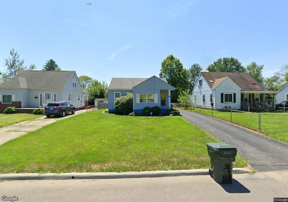
2065 Argyle Dr Columbus, OH 43219
Woodland Holt NeighborhoodEstimated Value: $117,349 - $141,000
3
Beds
1
Bath
672
Sq Ft
$194/Sq Ft
Est. Value
About This Home
This home is located at 2065 Argyle Dr, Columbus, OH 43219 and is currently estimated at $130,087, approximately $193 per square foot. 2065 Argyle Dr is a home located in Franklin County with nearby schools including South Mifflin Stem Academy (K-6), Linden-Mckinley Stem School On Arcadia, and Cesar Chavez College Preparatory School.
Ownership History
Date
Name
Owned For
Owner Type
Purchase Details
Closed on
Jun 21, 1996
Sold by
Ligon Vincent W
Bought by
Ronald N Wilder
Current Estimated Value
Home Financials for this Owner
Home Financials are based on the most recent Mortgage that was taken out on this home.
Original Mortgage
$45,399
Outstanding Balance
$1,677
Interest Rate
8.29%
Mortgage Type
FHA
Estimated Equity
$128,410
Purchase Details
Closed on
Nov 4, 1992
Purchase Details
Closed on
Mar 19, 1992
Create a Home Valuation Report for This Property
The Home Valuation Report is an in-depth analysis detailing your home's value as well as a comparison with similar homes in the area
Home Values in the Area
Average Home Value in this Area
Purchase History
| Date | Buyer | Sale Price | Title Company |
|---|---|---|---|
| Ronald N Wilder | $45,000 | -- | |
| -- | $26,000 | -- | |
| -- | -- | -- |
Source: Public Records
Mortgage History
| Date | Status | Borrower | Loan Amount |
|---|---|---|---|
| Open | Ronald N Wilder | $45,399 |
Source: Public Records
Tax History
| Year | Tax Paid | Tax Assessment Tax Assessment Total Assessment is a certain percentage of the fair market value that is determined by local assessors to be the total taxable value of land and additions on the property. | Land | Improvement |
|---|---|---|---|---|
| 2025 | $1,337 | $29,790 | $8,370 | $21,420 |
| 2024 | $1,337 | $29,790 | $8,370 | $21,420 |
| 2023 | $1,320 | $29,785 | $8,365 | $21,420 |
| 2022 | $738 | $14,220 | $2,420 | $11,800 |
| 2021 | $739 | $14,220 | $2,420 | $11,800 |
| 2020 | $740 | $14,220 | $2,420 | $11,800 |
| 2019 | $669 | $11,030 | $1,960 | $9,070 |
| 2018 | $792 | $11,030 | $1,960 | $9,070 |
| 2017 | $669 | $11,030 | $1,960 | $9,070 |
| 2016 | $1,009 | $15,230 | $2,700 | $12,530 |
| 2015 | $916 | $15,230 | $2,700 | $12,530 |
| 2014 | $918 | $15,230 | $2,700 | $12,530 |
| 2013 | $503 | $16,905 | $2,975 | $13,930 |
Source: Public Records
Map
Nearby Homes
- 2131 Argyle Dr
- 2145 Argyle Dr
- 2144 Toni St
- 1642 Marina Dr
- 1816 Brentnell Ave
- 1862 Argyle Dr
- 1477 Dove Dr
- 1991 Woodland Ave
- 1582 Vendome Dr S
- 0 Delbert Rd Unit 225030362
- 2054 Jermain Dr
- 2321 Dunning Ct
- 1805 E 26th Ave
- 2350 Edenburgh Dr S
- 2299 Holt Ave
- 2080 Parkwood Ave Unit 2090
- 0 Bretton Rd Unit 225029828
- 1810 E 26th Ave
- 1331 Woodnell Ave
- 0 Mock Rd
Your Personal Tour Guide
Ask me questions while you tour the home.