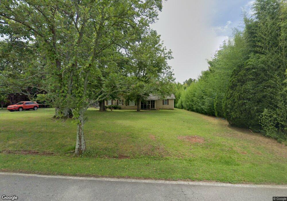
2065 County Line Rd Mansfield, GA 30055
Jasper County NeighborhoodEstimated Value: $165,457 - $417,000
--
Bed
1
Bath
1,632
Sq Ft
$188/Sq Ft
Est. Value
About This Home
This home is located at 2065 County Line Rd, Mansfield, GA 30055 and is currently estimated at $307,614, approximately $188 per square foot. 2065 County Line Rd is a home located in Jasper County with nearby schools including Jasper County Primary School, Washington Park Elementary School, and Jasper County Middle School.
Ownership History
Date
Name
Owned For
Owner Type
Purchase Details
Closed on
Nov 21, 2022
Sold by
Earnest Thomas James
Bought by
Earnest Thomas J and Thomas James Earnest Jr Residuary Tr
Current Estimated Value
Purchase Details
Closed on
Jul 9, 2001
Sold by
Wells Fargo
Bought by
Gresham Michael
Purchase Details
Closed on
Jan 18, 2001
Sold by
Brownlee Will and Brownlee Sher
Bought by
Wells Fargo
Purchase Details
Closed on
Oct 13, 1999
Sold by
Brownlee Will
Bought by
Brownlee Will and Brownlee Sher
Purchase Details
Closed on
Dec 14, 1994
Bought by
Brownlee Will
Create a Home Valuation Report for This Property
The Home Valuation Report is an in-depth analysis detailing your home's value as well as a comparison with similar homes in the area
Home Values in the Area
Average Home Value in this Area
Purchase History
| Date | Buyer | Sale Price | Title Company |
|---|---|---|---|
| Earnest Thomas J | -- | -- | |
| Gresham Michael | $59,000 | -- | |
| Wells Fargo | -- | -- | |
| Brownlee Will | -- | -- | |
| Brownlee Will | $42,500 | -- |
Source: Public Records
Tax History Compared to Growth
Tax History
| Year | Tax Paid | Tax Assessment Tax Assessment Total Assessment is a certain percentage of the fair market value that is determined by local assessors to be the total taxable value of land and additions on the property. | Land | Improvement |
|---|---|---|---|---|
| 2024 | $1,490 | $49,680 | $3,920 | $45,760 |
| 2023 | $1,365 | $44,760 | $3,080 | $41,680 |
| 2022 | $1,281 | $39,480 | $2,520 | $36,960 |
| 2021 | $1,220 | $34,000 | $2,360 | $31,640 |
| 2020 | $1,194 | $31,760 | $1,880 | $29,880 |
| 2019 | $1,182 | $30,120 | $1,840 | $28,280 |
| 2018 | $1,135 | $28,320 | $1,680 | $26,640 |
| 2017 | $1,143 | $27,960 | $1,320 | $26,640 |
| 2016 | $1,058 | $25,080 | $1,160 | $23,920 |
| 2015 | $950 | $20,888 | $1,160 | $19,728 |
| 2014 | $858 | $18,408 | $1,080 | $17,328 |
Source: Public Records
Map
Nearby Homes
- 2902 County Line Rd
- 0 Rocky Creek Rd Unit 10620872
- 246 Rocky Creek Ridge
- 105 Ashwood Dr
- 115 Sourwood Dr
- 31 Sourwood Dr
- 20 Wagon Trail
- 4 County Line Rd
- 833 Bearcreek Trail
- 1042 Stag Run Dr
- 295 Digby Rd
- 52 Armstrong Dr Unit 83
- 72 Armstrong Dr Unit 85
- 62 Armstrong Dr Unit 84
- 82 Armstrong Dr Unit 86
- 122 Armstrong Dr Unit 90
- 132 Armstrong Dr Unit 91
- 92 Armstrong Dr Unit 87
- 1893 Gaithers Rd
- 102 Armstrong Dr Unit 88
- 2095 County Line Rd
- 2121 County Line Rd
- 1991 County Line Rd
- 2000 County Line Rd
- 2000 County Line Rd
- 1865 County Line Rd
- 1869 County Line Rd
- 2301 County Line Rd
- 2098 Henderson Mill Rd
- 2361 County Line Rd
- 1889 County Line Rd
- 2038 Henderson Mill Rd
- 1990 County Line Rd
- 1805 County Line Rd
- 1996 Henderson Mill Rd
- 1011 County Line Trail
- 2366 County Line Rd
- 1950 Henderson Mill Rd
- 1710 County Line Rd
- 1908 Henderson Mill Rd