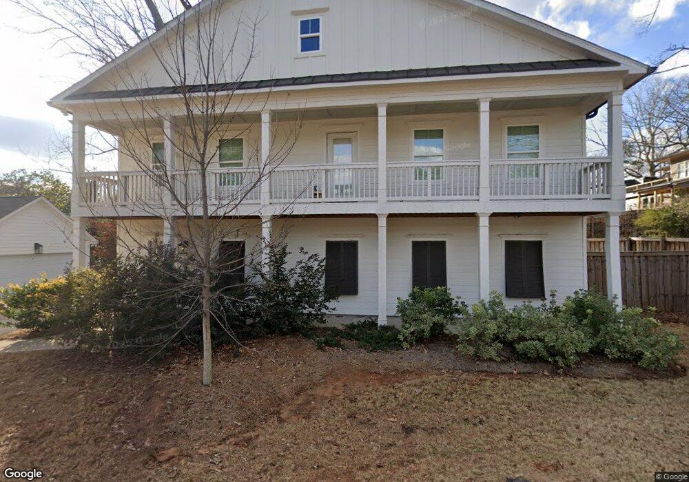
2065 Delphine Way Unit 1 Decatur, GA 30032
Parker NeighborhoodEstimated Value: $406,000 - $547,000
3
Beds
3
Baths
1,840
Sq Ft
$254/Sq Ft
Est. Value
About This Home
This home is located at 2065 Delphine Way Unit 1, Decatur, GA 30032 and is currently estimated at $467,503, approximately $254 per square foot. 2065 Delphine Way Unit 1 is a home located in DeKalb County with nearby schools including McNair Middle School, McNair High School, and Charles Drew Charter School.
Ownership History
Date
Name
Owned For
Owner Type
Purchase Details
Closed on
Oct 13, 2020
Sold by
Armistead Holdings Llc
Bought by
Pritchard Sarah E
Current Estimated Value
Purchase Details
Closed on
Dec 3, 2019
Sold by
Horton Walter
Bought by
Armistead Holdings Llc
Create a Home Valuation Report for This Property
The Home Valuation Report is an in-depth analysis detailing your home's value as well as a comparison with similar homes in the area
Home Values in the Area
Average Home Value in this Area
Purchase History
| Date | Buyer | Sale Price | Title Company |
|---|---|---|---|
| Pritchard Sarah E | $375,250 | -- | |
| Armistead Holdings Llc | $10,000 | -- |
Source: Public Records
Tax History Compared to Growth
Tax History
| Year | Tax Paid | Tax Assessment Tax Assessment Total Assessment is a certain percentage of the fair market value that is determined by local assessors to be the total taxable value of land and additions on the property. | Land | Improvement |
|---|---|---|---|---|
| 2025 | $4,746 | $154,480 | $37,440 | $117,040 |
| 2024 | $5,370 | $171,760 | $37,440 | $134,320 |
| 2023 | $5,370 | $157,480 | $37,440 | $120,040 |
| 2022 | $5,132 | $159,160 | $36,000 | $123,160 |
| 2021 | $4,693 | $140,160 | $36,000 | $104,160 |
| 2020 | $176 | $4,000 | $4,000 | $0 |
| 2019 | $126 | $2,880 | $2,880 | $0 |
| 2018 | $128 | $2,880 | $2,880 | $0 |
| 2017 | $127 | $2,880 | $2,880 | $0 |
| 2016 | $127 | $2,880 | $2,880 | $0 |
| 2014 | $130 | $2,880 | $2,880 | $0 |
Source: Public Records
Map
Nearby Homes
- 2076 Garden Cir
- 2049 Mcafee Rd
- 2009 Delphine Dr
- 2093 Garden Cir
- 2032 Juanita St
- 2053 Juanita St
- 2013 Marco Dr
- 2147 Mcafee Rd
- 2164 Rockhaven Cir
- 2010 2nd Ave
- 2030 Mark Trail
- 2177 Mcafee Rd
- 1942 E Starmount Way
- 1977 Camellia Dr
- 1967 Cogar Dr
- 2128 Mark Trail
- 701 Daniel Ave
- 1926 Second Ave
- 1893 Burning Tree Dr
- 2065 Delphine Way
- 0 Delphine Way Unit 8655023
- 0 Delphine Way Unit 8836135
- 2057 Mcafee Rd
- 2067 Delphine Way 0
- 2056 Garden Cir
- 2065 Mcafee Rd Unit 188
- 2065 Mcafee Rd
- 2071 Mcafee Rd
- 2069 Delphine Way
- 2067 Delphine Way
- 2048 Garden Cir
- 2077 Mcafee Rd
- 2076 Garden Cir Unit 2076
- 2081 Mcafee Rd
- 2041 Mcafee Rd
- 2041 Mcafee Rd Unit 13
- 2088 Garden Cir
- 2040 Garden Cir
- 0 Garden Cir Unit 7257097