Estimated Value: $430,000 - $550,000
3
Beds
3
Baths
1,921
Sq Ft
$249/Sq Ft
Est. Value
About This Home
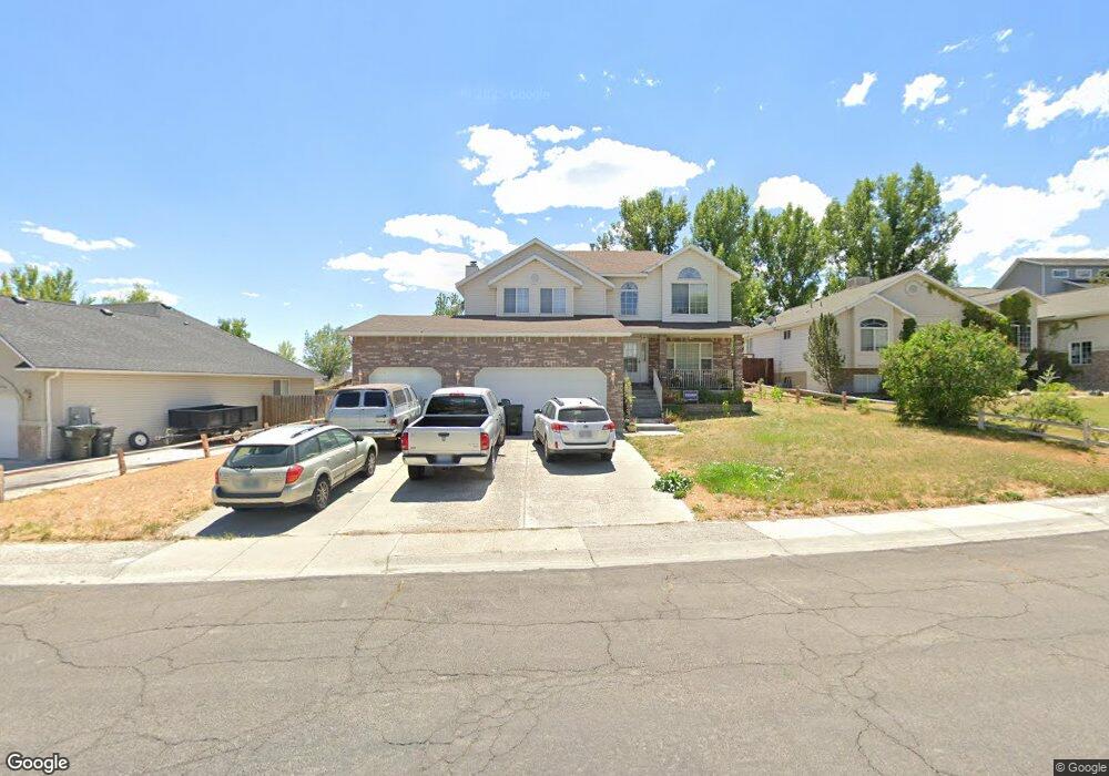
This home is located at 2065 Meadow Ridge Dr, Elko, NV 89801 and is currently estimated at $478,082, approximately $248 per square foot. 2065 Meadow Ridge Dr is a home located in Elko County with nearby schools including Mountain View Elementary School, Adobe Middle School, and Flagview Intermediate School.
Ownership History
Date
Name
Owned For
Owner Type
Purchase Details
Closed on
Dec 27, 2004
Sold by
Lawson Sam L
Bought by
Lawson Sam L and Sam L Lawson Trust
Current Estimated Value
Home Financials for this Owner
Home Financials are based on the most recent Mortgage that was taken out on this home.
Original Mortgage
$206,500
Interest Rate
5.74%
Mortgage Type
New Conventional
Create a Home Valuation Report for This Property
The Home Valuation Report is an in-depth analysis detailing your home's value as well as a comparison with similar homes in the area
Purchase History
| Date | Buyer | Sale Price | Title Company |
|---|---|---|---|
| Lawson Sam L | -- | Stewart Title Co | |
| Lawson Sam L | -- | Stewart Title Co |
Source: Public Records
Mortgage History
| Date | Status | Borrower | Loan Amount |
|---|---|---|---|
| Closed | Lawson Sam L | $206,500 |
Source: Public Records
Tax History
| Year | Tax Paid | Tax Assessment Tax Assessment Total Assessment is a certain percentage of the fair market value that is determined by local assessors to be the total taxable value of land and additions on the property. | Land | Improvement |
|---|---|---|---|---|
| 2025 | $3,757 | $115,695 | $19,950 | $95,745 |
| 2024 | $3,757 | $113,582 | $14,875 | $98,707 |
| 2023 | $3,427 | $107,863 | $14,875 | $92,988 |
| 2022 | $3,328 | $94,051 | $14,875 | $79,176 |
| 2021 | $3,231 | $92,245 | $14,875 | $77,370 |
| 2020 | $3,149 | $90,391 | $12,250 | $78,141 |
| 2019 | $3,047 | $87,462 | $12,250 | $75,212 |
| 2018 | $3,064 | $87,961 | $12,250 | $75,711 |
| 2017 | $3,026 | $86,864 | $12,250 | $74,614 |
| 2016 | $3,075 | $87,593 | $12,250 | $75,343 |
| 2015 | $2,992 | $85,057 | $12,250 | $72,807 |
| 2014 | -- | $81,639 | $12,250 | $69,389 |
Source: Public Records
Map
Nearby Homes
- TBD Spruce Rd
- 2107 Sierra Cir
- 2085 Colonial Dr
- 2607 Platinum Dr
- 2413 5th St
- 2427 5th St
- 2503 5th St
- 2505 5th St
- 2511 5th St
- 072006013 Walnut St
- 2405 Mittry Ave
- 0 Interstate 80
- 2621 Platinum Dr
- 2623 Platinum Dr
- 515 Ash St Unit 1
- 519 Ash St Unit 7
- 523 Ash St Unit 2
- 345 Fir St
- 527 Ash St Unit 8
- 531 Ash St Unit 3
- 2061 Meadow Ridge Dr
- 2069 Meadow Ridge Dr
- 2057 Meadow Ridge Dr
- 202 Aerie Ln
- 2073 Meadow Ridge Dr
- 2070 Meadow Ridge Dr
- 203 Raptor Ct
- 2053 Meadow Ridge Dr
- 2077 Meadow Ridge Dr
- 2074 Meadow Ridge Dr
- 206 Aerie Ln
- 2078 Meadow Ridge Dr
- 2081 Meadow Ridge Dr
- 202 Raptor Ct
- 207 Raptor Ct
- 210 Aerie Ln
- 215 Aerie Ln
- 2082 Meadow Ridge Dr
- 209 Raptor Ct
- 219 Aerie Ln
Your Personal Tour Guide
Ask me questions while you tour the home.