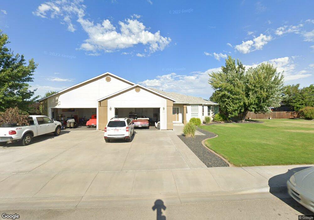
2065 N Haskett St Mountain Home, ID 83647
Estimated Value: $576,000 - $703,000
3
Beds
3
Baths
3,057
Sq Ft
$209/Sq Ft
Est. Value
About This Home
This home is located at 2065 N Haskett St, Mountain Home, ID 83647 and is currently estimated at $639,498, approximately $209 per square foot. 2065 N Haskett St is a home located in Elmore County with nearby schools including North Elementary School, Hacker Middle School, and Mountain Home Junior High School.
Ownership History
Date
Name
Owned For
Owner Type
Purchase Details
Closed on
Nov 22, 2017
Sold by
Clarke Mason B and Clarke Katherine A
Bought by
Vaughn Patricia I and Vaughn Carl J
Current Estimated Value
Home Financials for this Owner
Home Financials are based on the most recent Mortgage that was taken out on this home.
Original Mortgage
$335,000
Outstanding Balance
$281,158
Interest Rate
3.91%
Mortgage Type
VA
Estimated Equity
$358,340
Create a Home Valuation Report for This Property
The Home Valuation Report is an in-depth analysis detailing your home's value as well as a comparison with similar homes in the area
Home Values in the Area
Average Home Value in this Area
Purchase History
| Date | Buyer | Sale Price | Title Company |
|---|---|---|---|
| Vaughn Patricia I | -- | Guaranty Title Inc |
Source: Public Records
Mortgage History
| Date | Status | Borrower | Loan Amount |
|---|---|---|---|
| Open | Vaughn Patricia I | $335,000 |
Source: Public Records
Tax History Compared to Growth
Tax History
| Year | Tax Paid | Tax Assessment Tax Assessment Total Assessment is a certain percentage of the fair market value that is determined by local assessors to be the total taxable value of land and additions on the property. | Land | Improvement |
|---|---|---|---|---|
| 2024 | $4,305 | $643,655 | $110,000 | $533,655 |
| 2023 | $4,305 | $603,001 | $85,000 | $518,001 |
| 2022 | $5,537 | $632,004 | $77,375 | $554,629 |
| 2021 | $4,646 | $449,372 | $64,500 | $384,872 |
| 2020 | $4,570 | $377,852 | $53,750 | $324,102 |
| 2019 | $4,585 | $336,856 | $53,750 | $283,106 |
| 2018 | $4,421 | $304,097 | $44,915 | $259,182 |
| 2017 | $4,435 | $296,691 | $44,915 | $251,776 |
| 2016 | $4,615 | $296,691 | $44,915 | $251,776 |
| 2015 | $4,324 | $0 | $0 | $0 |
| 2012 | -- | $213,180 | $52,841 | $160,339 |
Source: Public Records
Map
Nearby Homes
- 214 NE Cisco Ct
- 1860 N Haskett St
- 1785 Knight Ct
- 1710 Queens Ct
- 1785 N Haskett St
- 1936 Stonetree Dr
- 1730 Castle Way
- 480 E 21st N
- 460 NE Greystone Loop
- 288 NE Thunder St
- 100 W 14th N
- 215 E 14th N
- 2025 N 6th E
- 250 NE Greystone Loop
- 115 NW Wilson Cir
- 1570 Sunset Strip Unit 10
- 1570 Sunset Strip Unit 4
- 2021 N 7th E
- 2128 N 7th St E
- 1280 N 3rd East St
- 2084 NE Onati Ave
- 2054 Onati Ave
- 2145 N Haskett St
- 2084 Onati Ave
- 2025 N Haskett St
- 2134 Onati Ave
- 2014 Onati Ave
- 1984 NE Onati Ave
- 2063 Onati Ave
- 1984 Onati Ave
- 2164 Onati Ave
- 2093 Onati Ave
- 2164 NE Onati Ave
- 2093 NE Onati Ave
- 2185 N Haskett St
- 253 Cisco Ct
- 234 Cisco Ct
- 1955 N Haskett St
- 2153 Onati Ave
- 235 NE Rosa Ct