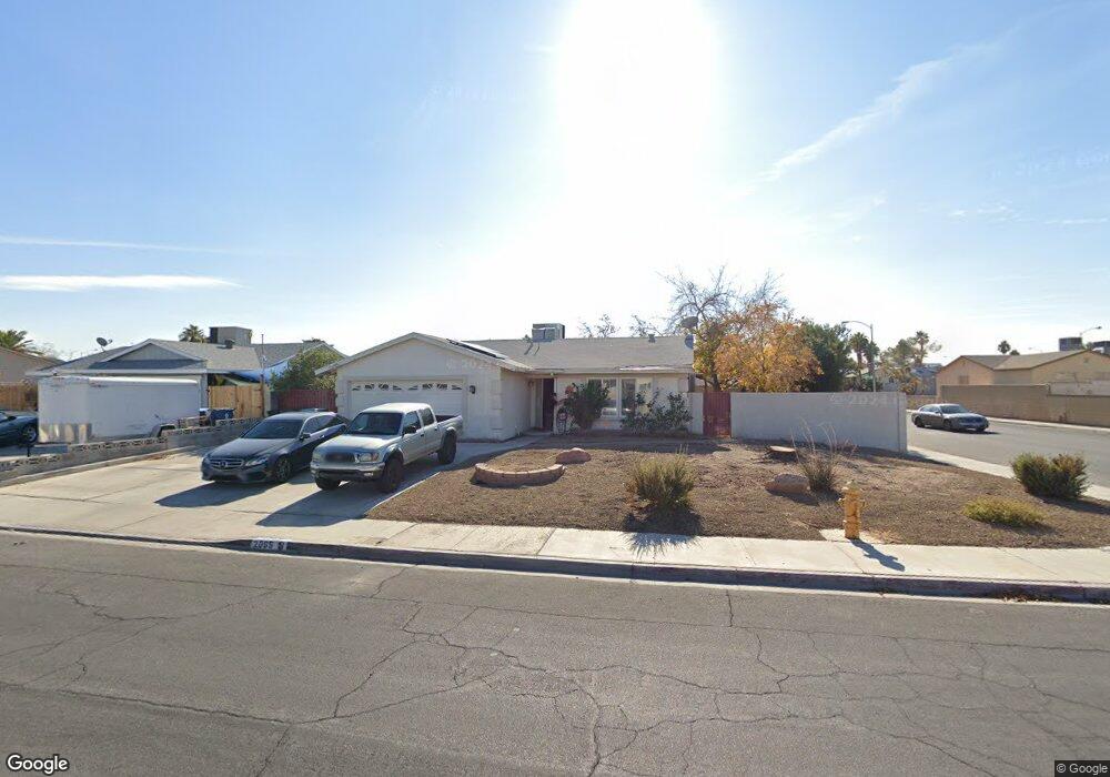
2065 Rawhide St Las Vegas, NV 89119
University District NeighborhoodEstimated Value: $333,000 - $379,000
3
Beds
2
Baths
1,224
Sq Ft
$284/Sq Ft
Est. Value
About This Home
This home is located at 2065 Rawhide St, Las Vegas, NV 89119 and is currently estimated at $347,642, approximately $284 per square foot. 2065 Rawhide St is a home located in Clark County with nearby schools including Jack Dailey Elementary School, Gene Ward Elementary School, and Helen C. Cannon Junior High School.
Ownership History
Date
Name
Owned For
Owner Type
Purchase Details
Closed on
Jun 20, 2000
Sold by
Fuson Mark F and Suzuki Tasha J
Bought by
Hernandez Gonzalo A and Vargas Hernandez Marissa A
Current Estimated Value
Home Financials for this Owner
Home Financials are based on the most recent Mortgage that was taken out on this home.
Original Mortgage
$119,019
Outstanding Balance
$42,885
Interest Rate
8.53%
Mortgage Type
FHA
Estimated Equity
$304,757
Purchase Details
Closed on
Dec 29, 1993
Sold by
Schulte Hans U
Bought by
Fuson Mark F and Suzuki Tasha J
Home Financials for this Owner
Home Financials are based on the most recent Mortgage that was taken out on this home.
Original Mortgage
$88,271
Interest Rate
7.29%
Mortgage Type
FHA
Create a Home Valuation Report for This Property
The Home Valuation Report is an in-depth analysis detailing your home's value as well as a comparison with similar homes in the area
Home Values in the Area
Average Home Value in this Area
Purchase History
| Date | Buyer | Sale Price | Title Company |
|---|---|---|---|
| Hernandez Gonzalo A | $120,000 | United Title | |
| Fuson Mark F | $89,000 | Nevada Title Company |
Source: Public Records
Mortgage History
| Date | Status | Borrower | Loan Amount |
|---|---|---|---|
| Open | Hernandez Gonzalo A | $119,019 | |
| Previous Owner | Fuson Mark F | $88,271 |
Source: Public Records
Tax History Compared to Growth
Tax History
| Year | Tax Paid | Tax Assessment Tax Assessment Total Assessment is a certain percentage of the fair market value that is determined by local assessors to be the total taxable value of land and additions on the property. | Land | Improvement |
|---|---|---|---|---|
| 2025 | $967 | $52,157 | $31,500 | $20,657 |
| 2024 | $939 | $52,157 | $31,500 | $20,657 |
| 2023 | $939 | $47,125 | $28,700 | $18,425 |
| 2022 | $1,000 | $44,546 | $28,000 | $16,546 |
| 2021 | $926 | $40,254 | $24,850 | $15,404 |
| 2020 | $857 | $38,639 | $22,750 | $15,889 |
| 2019 | $803 | $36,844 | $20,650 | $16,194 |
| 2018 | $766 | $34,685 | $18,550 | $16,135 |
| 2017 | $976 | $33,289 | $16,450 | $16,839 |
| 2016 | $719 | $29,694 | $11,900 | $17,794 |
| 2015 | $716 | $27,487 | $9,450 | $18,037 |
| 2014 | $695 | $22,989 | $7,000 | $15,989 |
Source: Public Records
Map
Nearby Homes
- 1963 Rawhide St
- 5399 Surrey St
- 5551 Corral Cir
- 2184 Sunnyslope Ave
- 5514 Oxbow St
- 5473 Clydesdale St
- 2033 Pommel Ave
- 5375 Chestnut St
- 5613 Chestnut St
- 5433 Latigo St
- 5473 S Eastern Ave
- 2174 E Russell Rd
- 2246 E Russell Rd
- 1673 Caliente Ct
- 5167 Martingale Ave
- 5445 Caliente St
- 1655 E Hacienda Ave
- 2486 Leigh Ave
- 5143 Martingale Ave
- 5403 Tamarus St
- 2085 Rawhide St
- 2064 Roan Ave
- 2082 Roan Ave
- 2029 Rawhide St
- 2103 Rawhide St
- 2103 Rawhide St Unit n/a
- 5454 Surrey St
- 2030 Roan Ave
- 2086 Rawhide St
- 2095 Roan Ave
- 2030 Rawhide St
- 2011 Rawhide St
- 2121 Rawhide St
- 5440 Surrey St
- 2106 Rawhide St
- 2014 Roan Ave
- 5544 Surrey St
- 2114 Roan Ave
- 2014 Rawhide St
- 2126 Rawhide St