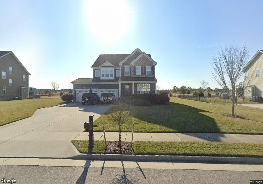
2065 Roger McClung Ln Virginia Beach, VA 23456
Virginia Beach Central NeighborhoodEstimated Value: $1,078,000 - $1,195,025
6
Beds
6
Baths
4,100
Sq Ft
$283/Sq Ft
Est. Value
About This Home
This home is located at 2065 Roger McClung Ln, Virginia Beach, VA 23456 and is currently estimated at $1,160,006, approximately $282 per square foot. 2065 Roger McClung Ln is a home located in Virginia Beach City with nearby schools including Three Oaks Elementary School, Princess Anne Middle School, and Floyd E. Kellam High School.
Ownership History
Date
Name
Owned For
Owner Type
Purchase Details
Closed on
May 22, 2025
Sold by
Wolf Christopher and Wolf Amy
Bought by
Wolf Family Revocable Trust and Wolf
Current Estimated Value
Purchase Details
Closed on
Mar 2, 2016
Sold by
Nvr Inc A Virginia Corporation
Bought by
Wolf Christopher and Wolf Amy
Home Financials for this Owner
Home Financials are based on the most recent Mortgage that was taken out on this home.
Original Mortgage
$613,814
Interest Rate
3.72%
Mortgage Type
VA
Create a Home Valuation Report for This Property
The Home Valuation Report is an in-depth analysis detailing your home's value as well as a comparison with similar homes in the area
Home Values in the Area
Average Home Value in this Area
Purchase History
| Date | Buyer | Sale Price | Title Company |
|---|---|---|---|
| Wolf Family Revocable Trust | -- | None Listed On Document | |
| Wolf Christopher | $653,375 | Nvr Settlement Services Inc |
Source: Public Records
Mortgage History
| Date | Status | Borrower | Loan Amount |
|---|---|---|---|
| Previous Owner | Wolf Christopher | $613,814 |
Source: Public Records
Tax History Compared to Growth
Tax History
| Year | Tax Paid | Tax Assessment Tax Assessment Total Assessment is a certain percentage of the fair market value that is determined by local assessors to be the total taxable value of land and additions on the property. | Land | Improvement |
|---|---|---|---|---|
| 2025 | -- | $1,060,200 | $290,000 | $770,200 |
| 2024 | $9,805 | $990,400 | $290,000 | $700,400 |
| 2023 | $8,367 | $845,200 | $212,000 | $633,200 |
| 2022 | $7,861 | $794,000 | $200,000 | $594,000 |
| 2021 | $7,211 | $728,400 | $185,000 | $543,400 |
| 2020 | $6,852 | $673,400 | $170,000 | $503,400 |
| 2019 | $6,744 | $647,400 | $170,000 | $477,400 |
| 2018 | $6,490 | $647,400 | $170,000 | $477,400 |
| 2017 | $6,378 | $636,200 | $170,000 | $466,200 |
| 2016 | $6,454 | $651,900 | $170,000 | $481,900 |
| 2015 | -- | $170,000 | $170,000 | $0 |
Source: Public Records
Map
Nearby Homes
- 2801 Keokirk Ln
- 2873 Weston Loop
- 2869 Weston Loop
- 2877 Weston Loop
- 2881 Weston Loop
- 2425 Wessington Dr
- 2885 Weston Loop
- 2884 Weston Loop
- 2889 Weston Loop
- 2893 Weston Loop
- 2856 Weston Loop
- 2852 Weston Loop
- 1836 Malvern Dr
- 2300 Wessington Dr
- 1845 Malvern Dr
- 2809 Alford St
- 2813 Alford St
- 2629 Level Loop Rd
- 2812 Alford St
- 1937 Channing Ln
- 2057 Roger McClung Ln
- 2073 Roger McClung Ln
- 2068 Roger McClung Ln
- 2060 Roger McClung Ln
- 2081 Roger McClung Ln
- 2076 Roger McClung Ln
- 2049 Roger McClung Ln
- 2048 Roger McClung Ln
- 2085 Roger McClung Ln
- 2084 Roger McClung Ln
- 2041 Roger McClung Ln
- 2036 Roger McClung Ln
- 2076 Princess Anne Rd
- 2033 Roger McClung Ln
- 2036 Princess Anne Rd
- 2708 Robert Monette Ln
- 2024 Roger McClung Ln
- 2684 Robert Monette Ln
- 2716 Robert Monette Ln
- 2676 Robert Monette Ln