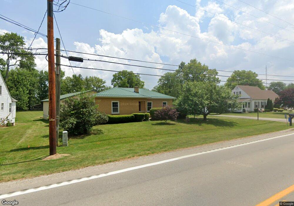
2065 S State Route 53 Tiffin, OH 44883
Estimated Value: $180,000 - $229,361
2
Beds
2
Baths
1,234
Sq Ft
$167/Sq Ft
Est. Value
About This Home
This home is located at 2065 S State Route 53, Tiffin, OH 44883 and is currently estimated at $206,340, approximately $167 per square foot. 2065 S State Route 53 is a home located in Seneca County with nearby schools including Hopewell-Loudon Local Elementary School, North Central Academy - Fremont, and Calvert Catholic Elementary School.
Ownership History
Date
Name
Owned For
Owner Type
Purchase Details
Closed on
Apr 29, 2024
Sold by
Siebenaller Donald E and Siebenaller Donna J
Bought by
Dennis Kiahna J and Lachner Alexzander A
Current Estimated Value
Home Financials for this Owner
Home Financials are based on the most recent Mortgage that was taken out on this home.
Original Mortgage
$180,500
Outstanding Balance
$177,964
Interest Rate
6.87%
Mortgage Type
New Conventional
Estimated Equity
$28,376
Purchase Details
Closed on
Feb 22, 2001
Sold by
Sauber George M
Bought by
Siebenaller Donald E
Purchase Details
Closed on
Dec 15, 2000
Sold by
Widmer Bernard A
Bought by
Sauber George M
Purchase Details
Closed on
Aug 14, 1996
Bought by
Widmer Bernard A
Purchase Details
Closed on
Mar 2, 1990
Create a Home Valuation Report for This Property
The Home Valuation Report is an in-depth analysis detailing your home's value as well as a comparison with similar homes in the area
Home Values in the Area
Average Home Value in this Area
Purchase History
| Date | Buyer | Sale Price | Title Company |
|---|---|---|---|
| Dennis Kiahna J | $190,000 | Assured Title | |
| Dennis Kiahna J | $190,000 | Assured Title | |
| Siebenaller Donald E | $90,000 | -- | |
| Sauber George M | $35,000 | -- | |
| Widmer Bernard A | -- | -- | |
| -- | -- | -- |
Source: Public Records
Mortgage History
| Date | Status | Borrower | Loan Amount |
|---|---|---|---|
| Open | Dennis Kiahna J | $180,500 | |
| Closed | Dennis Kiahna J | $180,500 |
Source: Public Records
Tax History Compared to Growth
Tax History
| Year | Tax Paid | Tax Assessment Tax Assessment Total Assessment is a certain percentage of the fair market value that is determined by local assessors to be the total taxable value of land and additions on the property. | Land | Improvement |
|---|---|---|---|---|
| 2024 | $2,393 | $64,060 | $11,800 | $52,260 |
| 2023 | $2,394 | $64,060 | $11,800 | $52,260 |
| 2022 | $2,188 | $53,930 | $10,440 | $43,490 |
| 2021 | $2,200 | $53,930 | $10,440 | $43,490 |
| 2020 | $2,210 | $53,935 | $10,444 | $43,491 |
| 2019 | $1,910 | $46,151 | $9,079 | $37,072 |
| 2018 | $1,957 | $46,151 | $9,079 | $37,072 |
| 2017 | $1,863 | $46,151 | $9,079 | $37,072 |
| 2016 | $1,779 | $45,101 | $9,079 | $36,022 |
| 2015 | $1,737 | $44,636 | $9,079 | $35,557 |
| 2014 | $1,611 | $43,705 | $9,079 | $34,626 |
| 2013 | $1,743 | $43,428 | $9,079 | $34,349 |
Source: Public Records
Map
Nearby Homes
- 1590 Meadowlake Dr
- 2351 S State Route 53
- 841 S Sandusky St
- 185 Longfellow Dr
- 153 Longfellow Dr
- 0 County Road 54 Unit 225023228
- 0 County Road 54 Unit 20242258
- 2050 W County Road 52
- 2465 S County Road 19
- 106 Sycamore Woods Ln
- 2483 W County Road 52
- 2031 W County Road 52
- 378 Lelar St
- 269 Lelar St
- 137 Hampden Park
- 115 Lindsay Ave
- 0 W Market St
- 0 Shaffer Park Dr Unit 20251435
- 314 S Sandusky St
- 43 Siesta Dr
- 2051 S State Route 53
- 2085 S State Route 53
- 2119 S State Route 53
- 2044 S State Route 53
- 2044 Ohio 53
- 2064 S State Route 53
- 1857 S State Route 53
- 0 S State Route 53
- 2017 S State Route 53
- 2010 S State Route 53
- 2153 S State Route 53
- 2167 S State Route 53
- 1927 S State Route 53
- 2015 S State Route 53
- 1680 Meadowlake Dr
- 1720 Meadowlake Dr
- 1700 Meadowlake Dr
- 1740 Meadowlake Dr
- 1600 Meadowlake Dr
- 1580 Meadowlake Dr