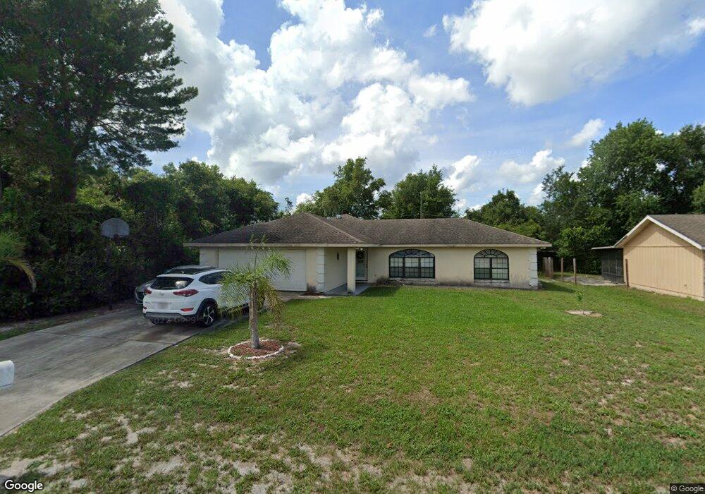
2065 Swanson Dr Deltona, FL 32738
Estimated Value: $276,000 - $288,000
3
Beds
2
Baths
1,656
Sq Ft
$171/Sq Ft
Est. Value
About This Home
This home is located at 2065 Swanson Dr, Deltona, FL 32738 and is currently estimated at $282,696, approximately $170 per square foot. 2065 Swanson Dr is a home located in Volusia County with nearby schools including Deltona Lakes Elementary School, Heritage Middle School, and Pine Ridge High School.
Ownership History
Date
Name
Owned For
Owner Type
Purchase Details
Closed on
Mar 18, 2004
Sold by
Adams Charles
Bought by
Perez Rafael and Perez Angela
Current Estimated Value
Home Financials for this Owner
Home Financials are based on the most recent Mortgage that was taken out on this home.
Original Mortgage
$98,992
Outstanding Balance
$47,396
Interest Rate
6.02%
Mortgage Type
Purchase Money Mortgage
Estimated Equity
$235,300
Purchase Details
Closed on
Jun 15, 1989
Bought by
Perez Rafael
Purchase Details
Closed on
Dec 15, 1974
Bought by
Perez Rafael
Create a Home Valuation Report for This Property
The Home Valuation Report is an in-depth analysis detailing your home's value as well as a comparison with similar homes in the area
Home Values in the Area
Average Home Value in this Area
Purchase History
| Date | Buyer | Sale Price | Title Company |
|---|---|---|---|
| Perez Rafael | $110,200 | Deltona Title Ins Co Inc | |
| Perez Rafael | $12,000 | -- | |
| Perez Rafael | $1,300 | -- |
Source: Public Records
Mortgage History
| Date | Status | Borrower | Loan Amount |
|---|---|---|---|
| Open | Perez Rafael | $98,992 |
Source: Public Records
Tax History Compared to Growth
Tax History
| Year | Tax Paid | Tax Assessment Tax Assessment Total Assessment is a certain percentage of the fair market value that is determined by local assessors to be the total taxable value of land and additions on the property. | Land | Improvement |
|---|---|---|---|---|
| 2025 | $4,637 | $247,591 | $54,400 | $193,191 |
| 2024 | $4,637 | $248,424 | $54,400 | $194,024 |
| 2023 | $4,637 | $237,267 | $54,400 | $182,867 |
| 2022 | $4,229 | $193,401 | $34,800 | $158,601 |
| 2021 | $972 | $67,403 | $0 | $0 |
| 2020 | $970 | $66,472 | $0 | $0 |
| 2019 | $988 | $64,978 | $0 | $0 |
| 2018 | $978 | $63,766 | $0 | $0 |
| 2017 | $965 | $62,454 | $0 | $0 |
| 2016 | $952 | $61,169 | $0 | $0 |
| 2015 | $971 | $60,744 | $0 | $0 |
| 2014 | $947 | $60,262 | $0 | $0 |
Source: Public Records
Map
Nearby Homes
- 2067 Everest St
- 968 Fort Smith Blvd
- 973 Radford Dr
- 2046 Galahad Dr
- 732 Fort Smith Blvd
- 747 Fort Smith Blvd
- 1057 Fort Smith Blvd
- 1082 Worthington Dr
- 1113 Fort Smith Blvd
- 884 Fort Smith Blvd
- 2287 Belen Dr
- 1961 Paragon St
- 825 Fort Smith Blvd
- 1901 Odham Dr
- 2301 Weatherford Dr
- 745 Mentmore Cir
- 2303 Harding Cir
- 787 Leeward Dr
- 2332 Salem Dr
- 1922 Marlow St
- 2057 Swanson Dr
- 972 Fort Smith Blvd
- 2081 Swanson Dr
- 2049 Swanson Dr
- 964 Fort Smith Blvd
- 2058 Swanson Dr
- 2066 Swanson Dr
- 0 Swanson Dr Unit V4706641
- 2050 Swanson Dr
- 960 Fort Smith Blvd
- 2089 Swanson Dr
- 2074 Swanson Dr
- 980 Fort Smith Blvd
- 2042 Swanson Dr
- 976 Fort Smith Blvd
- 2082 Swanson Dr
- 956 Fort Smith Blvd
- 984 Fort Smith Blvd
- 2059 Everest St
- 2097 Swanson Dr