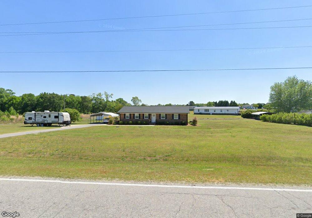
2065 Woodall Dairy Rd Benson, NC 27504
Estimated Value: $215,000 - $302,000
3
Beds
2
Baths
1,432
Sq Ft
$182/Sq Ft
Est. Value
About This Home
This home is located at 2065 Woodall Dairy Rd, Benson, NC 27504 and is currently estimated at $260,442, approximately $181 per square foot. 2065 Woodall Dairy Rd is a home located in Johnston County with nearby schools including Benson Elementary School, Benson Middle School, and South Johnston High School.
Ownership History
Date
Name
Owned For
Owner Type
Purchase Details
Closed on
Jun 20, 2018
Sold by
Freedom Road Rentals Llc
Bought by
Freedom Road Rentals Llc
Current Estimated Value
Purchase Details
Closed on
Mar 15, 2018
Sold by
Godwin Joey Bryan
Bought by
Freedom Road Rentals Llc
Create a Home Valuation Report for This Property
The Home Valuation Report is an in-depth analysis detailing your home's value as well as a comparison with similar homes in the area
Home Values in the Area
Average Home Value in this Area
Purchase History
| Date | Buyer | Sale Price | Title Company |
|---|---|---|---|
| Freedom Road Rentals Llc | -- | None Available | |
| Freedom Road Rentals Llc | $92,000 | None Available |
Source: Public Records
Tax History Compared to Growth
Tax History
| Year | Tax Paid | Tax Assessment Tax Assessment Total Assessment is a certain percentage of the fair market value that is determined by local assessors to be the total taxable value of land and additions on the property. | Land | Improvement |
|---|---|---|---|---|
| 2025 | $1,611 | $253,660 | $57,790 | $195,870 |
| 2024 | $1,088 | $134,330 | $26,010 | $108,320 |
| 2023 | $1,061 | $134,330 | $26,010 | $108,320 |
| 2022 | $1,115 | $134,330 | $26,010 | $108,320 |
| 2021 | $1,115 | $134,330 | $26,010 | $108,320 |
| 2020 | $1,155 | $134,330 | $26,010 | $108,320 |
| 2019 | $1,155 | $134,330 | $26,010 | $108,320 |
| 2018 | $766 | $87,080 | $23,000 | $64,080 |
| 2017 | $383 | $87,080 | $23,000 | $64,080 |
| 2016 | $383 | $87,080 | $23,000 | $64,080 |
| 2015 | $766 | $87,080 | $23,000 | $64,080 |
| 2014 | $766 | $87,080 | $23,000 | $64,080 |
Source: Public Records
Map
Nearby Homes
- 87 Sun Meadow Cir
- 95 Mapledale Ct
- 99 Mapledale Ct
- 97 Shadybrook Dr
- 76 Shadybrook Dr
- 32 Boulder River Trail
- 200 Kissington Way
- 45 S Harper Faith Way
- 184 Kissington Way
- 193 Kissington Way
- 243 Kissington Way
- 261 Kissington Way
- 255 Ravens Row Dr
- Colfax Plan at Weddington
- Cypress Plan at Weddington
- Wescott Plan at Weddington
- Asheboro Plan at Weddington
- Avery Plan at Weddington
- Davidson Plan at Weddington
- Cooper Plan at Weddington
- 119 Westside Dr
- 2099 Woodall Dairy Rd
- 123 Westside Dr
- 115 Westside Dr
- 0 Byrdtown Rd
- 2150 Woodall Dairy Rd
- 2131 Woodall Dairy Rd
- 122 Westside Dr
- 105 Westside Dr
- 2128 Woodall Dairy Rd
- 118 Westside Dr
- 63 Byrdtown Rd
- 114 Westside Dr
- 106 Westside Dr
- 2201 Woodall Dairy Rd
- 110 Westside Dr
- 128 Fireside Dr
- 2219 Woodall Dairy Rd
- 125 Fireside Dr
- 150 Briar Den Ct