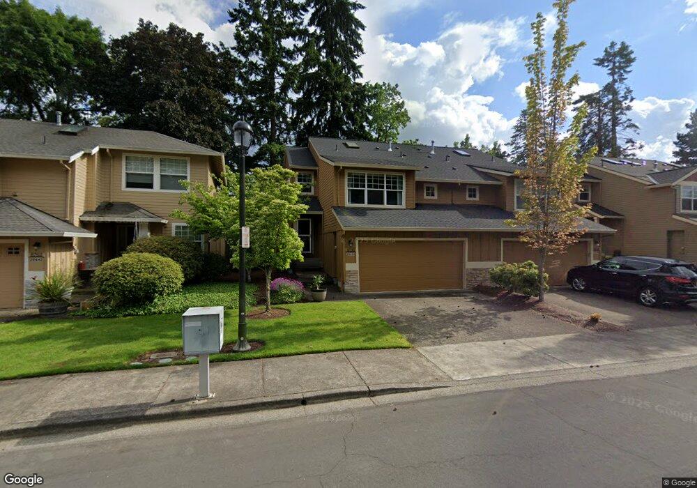
20654 NW Rockspring Ln Beaverton, OR 97006
AmberGlen NeighborhoodEstimated Value: $456,107 - $490,000
2
Beds
3
Baths
1,568
Sq Ft
$304/Sq Ft
Est. Value
About This Home
This home is located at 20654 NW Rockspring Ln, Beaverton, OR 97006 and is currently estimated at $476,027, approximately $303 per square foot. 20654 NW Rockspring Ln is a home located in Washington County with nearby schools including Lenox Elementary School, J.W. Poynter Middle School, and Liberty High School.
Ownership History
Date
Name
Owned For
Owner Type
Purchase Details
Closed on
Aug 20, 2001
Sold by
Murray Randy J
Bought by
Roberts Bert L
Current Estimated Value
Home Financials for this Owner
Home Financials are based on the most recent Mortgage that was taken out on this home.
Original Mortgage
$166,840
Outstanding Balance
$65,364
Interest Rate
7.21%
Mortgage Type
Purchase Money Mortgage
Estimated Equity
$410,663
Purchase Details
Closed on
Jan 29, 1998
Sold by
Habitat Northwest Inc
Bought by
Murray Randy J
Home Financials for this Owner
Home Financials are based on the most recent Mortgage that was taken out on this home.
Original Mortgage
$126,064
Interest Rate
7.05%
Mortgage Type
Purchase Money Mortgage
Create a Home Valuation Report for This Property
The Home Valuation Report is an in-depth analysis detailing your home's value as well as a comparison with similar homes in the area
Home Values in the Area
Average Home Value in this Area
Purchase History
| Date | Buyer | Sale Price | Title Company |
|---|---|---|---|
| Roberts Bert L | $172,000 | Chicago Title Insurance Co | |
| Murray Randy J | $158,500 | Fidelity National Title Co |
Source: Public Records
Mortgage History
| Date | Status | Borrower | Loan Amount |
|---|---|---|---|
| Open | Roberts Bert L | $166,840 | |
| Previous Owner | Murray Randy J | $126,064 |
Source: Public Records
Tax History Compared to Growth
Tax History
| Year | Tax Paid | Tax Assessment Tax Assessment Total Assessment is a certain percentage of the fair market value that is determined by local assessors to be the total taxable value of land and additions on the property. | Land | Improvement |
|---|---|---|---|---|
| 2025 | $4,409 | $269,740 | -- | -- |
| 2024 | $4,284 | $261,890 | -- | -- |
| 2023 | $4,284 | $254,270 | $0 | $0 |
| 2022 | $4,168 | $254,270 | $0 | $0 |
| 2021 | $4,084 | $239,680 | $0 | $0 |
| 2020 | $3,996 | $232,700 | $0 | $0 |
| 2019 | $3,881 | $225,930 | $0 | $0 |
| 2018 | $3,715 | $219,350 | $0 | $0 |
| 2017 | $3,580 | $212,970 | $0 | $0 |
| 2016 | $3,482 | $206,770 | $0 | $0 |
| 2015 | $3,342 | $200,750 | $0 | $0 |
| 2014 | $3,323 | $194,910 | $0 | $0 |
Source: Public Records
Map
Nearby Homes
- 8654 NE Rockspring St
- 2127 NE Cadbury Ave
- 8599 NE Hodes St
- 2315 NE Redelfs Way
- 8686 NE Hyde Park Ln
- 734 NE Adwick Dr
- 881 NE Wheelock Place
- 7959 NE Rockne Way
- 8100 NE Miriam Way
- 680 NE Adwick Dr Unit 5
- 7915 NE Rockne Way
- 645 NE Garswood Ln
- 1853 NE 101st Ave Unit 102
- 637 NE Garswood Ln
- 7906 NE Miriam Way
- 7902 NE Miriam Way
- 1845 NE 101st Ave Unit 201
- 963 NE 73rd Ave Unit 141
- 622 NE Garswood Ln
- 613 NE Garswood Ln
- 20668 NW Rockspring Ln
- 20642 NW Rockspring Ln
- 20680 NE Rockspring St
- 20680 NW Rockspring Ln
- 8770 NE Rockspring St
- 20630 NW Rockspring Ln
- 20630 NE Rockspring St
- 20692 NW Rockspring Ln
- 20729 NW Windstone St
- 20711 NW Windstone St
- 8784 NE Rockspring St
- 20614 NW Rockspring Ln
- 20747 NW Windstone St
- 20614 NE Rockspring St
- 20663 NW Rockspring Ln
- 20651 NW Rockspring Ln
- 20695 NW Windstone St
- 20706 NW Rockspring Ln
- 8686 NE Rockspring St
- 8775 NE Windstone St