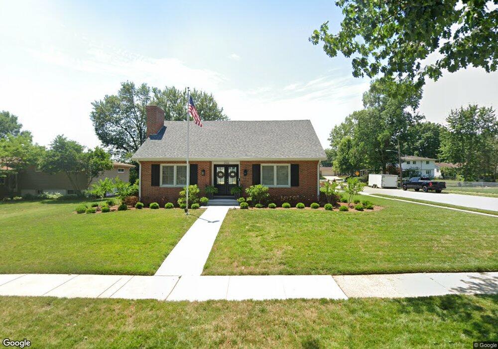
2066 Brentwood Dr Springfield, IL 62704
Westwood Forum NeighborhoodEstimated Value: $212,000 - $258,000
--
Bed
--
Bath
--
Sq Ft
0.27
Acres
About This Home
This home is located at 2066 Brentwood Dr, Springfield, IL 62704 and is currently estimated at $226,803. 2066 Brentwood Dr is a home located in Sangamon County with nearby schools including Owen Marsh Elementary School, Benjamin Franklin Middle School, and Springfield High School.
Ownership History
Date
Name
Owned For
Owner Type
Purchase Details
Closed on
Jan 20, 2021
Sold by
Rogers Martin J
Bought by
Rogers Daniel J and Rogers Katie L
Current Estimated Value
Home Financials for this Owner
Home Financials are based on the most recent Mortgage that was taken out on this home.
Original Mortgage
$114,750
Outstanding Balance
$8,135
Interest Rate
2.67%
Mortgage Type
New Conventional
Estimated Equity
$218,668
Purchase Details
Closed on
Jan 22, 2013
Create a Home Valuation Report for This Property
The Home Valuation Report is an in-depth analysis detailing your home's value as well as a comparison with similar homes in the area
Home Values in the Area
Average Home Value in this Area
Purchase History
| Date | Buyer | Sale Price | Title Company |
|---|---|---|---|
| Rogers Daniel J | $135,000 | Prairie Land Title | |
| -- | -- | -- |
Source: Public Records
Mortgage History
| Date | Status | Borrower | Loan Amount |
|---|---|---|---|
| Open | Rogers Daniel J | $114,750 |
Source: Public Records
Tax History Compared to Growth
Tax History
| Year | Tax Paid | Tax Assessment Tax Assessment Total Assessment is a certain percentage of the fair market value that is determined by local assessors to be the total taxable value of land and additions on the property. | Land | Improvement |
|---|---|---|---|---|
| 2024 | $5,648 | $73,239 | $8,259 | $64,980 |
| 2023 | $5,384 | $66,897 | $7,544 | $59,353 |
| 2022 | $5,149 | $63,457 | $7,156 | $56,301 |
| 2021 | $4,508 | $61,081 | $6,888 | $54,193 |
| 2020 | $4,420 | $61,172 | $6,898 | $54,274 |
| 2019 | $4,334 | $60,959 | $6,874 | $54,085 |
| 2018 | $3,203 | $56,080 | $6,839 | $49,241 |
| 2017 | $3,178 | $55,355 | $6,751 | $48,604 |
| 2016 | $3,162 | $54,548 | $6,653 | $47,895 |
| 2015 | $3,169 | $53,895 | $6,573 | $47,322 |
| 2014 | $3,142 | $53,547 | $6,531 | $47,016 |
| 2013 | $3,072 | $53,547 | $6,531 | $47,016 |
Source: Public Records
Map
Nearby Homes
- 2201 Warwick Dr
- 2609 Arlington Dr
- 2306 Chatham Rd
- 2212 Greenbriar Rd
- 2805 Arlington Dr
- 2717 Bennington Dr
- 3 Hillcrest Rd
- 2315 Connie Dr
- 2353 S Wiggins Ave
- 1609 Cressa Ct
- 520 E South Grand Ave
- 1604 Cressa Ct
- 2212 Greenside Dr
- 2316 S Willemore Ave
- 2001 Maryknoll Place
- 2001 W Laurel St
- 20 Longbow Ln
- 2533 Charlack Ave
- 1621 Seton Dr
- 1605 Claude Dr
- 2060 Brentwood Dr
- 2100 Brentwood Dr
- 2054 Brentwood Dr
- 2404 Lehigh Dr
- 2057 Brentwood Dr
- 2063 Brentwood Dr
- 2051 Brentwood Dr
- 2101 Brentwood Dr
- 2048 Brentwood Dr
- 2410 Lehigh Dr
- 2106 Brentwood Dr
- 2101 Warwick Dr
- 2039 Brentwood Dr
- 2107 Brentwood Dr
- 2042 Brentwood Dr
- 2112 Brentwood Dr
- 2601 Montega Dr
- 2107 Warwick Dr
- 2416 Lehigh Dr
- 2050 Cambridge Rd