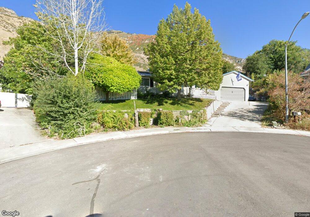
2066 California Cir Provo, UT 84606
Provost NeighborhoodEstimated Value: $537,000 - $609,000
5
Beds
3
Baths
2,706
Sq Ft
$209/Sq Ft
Est. Value
About This Home
This home is located at 2066 California Cir, Provo, UT 84606 and is currently estimated at $566,284, approximately $209 per square foot. 2066 California Cir is a home located in Utah County with nearby schools including Spring Creek Elementary School, Centennial Middle School, and Timpview High School.
Ownership History
Date
Name
Owned For
Owner Type
Purchase Details
Closed on
Sep 28, 2012
Sold by
Stewart Lowell and Stewart Jennifer M
Bought by
Kellian Pace J and Kellian Kari J
Current Estimated Value
Home Financials for this Owner
Home Financials are based on the most recent Mortgage that was taken out on this home.
Original Mortgage
$192,660
Outstanding Balance
$133,850
Interest Rate
3.58%
Mortgage Type
New Conventional
Estimated Equity
$432,434
Purchase Details
Closed on
May 8, 2003
Sold by
Leslie Lance A and Leslie Soya L
Bought by
Stewart Lowell and Stewart Jennifer M
Purchase Details
Closed on
Aug 17, 1999
Sold by
Mcmeen William O and Flake Elaine M
Bought by
Mcmeen William O and Flake Cannon W
Home Financials for this Owner
Home Financials are based on the most recent Mortgage that was taken out on this home.
Original Mortgage
$127,000
Interest Rate
7.63%
Create a Home Valuation Report for This Property
The Home Valuation Report is an in-depth analysis detailing your home's value as well as a comparison with similar homes in the area
Home Values in the Area
Average Home Value in this Area
Purchase History
| Date | Buyer | Sale Price | Title Company |
|---|---|---|---|
| Kellian Pace J | -- | Inwest Title Services Inc | |
| Stewart Lowell | -- | Old Republic Title Company | |
| Mcmeen William O | -- | Provo Land Title Company |
Source: Public Records
Mortgage History
| Date | Status | Borrower | Loan Amount |
|---|---|---|---|
| Open | Kellian Pace J | $192,660 | |
| Previous Owner | Mcmeen William O | $127,000 |
Source: Public Records
Tax History Compared to Growth
Tax History
| Year | Tax Paid | Tax Assessment Tax Assessment Total Assessment is a certain percentage of the fair market value that is determined by local assessors to be the total taxable value of land and additions on the property. | Land | Improvement |
|---|---|---|---|---|
| 2025 | $2,691 | $513,600 | $196,800 | $316,800 |
| 2024 | $2,691 | $264,935 | $0 | $0 |
| 2023 | $2,705 | $262,460 | $0 | $0 |
| 2022 | $2,567 | $251,185 | $0 | $0 |
| 2021 | $1,995 | $340,400 | $111,000 | $229,400 |
| 2020 | $1,923 | $307,600 | $100,900 | $206,700 |
| 2019 | $1,849 | $307,600 | $100,900 | $206,700 |
| 2018 | $1,699 | $286,700 | $93,400 | $193,300 |
| 2017 | $1,485 | $137,665 | $0 | $0 |
| 2016 | $1,474 | $127,380 | $0 | $0 |
| 2015 | $1,414 | $123,475 | $0 | $0 |
| 2014 | $1,297 | $118,085 | $0 | $0 |
Source: Public Records
Map
Nearby Homes
- 1754 California Ave
- 1911 S Oregon Ave
- 1778 S Buckley Ln
- 2046 S Nevada Ave
- 2050 S Nevada Ave
- 2149 S Nevada Ave Unit A-D
- 2103 Mountain Vista Ln
- 2131 Mountain Vista Ln
- 2353 Alaska Ave
- 1339 Alpine Way
- 1454 E 1370 S
- 1208 Meadow Fork Rd Unit 2
- 1417 S 1420 E
- 1494 E 1300 S
- 2400 S State E Unit 4
- 2400 S State E Unit 2
- 2400 S State E Unit 3
- 2400 S State E
- 1145 Meadow Fork Rd Unit 4
- 1356 S 1400 E
- 2062 California Cir
- 1796 S Oregon Ave
- 1818 S Oregon Ave
- 2059 California Cir
- 1778 S Oregon Ave
- 1778 S Oregon Ave Unit lot 63
- 1866 Washington Ave
- 1840 S Oregon Ave
- 5326 Alaska Ave
- 1797 California Ave
- 2069 Oregon Ave
- 1861 California Ave
- 1771 California Ave
- 1744 S Oregon Ave
- 1862 S Oregon Ave
- 1877 Washington Ave
- 1797 S Oregon Ave
- 1797 S Oregon Ave Unit lot 62
- 1817 S Oregon Ave
- 1749 California Ave