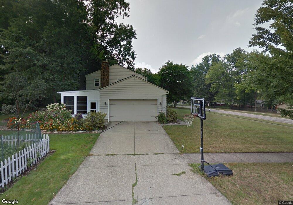
20667 Chestnut Dr Strongsville, OH 44149
Estimated Value: $309,754 - $334,000
3
Beds
2
Baths
1,440
Sq Ft
$223/Sq Ft
Est. Value
About This Home
This home is located at 20667 Chestnut Dr, Strongsville, OH 44149 and is currently estimated at $321,439, approximately $223 per square foot. 20667 Chestnut Dr is a home located in Cuyahoga County with nearby schools including Strongsville High School, St Mary School, and Sts Joseph & John Interparochial School.
Ownership History
Date
Name
Owned For
Owner Type
Purchase Details
Closed on
Dec 27, 1996
Sold by
Kryz Nancy E
Bought by
Cook Tobey C and Cook Margaret M
Current Estimated Value
Home Financials for this Owner
Home Financials are based on the most recent Mortgage that was taken out on this home.
Original Mortgage
$138,700
Outstanding Balance
$13,401
Interest Rate
6.5%
Mortgage Type
New Conventional
Estimated Equity
$308,038
Purchase Details
Closed on
Oct 20, 1989
Sold by
Kryz Duane D
Bought by
Kryz Nancy E
Purchase Details
Closed on
Jul 2, 1982
Sold by
Kryz Duane D and Kryz Nancy E
Bought by
Kryz Duane D
Purchase Details
Closed on
Jan 1, 1975
Bought by
Kryz Duane D and Kryz Nancy E
Create a Home Valuation Report for This Property
The Home Valuation Report is an in-depth analysis detailing your home's value as well as a comparison with similar homes in the area
Home Values in the Area
Average Home Value in this Area
Purchase History
| Date | Buyer | Sale Price | Title Company |
|---|---|---|---|
| Cook Tobey C | $146,000 | -- | |
| Kryz Nancy E | -- | -- | |
| Kryz Duane D | -- | -- | |
| Kryz Duane D | -- | -- |
Source: Public Records
Mortgage History
| Date | Status | Borrower | Loan Amount |
|---|---|---|---|
| Open | Cook Tobey C | $138,700 |
Source: Public Records
Tax History Compared to Growth
Tax History
| Year | Tax Paid | Tax Assessment Tax Assessment Total Assessment is a certain percentage of the fair market value that is determined by local assessors to be the total taxable value of land and additions on the property. | Land | Improvement |
|---|---|---|---|---|
| 2024 | $4,256 | $90,650 | $20,790 | $69,860 |
| 2023 | $4,718 | $73,750 | $17,610 | $56,140 |
| 2022 | $4,584 | $210,700 | $50,300 | $160,400 |
| 2021 | $4,548 | $73,750 | $17,610 | $56,140 |
| 2020 | $4,214 | $60,450 | $14,420 | $46,030 |
| 2019 | $4,090 | $172,700 | $41,200 | $131,500 |
| 2018 | $3,724 | $60,450 | $14,420 | $46,030 |
| 2017 | $3,806 | $57,370 | $13,130 | $44,240 |
| 2016 | $3,775 | $57,370 | $13,130 | $44,240 |
| 2015 | $3,716 | $57,370 | $13,130 | $44,240 |
| 2014 | $3,716 | $55,690 | $12,740 | $42,950 |
Source: Public Records
Map
Nearby Homes
- 20424 Scotch Pine Way
- 20684 Albion Rd
- 10839 Prospect Rd
- 21176 Hickory Branch Trail
- 20050 Idlewood Trail
- 19890 Idlewood Trail
- 19997 Idlewood Trail
- 21355 Hickory Branch Trail
- 9401 Pheasant Run Place
- 10353 Oak Branch Trail
- 10986 Fawn Meadow Ln
- 11179 Fawn Meadow Ln
- 21469 Woodview Cir
- 0 Priem Rd
- 19240 Briarwood Ln
- 9829 Plum Brook Ln
- 22300 Rock Creek Cir
- 8627 Courtland Dr
- 11432 Pearl Rd
- 11499 Pearl Rd Unit A106
- 20665 Chestnut Dr
- 20669 Chestnut Dr
- 20663 Chestnut Dr
- 20671 Chestnut Dr
- 20661 Chestnut Dr
- 20442 Prairie Meadows Place
- 20438 Prairie Meadows Place
- 10141 Peachtree Dr
- 10138 Peachtree Dr
- 10295 Fairtree Dr
- 20673 Chestnut Dr
- 20659 Fairtree Dr
- 10139 Peachtree Dr
- 10134 Peachtree Dr
- 10253 Fairtree Dr
- 20449 Prairie Meadows Place
- 20434 Prairie Meadows Place
- 20675 Chestnut Dr
- 20674 Chestnut Dr
- 10135 Peachtree Dr