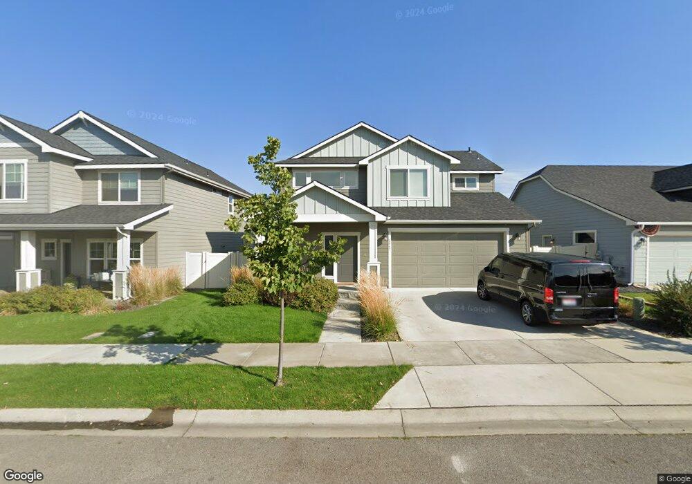
2067 Alsea Post Falls, ID 83854
West Prairie NeighborhoodEstimated Value: $463,819 - $531,000
3
Beds
3
Baths
1,887
Sq Ft
$256/Sq Ft
Est. Value
About This Home
This home is located at 2067 Alsea, Post Falls, ID 83854 and is currently estimated at $482,455, approximately $255 per square foot. 2067 Alsea is a home located in Kootenai County with nearby schools including West Ridge Elementary School, River City Middle School, and Post Falls High School.
Ownership History
Date
Name
Owned For
Owner Type
Purchase Details
Closed on
Jan 14, 2026
Sold by
Burns Benjamin B
Bought by
Glinski John George and Glinski Tonya Lynn
Current Estimated Value
Purchase Details
Closed on
Apr 10, 2025
Sold by
Flying S Title And Escrow Of Idaho Inc
Bought by
Burns Benjamin B
Purchase Details
Closed on
Oct 1, 2021
Sold by
Burns Benjamin B
Bought by
Quamish Drive Llc
Home Financials for this Owner
Home Financials are based on the most recent Mortgage that was taken out on this home.
Original Mortgage
$472,500
Interest Rate
2.8%
Mortgage Type
Seller Take Back
Purchase Details
Closed on
Apr 20, 2021
Sold by
Ebanks Colby and Ebanks Sydney
Bought by
Burns Benjamin B
Purchase Details
Closed on
Nov 25, 2019
Sold by
Sorbonne Homes Llc
Bought by
Ebanks Colby and Ebanks Sydney
Home Financials for this Owner
Home Financials are based on the most recent Mortgage that was taken out on this home.
Original Mortgage
$301,656
Interest Rate
3.6%
Mortgage Type
New Conventional
Create a Home Valuation Report for This Property
The Home Valuation Report is an in-depth analysis detailing your home's value as well as a comparison with similar homes in the area
Home Values in the Area
Average Home Value in this Area
Purchase History
| Date | Buyer | Sale Price | Title Company |
|---|---|---|---|
| Glinski John George | -- | Kootenai County Title | |
| Burns Benjamin B | $450,000 | Title Financial Specialty Serv | |
| Quamish Drive Llc | -- | North Idaho Title | |
| Burns Benjamin B | -- | North Id Ttl Co Coeur D Alen | |
| Burns Benjamin | -- | North Idaho Title | |
| Ebanks Colby | -- | Pioneer Title Kootenai Cnty |
Source: Public Records
Mortgage History
| Date | Status | Borrower | Loan Amount |
|---|---|---|---|
| Previous Owner | Quamish Drive Llc | $472,500 | |
| Previous Owner | Ebanks Colby | $301,656 |
Source: Public Records
Tax History
| Year | Tax Paid | Tax Assessment Tax Assessment Total Assessment is a certain percentage of the fair market value that is determined by local assessors to be the total taxable value of land and additions on the property. | Land | Improvement |
|---|---|---|---|---|
| 2025 | $2,796 | $465,990 | $155,000 | $310,990 |
| 2024 | $2,801 | $447,160 | $155,000 | $292,160 |
| 2023 | $2,801 | $461,827 | $120,000 | $341,827 |
| 2022 | $2,955 | $481,043 | $110,000 | $371,043 |
| 2021 | $1,868 | $306,770 | $90,000 | $216,770 |
| 2020 | $2,051 | $277,630 | $75,000 | $202,630 |
| 2019 | $860 | $260,060 | $70,000 | $190,060 |
| 2018 | $945 | $70,000 | $70,000 | $0 |
Source: Public Records
Map
Nearby Homes
- 2120 W Platte Ct
- 2073 W Platte Ct
- 2133 W Platte Ct
- 2036 N Skagit Dr
- 1971 N Skagit Dr
- 2021 N Skagit Dr
- 2101 N Skagit Dr
- 1999 N Skagit Dr
- 2045 N Skagit Dr
- 1531 N Wilhelm Way
- 1436 N Minam Loop
- 1478 N Wollaston Dr
- 1688 Umpqua Ct
- 1087 N Lean St
- 2118 N Teanaway
- 1190 W Palouse Dr
- 2661 N Distant Star Rd
- 2243 W Gueneveres
- 2899 N Radiant Star Rd
- 957 N Maranatha Dr Unit 10
- 2067 W Alsea Ave
- 2051 W Alsea Ave
- 2051 W Alsea Ave
- 2085 W Alsea Ave
- 2085 W Alsea Ave
- 2037 W Alsea Ave
- 2037 W Alsea Ave
- 2070 W Malad Ave
- 2105 W Alsea Ave
- 2052 W Malad Ave
- 2105 W Alsea Ave
- 2088 W Malad Ave
- 2021 W Alsea Ave
- 2036 Malad
- 2021 W Alsea Ave
- 2088 W Malad Ave
- 2052 W Malad Ave
- 2036 W Malad Ave
- 2054 W Alsea Loop
- 2070 W Malad Ave
Your Personal Tour Guide
Ask me questions while you tour the home.