Estimated Value: $67,300 - $110,000
4
Beds
1
Bath
696
Sq Ft
$129/Sq Ft
Est. Value
About This Home
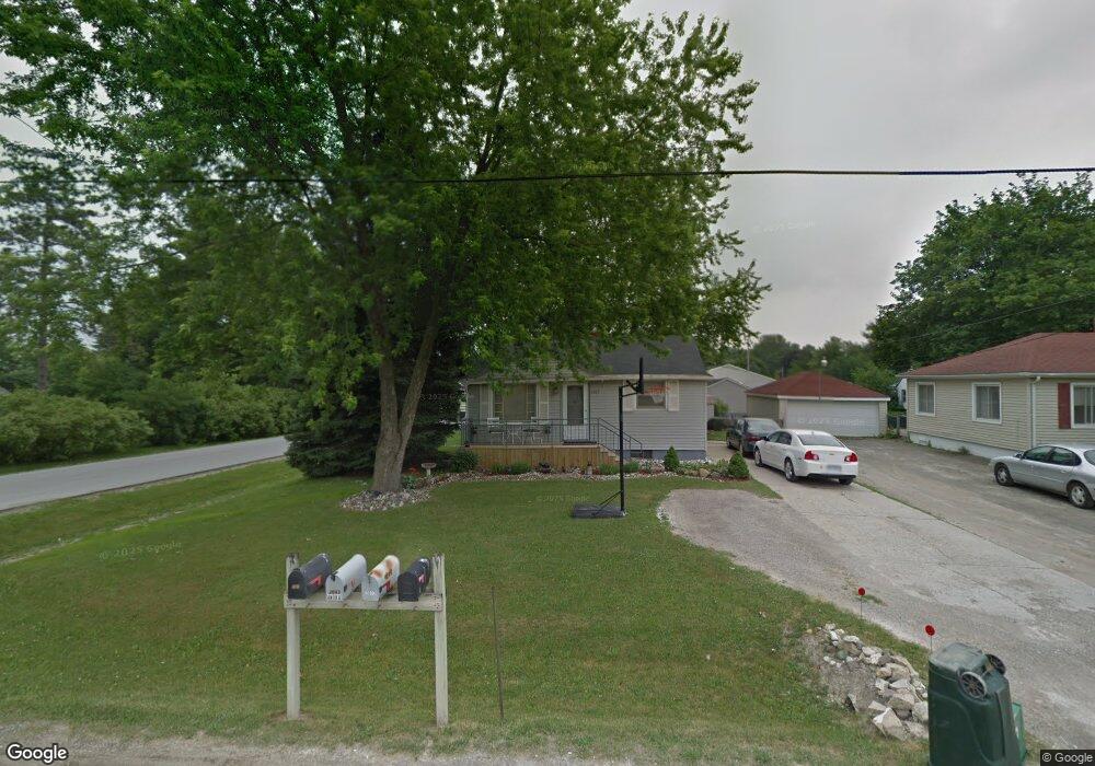
This home is located at 2067 Anoka St, Flint, MI 48532 and is currently estimated at $89,825, approximately $129 per square foot. 2067 Anoka St is a home located in Genesee County with nearby schools including Carman-Ainsworth High School, Genesee STEM Academy, and St. Paul Lutheran School.
Ownership History
Date
Name
Owned For
Owner Type
Purchase Details
Closed on
Sep 29, 2003
Sold by
Murphy Shane D and Murphy Heather Y
Bought by
Auten William and Auten Debra
Current Estimated Value
Purchase Details
Closed on
Aug 24, 2001
Sold by
Murphy Shane D
Bought by
Murphy Shane D and Murphy Heather Y
Home Financials for this Owner
Home Financials are based on the most recent Mortgage that was taken out on this home.
Original Mortgage
$48,466
Interest Rate
7.11%
Create a Home Valuation Report for This Property
The Home Valuation Report is an in-depth analysis detailing your home's value as well as a comparison with similar homes in the area
Home Values in the Area
Average Home Value in this Area
Purchase History
| Date | Buyer | Sale Price | Title Company |
|---|---|---|---|
| Auten William | $65,500 | Sargents Title Company | |
| Murphy Shane D | -- | Guaranty Title Company |
Source: Public Records
Mortgage History
| Date | Status | Borrower | Loan Amount |
|---|---|---|---|
| Previous Owner | Murphy Shane D | $48,466 |
Source: Public Records
Tax History
| Year | Tax Paid | Tax Assessment Tax Assessment Total Assessment is a certain percentage of the fair market value that is determined by local assessors to be the total taxable value of land and additions on the property. | Land | Improvement |
|---|---|---|---|---|
| 2025 | $1,438 | $31,400 | $0 | $0 |
| 2024 | $810 | $27,900 | $0 | $0 |
| 2023 | $736 | $22,800 | $0 | $0 |
| 2022 | $559 | $20,700 | $0 | $0 |
| 2021 | $1,144 | $19,300 | $0 | $0 |
| 2020 | $642 | $16,300 | $0 | $0 |
| 2019 | $638 | $13,900 | $0 | $0 |
| 2018 | $1,183 | $16,500 | $0 | $0 |
| 2017 | $1,270 | $16,500 | $0 | $0 |
| 2016 | $1,179 | $15,300 | $0 | $0 |
| 2015 | $575 | $14,900 | $0 | $0 |
| 2014 | $341 | $14,300 | $0 | $0 |
| 2012 | -- | $16,800 | $16,800 | $0 |
Source: Public Records
Map
Nearby Homes
- 18.41 Taft Rd
- 4051 Red Wing Dr
- 1512 Crescent Lane Dr Lot#46
- 10 Acres T A Mansour Blvd
- 4199 Sheraton Dr
- 4474 Corunna Rd
- 4480 Corunna Rd
- 1455 S Linden Rd
- 3277 Whitney Ave
- 3365 Ridgecliffe Dr
- 0 Charter Dr Unit 50153638
- VL Clairmont St
- 3.9 Acres W Court St
- 2521 White Oak Place
- 3493 Ridgecliffe Dr
- 3320 Timberview St
- 1137 S Graham Rd
- 2 Charter Dr
- 4335 Lennon Rd
- 3045 Old Farm Rd
Your Personal Tour Guide
Ask me questions while you tour the home.