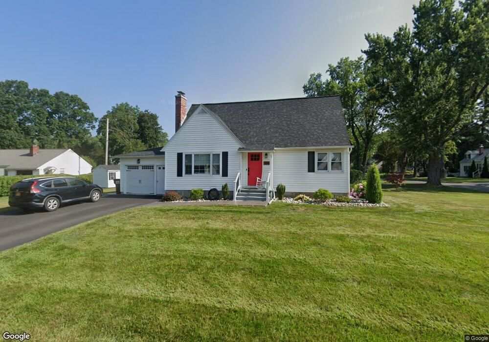
2067 Baker Ave Schenectady, NY 12309
Estimated Value: $322,113 - $366,000
4
Beds
2
Baths
1,620
Sq Ft
$210/Sq Ft
Est. Value
About This Home
This home is located at 2067 Baker Ave, Schenectady, NY 12309 and is currently estimated at $339,528, approximately $209 per square foot. 2067 Baker Ave is a home located in Schenectady County with nearby schools including Craig Elementary School, Van Antwerp Middle School, and Iroquois Middle School.
Ownership History
Date
Name
Owned For
Owner Type
Purchase Details
Closed on
Sep 2, 2011
Sold by
Georgelas Arthur and Kondoprias Theodore
Bought by
Lewandowski Morgan E and Ausfeld Robert
Current Estimated Value
Home Financials for this Owner
Home Financials are based on the most recent Mortgage that was taken out on this home.
Original Mortgage
$175,950
Outstanding Balance
$120,892
Interest Rate
4.33%
Mortgage Type
Unknown
Estimated Equity
$218,636
Purchase Details
Closed on
Nov 23, 2010
Sold by
Jensen Carol
Bought by
Georgelas Arthur
Create a Home Valuation Report for This Property
The Home Valuation Report is an in-depth analysis detailing your home's value as well as a comparison with similar homes in the area
Home Values in the Area
Average Home Value in this Area
Purchase History
| Date | Buyer | Sale Price | Title Company |
|---|---|---|---|
| Lewandowski Morgan E | $195,500 | None Available | |
| Georgelas Arthur | $127,500 | Dean Riggi | |
| Georgelas Arthur | $127,500 | None Available |
Source: Public Records
Mortgage History
| Date | Status | Borrower | Loan Amount |
|---|---|---|---|
| Open | Lewandowski Morgan E | $175,950 |
Source: Public Records
Tax History
| Year | Tax Paid | Tax Assessment Tax Assessment Total Assessment is a certain percentage of the fair market value that is determined by local assessors to be the total taxable value of land and additions on the property. | Land | Improvement |
|---|---|---|---|---|
| 2024 | $8,515 | $190,000 | $41,400 | $148,600 |
| 2023 | $86 | $190,000 | $41,400 | $148,600 |
| 2022 | $8,432 | $190,000 | $41,400 | $148,600 |
| 2021 | $6,892 | $190,000 | $41,400 | $148,600 |
| 2020 | $6,217 | $190,000 | $41,400 | $148,600 |
| 2019 | $3,131 | $190,000 | $41,400 | $148,600 |
| 2018 | $5,988 | $190,000 | $41,400 | $148,600 |
| 2017 | $5,884 | $190,000 | $41,400 | $148,600 |
| 2016 | $6,078 | $190,000 | $41,400 | $148,600 |
| 2015 | -- | $190,000 | $41,400 | $148,600 |
| 2014 | -- | $190,000 | $41,400 | $148,600 |
Source: Public Records
Map
Nearby Homes
- 2041 Morrow Ave
- 2324 Niskayuna Dr
- 2303 Balltown Rd
- 2313 Balltown Rd
- 2135 Morrow Ave
- 1535 Myron St
- 1549 Wyoming Ave
- 1527 Dean St
- 1829 Pawtucket Ave
- 14 Carrie Ct
- 2066 Orchard Park Dr
- 1971 Nott St
- 1501 Baker Ave
- 2370 Nott St E Unit 2370
- 1450 Baker Ave
- 241 Mohawk Trail
- 1377 Tracy Ave
- 2131 Grand Blvd
- 1295 Myron St
- 1345 Tracy Ave
- 2003 Clifton Park Rd
- 2063 Baker Ave
- 2011 Clifton Park Rd
- 1947 Clifton Park Rd
- 2000 Clifton Park Rd
- 2064 Baker Ave
- 2061 Baker Ave
- 2060 Baker Ave
- 1943 Clifton Park Rd
- 2056 Hoover Rd
- 2075 Baker Ave
- 2004 Clifton Park Rd
- 1942 Clifton Park Rd
- 2048 Hoover Rd
- 2052 Hoover Rd
- 2044 Hoover Rd
- 2074 Baker Ave
- 2055 Baker Ave
- 2056 Baker Ave
- 2008 Clifton Park Rd
Your Personal Tour Guide
Ask me questions while you tour the home.