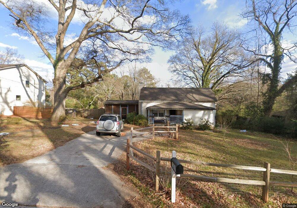
2067 Delphine Way 0 Decatur, GA 30032
Parker NeighborhoodEstimated Value: $314,120 - $400,000
3
Beds
2
Baths
1,515
Sq Ft
$234/Sq Ft
Est. Value
About This Home
This home is located at 2067 Delphine Way 0, Decatur, GA 30032 and is currently estimated at $355,030, approximately $234 per square foot. 2067 Delphine Way 0 is a home located in DeKalb County with nearby schools including McNair Middle School, McNair High School, and Charles Drew Charter School.
Ownership History
Date
Name
Owned For
Owner Type
Purchase Details
Closed on
Jan 27, 2020
Sold by
Arp Realty Llc
Bought by
Sawyer Kathleen
Current Estimated Value
Home Financials for this Owner
Home Financials are based on the most recent Mortgage that was taken out on this home.
Original Mortgage
$200,000
Outstanding Balance
$177,183
Interest Rate
3.74%
Mortgage Type
New Conventional
Estimated Equity
$177,847
Purchase Details
Closed on
Mar 28, 2017
Sold by
Price Rodney
Bought by
Georgia Platinum Property Inc
Purchase Details
Closed on
Mar 27, 2017
Sold by
Georgia Platinum Property Inc
Bought by
Arp Realty Llc
Create a Home Valuation Report for This Property
The Home Valuation Report is an in-depth analysis detailing your home's value as well as a comparison with similar homes in the area
Home Values in the Area
Average Home Value in this Area
Purchase History
| Date | Buyer | Sale Price | Title Company |
|---|---|---|---|
| Sawyer Kathleen | $250,000 | -- | |
| Georgia Platinum Property Inc | $73,333 | -- | |
| Arp Realty Llc | $78,800 | -- |
Source: Public Records
Mortgage History
| Date | Status | Borrower | Loan Amount |
|---|---|---|---|
| Open | Sawyer Kathleen | $200,000 |
Source: Public Records
Tax History Compared to Growth
Tax History
| Year | Tax Paid | Tax Assessment Tax Assessment Total Assessment is a certain percentage of the fair market value that is determined by local assessors to be the total taxable value of land and additions on the property. | Land | Improvement |
|---|---|---|---|---|
| 2025 | $892 | $119,160 | $41,120 | $78,040 |
| 2024 | $4,372 | $130,800 | $41,120 | $89,680 |
| 2023 | $4,372 | $99,120 | $5,947 | $93,173 |
| 2022 | $3,328 | $99,120 | $5,947 | $93,173 |
| 2021 | $2,817 | $99,120 | $5,880 | $93,240 |
| 2020 | $2,927 | $59,560 | $5,880 | $53,680 |
| 2019 | $2,288 | $45,000 | $5,880 | $39,120 |
| 2018 | $1,426 | $29,360 | $4,920 | $24,440 |
| 2017 | $1,773 | $30,360 | $3,000 | $27,360 |
| 2016 | $1,561 | $28,240 | $3,000 | $25,240 |
| 2014 | $1,043 | $16,120 | $3,000 | $13,120 |
Source: Public Records
Map
Nearby Homes
- 2076 Garden Cir
- 2093 Garden Cir
- 2049 Mcafee Rd
- 2009 Delphine Dr
- 2053 Juanita St
- 2032 Juanita St
- 2147 Mcafee Rd
- 2164 Rockhaven Cir
- 2013 Marco Dr
- 2030 Mark Trail
- 2010 2nd Ave
- 2177 Mcafee Rd
- 1942 E Starmount Way
- 1977 Camellia Dr
- 2128 Mark Trail
- 701 Daniel Ave
- 1967 Cogar Dr
- 2146 Trailwood Rd
- 2203 Hillcrest Ave
- 2067 Delphine Way
- 0 Delphine Way Unit 8655023
- 0 Delphine Way Unit 8836135
- 2076 Garden Cir Unit 2076
- 2069 Delphine Way
- 2065 Delphine Way
- 2065 Delphine Way Unit 1
- 2088 Garden Cir
- 2056 Garden Cir
- 2094 Garden Cir
- 2071 Mcafee Rd
- 2077 Mcafee Rd
- 2065 Mcafee Rd Unit 188
- 2065 Mcafee Rd
- 2081 Mcafee Rd
- 2100 Garden Cir
- 2057 Mcafee Rd
- 2077 Garden Cir
- 2073 Garden Cir
- 2048 Garden Cir