Estimated Value: $81,000 - $139,000
3
Beds
1
Bath
1,172
Sq Ft
$99/Sq Ft
Est. Value
About This Home
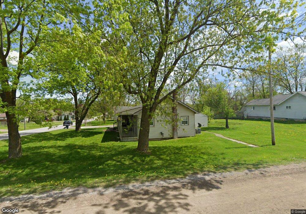
This home is located at 2067 Diamond Ave, Flint, MI 48532 and is currently estimated at $116,305, approximately $99 per square foot. 2067 Diamond Ave is a home located in Genesee County with nearby schools including Carman-Ainsworth High School, Genesee STEM Academy, and St. Paul Lutheran School.
Ownership History
Date
Name
Owned For
Owner Type
Purchase Details
Closed on
Apr 30, 2010
Sold by
Donovan Shaun and Secretary Of Housing & Urban D
Bought by
Covert Patricia L
Current Estimated Value
Purchase Details
Closed on
May 20, 2009
Sold by
Mortgage Electronic Registration Systems
Bought by
U S Department Of Housing & Urban Develo
Purchase Details
Closed on
Apr 15, 2009
Sold by
Ventimiglia Alan
Bought by
Mortgage Electronic Registration Systems
Purchase Details
Closed on
Mar 13, 2006
Sold by
Luck Harold L
Bought by
Ventimiglia Alan
Create a Home Valuation Report for This Property
The Home Valuation Report is an in-depth analysis detailing your home's value as well as a comparison with similar homes in the area
Home Values in the Area
Average Home Value in this Area
Purchase History
| Date | Buyer | Sale Price | Title Company |
|---|---|---|---|
| Covert Patricia L | $12,000 | None Available | |
| U S Department Of Housing & Urban Develo | -- | None Available | |
| Mortgage Electronic Registration Systems | $89,381 | None Available | |
| Ventimiglia Alan | $85,500 | Sargents Title Company |
Source: Public Records
Tax History
| Year | Tax Paid | Tax Assessment Tax Assessment Total Assessment is a certain percentage of the fair market value that is determined by local assessors to be the total taxable value of land and additions on the property. | Land | Improvement |
|---|---|---|---|---|
| 2025 | $1,764 | $43,900 | $0 | $0 |
| 2024 | $971 | $38,900 | $0 | $0 |
| 2023 | $889 | $32,000 | $0 | $0 |
| 2022 | $709 | $29,200 | $0 | $0 |
| 2021 | $1,436 | $27,200 | $0 | $0 |
| 2020 | $671 | $23,200 | $0 | $0 |
| 2019 | $774 | $20,000 | $0 | $0 |
| 2018 | $1,446 | $23,600 | $0 | $0 |
| 2017 | $1,526 | $23,600 | $0 | $0 |
| 2016 | $1,445 | $21,200 | $0 | $0 |
| 2015 | $796 | $20,600 | $0 | $0 |
| 2014 | $472 | $19,800 | $0 | $0 |
| 2012 | -- | $23,400 | $23,400 | $0 |
Source: Public Records
Map
Nearby Homes
- 18.41 Taft Rd
- 1512 Crescent Lane Dr Lot#46
- 10 Acres T A Mansour Blvd
- 4051 Red Wing Dr
- 4474 Corunna Rd
- 4199 Sheraton Dr
- 4480 Corunna Rd
- 1455 S Linden Rd
- 2379 Hialeah Dr
- 0 Charter Dr Unit 50153638
- 3.9 Acres W Court St
- 2521 White Oak Place
- 2525 White Oak Place Unit 3
- 2442 Valley Oaks Cir Unit 35
- 3277 Whitney Ave
- 2 Charter Dr
- 1184 Normandy Terrace Dr
- 4335 Lennon Rd
- 5151 Brobeck St
- 3045 Old Farm Rd
- 2077 Diamond Ave
- 2066 Monaco St
- 2055 Diamond Ave
- 2085 Diamond Ave
- 2066 Diamond Ave
- 2051 Diamond Ave
- 2076 Diamond Ave
- 2052 Monaco St
- 2052 Diamond St
- 2045 Diamond Ave
- 2052 Diamond Ave
- 2048 Monaco St Unit Bldg-Unit
- 2048 Monaco St
- 2090 Diamond Ave
- 2103 Diamond Ave
- 2037 Diamond Ave
- 2065 Dutcher St
- 2096 Diamond Ave
- 2073 Dutcher St
- 2071 Monaco St
Your Personal Tour Guide
Ask me questions while you tour the home.