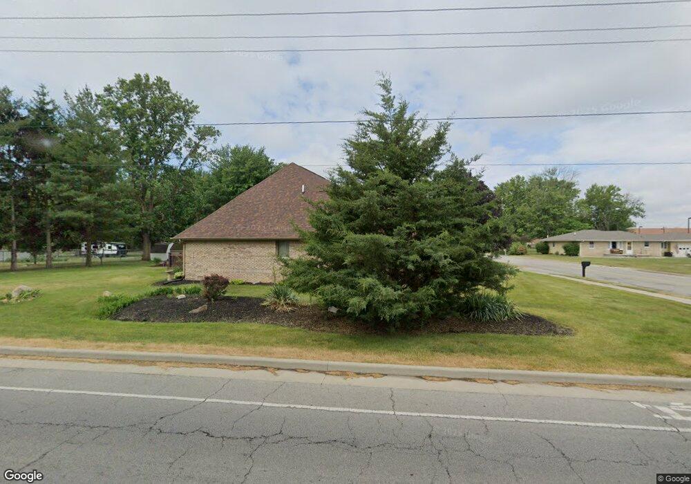
2067 Haven Ave Frankfort, IN 46041
Estimated Value: $289,791 - $318,000
3
Beds
2
Baths
2,240
Sq Ft
$137/Sq Ft
Est. Value
About This Home
This home is located at 2067 Haven Ave, Frankfort, IN 46041 and is currently estimated at $306,198, approximately $136 per square foot. 2067 Haven Ave is a home located in Clinton County with nearby schools including Frankfort Senior High School and Frankfort Covenant Academy.
Ownership History
Date
Name
Owned For
Owner Type
Purchase Details
Closed on
Mar 4, 2021
Sold by
Waggoner N Keith N and Waggoner Sharon R
Bought by
Waggoner N Keith N and Waggoner Sharon R
Current Estimated Value
Purchase Details
Closed on
Dec 18, 2013
Sold by
Ricker Chris
Bought by
Waggoner N Keith N and Waggoner Sharon R
Purchase Details
Closed on
Nov 27, 2013
Sold by
Ricker Jay B
Bought by
Ricker Chris
Purchase Details
Closed on
Jun 29, 2009
Sold by
Ricker Barbara J
Bought by
Ricker Jay B and Ricker Chris
Create a Home Valuation Report for This Property
The Home Valuation Report is an in-depth analysis detailing your home's value as well as a comparison with similar homes in the area
Home Values in the Area
Average Home Value in this Area
Purchase History
| Date | Buyer | Sale Price | Title Company |
|---|---|---|---|
| Waggoner N Keith N | -- | None Available | |
| Waggoner N Keith N | -- | None Available | |
| Ricker Chris | -- | None Available | |
| Ricker Jay B | -- | None Available |
Source: Public Records
Tax History Compared to Growth
Tax History
| Year | Tax Paid | Tax Assessment Tax Assessment Total Assessment is a certain percentage of the fair market value that is determined by local assessors to be the total taxable value of land and additions on the property. | Land | Improvement |
|---|---|---|---|---|
| 2024 | $1,755 | $158,400 | $23,000 | $135,400 |
| 2023 | $1,811 | $158,400 | $23,000 | $135,400 |
| 2022 | $1,820 | $158,400 | $23,000 | $135,400 |
| 2021 | $1,655 | $145,400 | $23,000 | $122,400 |
| 2020 | $3,411 | $145,400 | $23,000 | $122,400 |
| 2019 | $3,491 | $148,600 | $23,000 | $125,600 |
| 2018 | $3,453 | $148,600 | $23,000 | $125,600 |
| 2017 | $3,553 | $151,200 | $25,900 | $125,300 |
| 2016 | $3,594 | $130,300 | $25,900 | $104,400 |
| 2014 | $2,626 | $131,300 | $25,900 | $105,400 |
Source: Public Records
Map
Nearby Homes
- 759 Sunrise Dr Unit 111
- 837 Sunrise Dr Unit 119
- 832 Sunrise Dr Unit 118
- 829 Sunrise Dr Unit 117
- 806 Sunrise Dr Unit 112
- 813 Sunrise Dr Unit 113
- 845 Sunrise Dr Unit 121
- 821 Sunrise Dr Unit 115
- 851 Sunrise Dr Unit 123
- 848 Sunrise Dr Unit 122
- 842 Sunrise Dr Unit 120
- 818 Sunrise Dr Unit 114
- 1816 Southridge Dr
- 1828 Southridge Dr
- 1309 Lea Ct
- 837 S Hoke Ave
- 909 S Hoke Ave
- 840 S Hoke Ave
- 1758 E Clinton St
- 359 Center Dr
- 2049 Haven Ave
- 1004 S Maish Rd
- 958 S Maish Rd
- 1050 S Maish Rd
- 1008 S Maish Rd
- 2029 Haven Ave
- 2034 Haven Ave
- 2052 Maranatha Dr
- 2004 Maranatha Dr
- 2058 Maranatha Dr
- 1001 S Maish Rd
- 2050 Maranatha Dr
- 959 S Maish Rd
- 2011 Haven Ave
- 2018 Haven Ave
- 1057 S Maish Rd
- 2035 Haven Ave
- 955 S Maish Rd
- 2002 Maranatha Dr
- 2155 Haven Ave