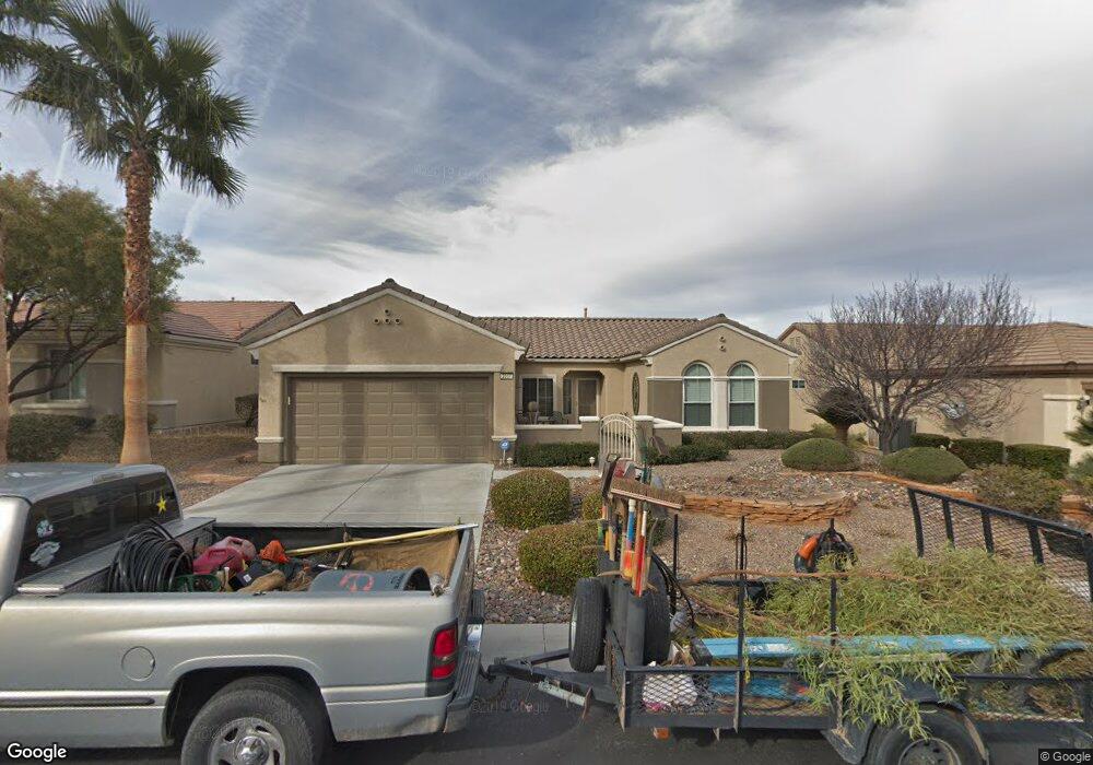
2067 Mountain City St Unit 12 Henderson, NV 89052
Sun City Anthem NeighborhoodEstimated Value: $496,000 - $542,000
2
Beds
2
Baths
1,600
Sq Ft
$322/Sq Ft
Est. Value
About This Home
This home is located at 2067 Mountain City St Unit 12, Henderson, NV 89052 and is currently estimated at $515,850, approximately $322 per square foot. 2067 Mountain City St Unit 12 is a home located in Clark County with nearby schools including Shirley & Bill Wallin Elementary School, Del E. Webb Middle School, and Liberty High School.
Ownership History
Date
Name
Owned For
Owner Type
Purchase Details
Closed on
Mar 4, 2019
Sold by
Peterson Bruce and Peterson Mary
Bought by
Peterson Bruce and Peterson Mary
Current Estimated Value
Home Financials for this Owner
Home Financials are based on the most recent Mortgage that was taken out on this home.
Original Mortgage
$263,000
Outstanding Balance
$169,812
Interest Rate
4.4%
Mortgage Type
New Conventional
Estimated Equity
$346,038
Purchase Details
Closed on
May 24, 2016
Sold by
Peterson Bruce D and Peterson Mary E
Bought by
Peterson Family Living Trust
Purchase Details
Closed on
Dec 6, 2002
Sold by
Del Webb Communities Inc
Bought by
Peterson Bruce D and Peterson Mary E
Home Financials for this Owner
Home Financials are based on the most recent Mortgage that was taken out on this home.
Original Mortgage
$184,222
Interest Rate
5.86%
Create a Home Valuation Report for This Property
The Home Valuation Report is an in-depth analysis detailing your home's value as well as a comparison with similar homes in the area
Home Values in the Area
Average Home Value in this Area
Purchase History
| Date | Buyer | Sale Price | Title Company |
|---|---|---|---|
| Peterson Bruce | -- | Amrock Inc | |
| Peterson Bruce | -- | Amrock Inc | |
| Peterson Family Living Trust | -- | None Available | |
| Peterson Bruce D | $225,167 | Del Webb Title Company Of Ne |
Source: Public Records
Mortgage History
| Date | Status | Borrower | Loan Amount |
|---|---|---|---|
| Open | Peterson Bruce | $263,000 | |
| Closed | Peterson Bruce D | $184,222 |
Source: Public Records
Tax History Compared to Growth
Tax History
| Year | Tax Paid | Tax Assessment Tax Assessment Total Assessment is a certain percentage of the fair market value that is determined by local assessors to be the total taxable value of land and additions on the property. | Land | Improvement |
|---|---|---|---|---|
| 2025 | $2,846 | $136,770 | $56,000 | $80,770 |
| 2024 | $2,764 | $136,770 | $56,000 | $80,770 |
| 2023 | $2,764 | $128,982 | $52,500 | $76,482 |
| 2022 | $2,683 | $114,343 | $44,450 | $69,893 |
| 2021 | $2,605 | $105,345 | $39,200 | $66,145 |
| 2020 | $2,526 | $104,108 | $38,850 | $65,258 |
| 2019 | $2,453 | $101,092 | $36,750 | $64,342 |
| 2018 | $2,381 | $97,339 | $35,000 | $62,339 |
| 2017 | $2,799 | $95,614 | $33,250 | $62,364 |
| 2016 | $2,255 | $88,429 | $26,250 | $62,179 |
| 2015 | $2,251 | $80,537 | $19,250 | $61,287 |
| 2014 | $2,185 | $74,074 | $15,750 | $58,324 |
Source: Public Records
Map
Nearby Homes
- 2048 Oliver Springs St
- 2069 Colvin Run Dr
- 2899 Brook Trout Ct
- 2077 Wildwood Lake St
- 2095 Colvin Run Dr
- 1999 Oliver Springs St
- 3029 Brownbirds Nest Dr Unit 17
- 2874 Hartwick Pines Dr
- 2002 Wildwood Lake St
- 2084 Fort Halifax St
- 3048 Brownbirds Nest Dr
- 2134 Colvin Run Dr
- 1964 Oliver Springs St
- 3017 Hartsville Rd
- 2170 Peyten Park St
- 2167 Maple Heights Ct
- 2138 Fort Halifax St
- 3065 Hartsville Rd
- 3052 Hartsville Rd
- 3013 Fort Stanwix Rd Unit 12
- 2063 Mountain City St
- 2071 Mountain City St
- 2064 Oliver Springs St
- 2068 Oliver Springs St Unit 17
- 2060 Oliver Springs St
- 2059 Mountain City St Unit 12
- 2075 Mountain City St Unit 12
- 2066 Mountain City St
- 2070 Mountain City St
- 2062 Mountain City St
- 2072 Oliver Springs St
- 2055 Mountain City St
- 2058 Mountain City St
- 2052 Oliver Springs St Unit 17
- 2065 Oliver Springs St
- 2069 Oliver Springs St
- 2081 Mountain City St Unit 17
- 2061 Oliver Springs St
- 2054 Mountain City St Unit 12
- 2051 Mountain City St