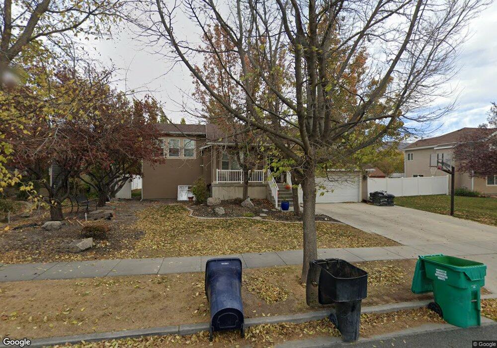
2067 S 1350 W Unit 209 Woods Cross, UT 84087
Estimated Value: $591,000 - $630,094
5
Beds
3
Baths
1,793
Sq Ft
$341/Sq Ft
Est. Value
About This Home
This home is located at 2067 S 1350 W Unit 209, Woods Cross, UT 84087 and is currently estimated at $610,524, approximately $340 per square foot. 2067 S 1350 W Unit 209 is a home located in Davis County with nearby schools including Odyssey School, South Davis Junior High School, and Woods Cross High School.
Ownership History
Date
Name
Owned For
Owner Type
Purchase Details
Closed on
Apr 15, 2016
Sold by
Spencer Justin C and Spencer Sara L
Bought by
Lane Joseph D and Lane Michelle T
Current Estimated Value
Home Financials for this Owner
Home Financials are based on the most recent Mortgage that was taken out on this home.
Original Mortgage
$266,950
Outstanding Balance
$211,850
Interest Rate
3.73%
Mortgage Type
New Conventional
Estimated Equity
$398,674
Purchase Details
Closed on
Mar 6, 2002
Sold by
Sunrise Homes Lc
Bought by
Spencer Justin C and Spencer Sara L
Home Financials for this Owner
Home Financials are based on the most recent Mortgage that was taken out on this home.
Original Mortgage
$140,600
Interest Rate
6.94%
Purchase Details
Closed on
Sep 13, 2001
Sold by
Newport Holding Inc
Bought by
Sunrise Homes Lc
Create a Home Valuation Report for This Property
The Home Valuation Report is an in-depth analysis detailing your home's value as well as a comparison with similar homes in the area
Home Values in the Area
Average Home Value in this Area
Purchase History
| Date | Buyer | Sale Price | Title Company |
|---|---|---|---|
| Lane Joseph D | -- | North American Title | |
| Spencer Justin C | -- | Founders Title Co | |
| Sunrise Homes Lc | -- | Aspen Title Insurance Agency |
Source: Public Records
Mortgage History
| Date | Status | Borrower | Loan Amount |
|---|---|---|---|
| Open | Lane Joseph D | $266,950 | |
| Previous Owner | Spencer Justin C | $140,600 |
Source: Public Records
Tax History Compared to Growth
Tax History
| Year | Tax Paid | Tax Assessment Tax Assessment Total Assessment is a certain percentage of the fair market value that is determined by local assessors to be the total taxable value of land and additions on the property. | Land | Improvement |
|---|---|---|---|---|
| 2025 | $3,708 | $326,701 | $111,095 | $215,606 |
| 2024 | $3,500 | $315,150 | $118,325 | $196,825 |
| 2023 | $3,286 | $549,000 | $156,647 | $392,353 |
| 2022 | $2,836 | $260,700 | $68,087 | $192,613 |
| 2021 | $2,532 | $370,000 | $99,861 | $270,139 |
| 2020 | $2,251 | $325,000 | $95,034 | $229,966 |
| 2019 | $2,343 | $334,000 | $88,741 | $245,259 |
| 2018 | $2,194 | $309,000 | $87,279 | $221,721 |
| 2016 | $1,746 | $134,475 | $37,075 | $97,400 |
| 2015 | $1,669 | $122,705 | $37,075 | $85,630 |
| 2014 | $1,709 | $130,796 | $37,075 | $93,721 |
| 2013 | -- | $111,061 | $25,709 | $85,352 |
Source: Public Records
Map
Nearby Homes
- 1384 W 2175 S
- 1255 W 2050 S
- 1984 S 1500 W
- 1998 S 1600 W
- 1334 W 1300 S
- 1422 W 1300 S
- 2024 S 925 W
- 1309 W 1200 S
- 916 W 2025 S
- 913 W 2025 S
- 1288 S 1050 W
- 1846 W 2280 S
- 1623 S 925 W
- 1137 S 1050 W
- 1552 S 850 W
- 826 W Ivywell Ln Unit 219
- 828 W Ivywell Ln Unit 220
- 1153 N Meridian Ln Unit 120
- 1971 W 1870 S
- 1160 N Clifton Dr Unit 114
- 2067 S 1350 W
- 2051 S 1350 W
- 2051 S 1350 W Unit 208
- 2079 S 1350 W
- 2079 S 1350 W Unit 210
- 1353 W 2050 S
- 1353 W 2050 S Unit 235
- 2043 S 1350 W
- 2043 S 1350 W Unit 207
- 2097 S 1350 W
- 1356 W 2100 S
- 1356 W 2100 S Unit 234
- 2042 S 1300 W
- 2042 S 1350 W
- 2022 S 1300 W
- 1358 W 2050 S Unit 242
- 1361 W 2050 S
- 1361 W 2050 S Unit 236
- 1986 S 1300 W
- 1305 W 2050 S