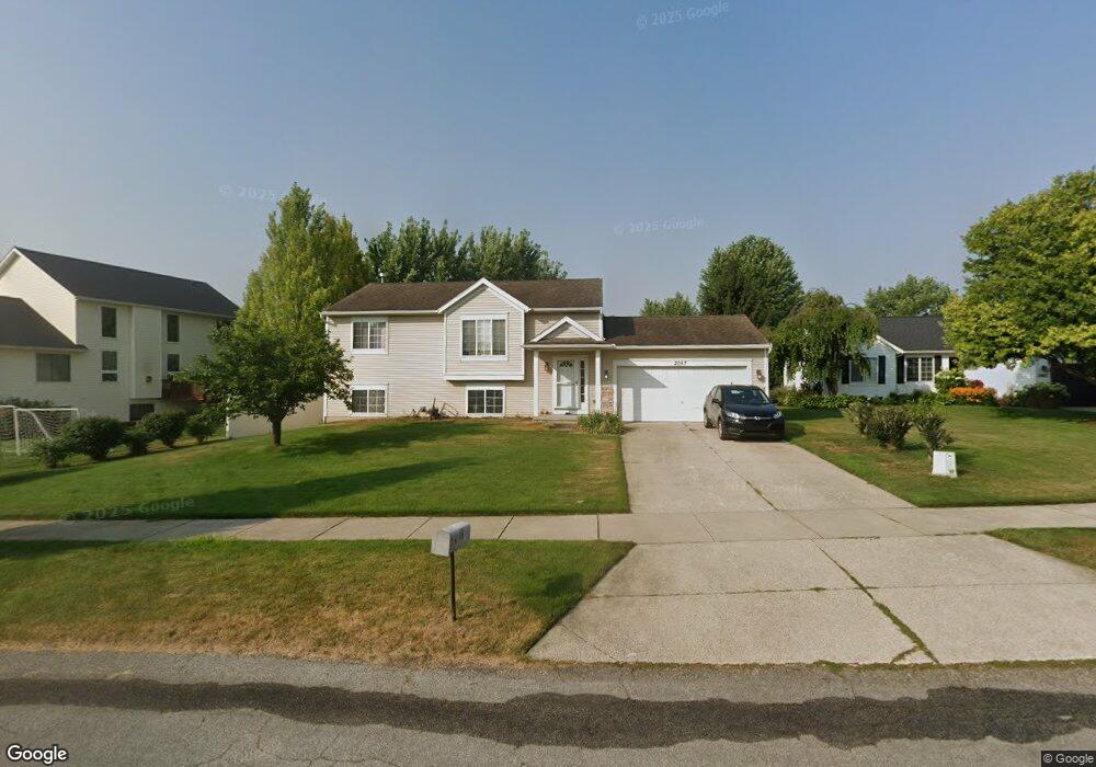
2067 Shiloh Point Dr SE Grand Rapids, MI 49546
East Paris NeighborhoodEstimated Value: $427,029 - $487,000
4
Beds
2
Baths
1,900
Sq Ft
$241/Sq Ft
Est. Value
About This Home
This home is located at 2067 Shiloh Point Dr SE, Grand Rapids, MI 49546 and is currently estimated at $458,007, approximately $241 per square foot. 2067 Shiloh Point Dr SE is a home located in Kent County with nearby schools including Meadow Brook Elementary School, Northern Trails 5/6 School, and Northern Hills Middle School.
Ownership History
Date
Name
Owned For
Owner Type
Purchase Details
Closed on
Aug 31, 2023
Sold by
Habib Kamal and Habib Thoraya A
Bought by
Habib Kamal
Current Estimated Value
Purchase Details
Closed on
Nov 21, 2011
Sold by
Burns Mark R and Burns Terri L
Bought by
Habib Kamal and Bashi Thorayn A
Purchase Details
Closed on
Nov 22, 2002
Sold by
Burns Marc R and Burns Terri L
Bought by
Burns Marc R and Burns Terri L
Home Financials for this Owner
Home Financials are based on the most recent Mortgage that was taken out on this home.
Original Mortgage
$146,501
Interest Rate
6.25%
Mortgage Type
FHA
Purchase Details
Closed on
Mar 8, 2001
Sold by
Shiloh Development Llc
Bought by
G & C Land Company Llc
Create a Home Valuation Report for This Property
The Home Valuation Report is an in-depth analysis detailing your home's value as well as a comparison with similar homes in the area
Home Values in the Area
Average Home Value in this Area
Purchase History
| Date | Buyer | Sale Price | Title Company |
|---|---|---|---|
| Habib Kamal | -- | None Listed On Document | |
| Habib Kamal | $150,000 | None Available | |
| Burns Marc R | -- | -- | |
| G & C Land Company Llc | $1,312,000 | Metropolitan Title Company |
Source: Public Records
Mortgage History
| Date | Status | Borrower | Loan Amount |
|---|---|---|---|
| Previous Owner | Burns Marc R | $146,501 |
Source: Public Records
Tax History Compared to Growth
Tax History
| Year | Tax Paid | Tax Assessment Tax Assessment Total Assessment is a certain percentage of the fair market value that is determined by local assessors to be the total taxable value of land and additions on the property. | Land | Improvement |
|---|---|---|---|---|
| 2025 | $3,558 | $174,900 | $0 | $0 |
| 2024 | $3,558 | $169,700 | $0 | $0 |
| 2023 | $3,806 | $157,500 | $0 | $0 |
| 2022 | $3,568 | $128,400 | $0 | $0 |
| 2021 | $3,475 | $132,000 | $0 | $0 |
| 2020 | $2,870 | $119,800 | $0 | $0 |
| 2019 | $3,355 | $109,700 | $0 | $0 |
| 2018 | $3,355 | $100,300 | $0 | $0 |
| 2017 | $3,327 | $95,600 | $0 | $0 |
| 2016 | $3,228 | $89,000 | $0 | $0 |
| 2015 | $3,190 | $89,000 | $0 | $0 |
| 2013 | -- | $79,700 | $0 | $0 |
Source: Public Records
Map
Nearby Homes
- 4496 Shiloh Way Dr SE
- 2045 Forest Hill Ave SE
- 4478 Burton Forest Ct SE
- 4223 Burton St SE
- 1950 Hidden Oak Ct SE
- 4365 Cloverleaf Dr SE Unit Lot 8
- 1618 Blue Grass Ct SE
- 4327 Woodside Oaks Dr SE
- 4323 Woodside Oaks Dr SE
- 1909 Deerfield Ct SE
- 2441 Kingbridge Terrace SE Unit 86
- 4694 E Meadows Dr SE
- 2376 Bob White Ct SE
- 4519 Thornberry Dr SE Unit 26
- 2462 Highridge Ln SE
- 2242 Christine Ct SE
- 1840 Keyhill Ave SE
- 6114 Stahl Dr Unit 16
- 1145 Eastmont Dr SE
- 1940 Observatory Ave SE
- 2063 Shiloh Point Dr SE
- 4511 Shiloh Way Dr SE
- 4499 Shiloh Way Dr SE
- 2055 Shiloh Point SE
- 2055 Shiloh Point Dr SE
- 2112 Shiloh Hills Dr SE
- 4487 Shiloh Way Dr SE
- 2070 Shiloh Point Dr SE
- 2056 Shiloh Point Dr SE
- 2076 Shiloh Point Dr SE
- 2044 Shiloh Point Dr SE
- 2046 Shiloh Point Dr SE
- 2056 Shiloh Point Dr SE
- 2082 Shiloh Point Dr SE
- 2108 Shiloh Hills Dr SE
- 4520 Shiloh Way Dr SE
- 4508 Shiloh Way Dr SE
- 4496 Shiloh Way SE
- 2096 Shiloh Point Dr SE
- 2106 Shiloh Hills Dr SE