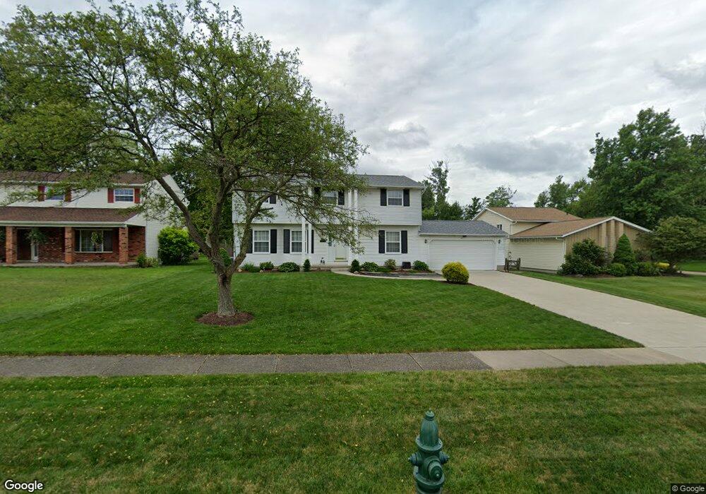
20671 Chestnut Dr Strongsville, OH 44149
Estimated Value: $344,742 - $378,000
4
Beds
3
Baths
2,142
Sq Ft
$169/Sq Ft
Est. Value
About This Home
This home is located at 20671 Chestnut Dr, Strongsville, OH 44149 and is currently estimated at $362,186, approximately $169 per square foot. 20671 Chestnut Dr is a home located in Cuyahoga County with nearby schools including Strongsville High School, St Mary School, and Sts Joseph & John Interparochial School.
Ownership History
Date
Name
Owned For
Owner Type
Purchase Details
Closed on
Jul 26, 1993
Sold by
Mohr John K
Bought by
Nimrichter Raymond D
Current Estimated Value
Purchase Details
Closed on
Nov 16, 1990
Sold by
Lennerth Francis E
Bought by
Mohr John K
Purchase Details
Closed on
Oct 21, 1983
Sold by
Rozga Joseph S
Bought by
Lennerth Francis E
Purchase Details
Closed on
Sep 24, 1980
Sold by
Schuster Terry D and Schuster Sandra R
Bought by
Rozga Joseph S
Purchase Details
Closed on
Jan 1, 1975
Bought by
Schuster Terry D and Schuster Sandra R
Create a Home Valuation Report for This Property
The Home Valuation Report is an in-depth analysis detailing your home's value as well as a comparison with similar homes in the area
Home Values in the Area
Average Home Value in this Area
Purchase History
| Date | Buyer | Sale Price | Title Company |
|---|---|---|---|
| Nimrichter Raymond D | $126,000 | -- | |
| Mohr John K | $121,300 | -- | |
| Lennerth Francis E | $89,500 | -- | |
| Rozga Joseph S | $93,700 | -- | |
| Schuster Terry D | -- | -- |
Source: Public Records
Tax History Compared to Growth
Tax History
| Year | Tax Paid | Tax Assessment Tax Assessment Total Assessment is a certain percentage of the fair market value that is determined by local assessors to be the total taxable value of land and additions on the property. | Land | Improvement |
|---|---|---|---|---|
| 2024 | $4,549 | $106,680 | $18,865 | $87,815 |
| 2023 | $5,026 | $80,260 | $15,960 | $64,300 |
| 2022 | $4,989 | $80,260 | $15,960 | $64,300 |
| 2021 | $4,950 | $80,260 | $15,960 | $64,300 |
| 2020 | $4,587 | $65,800 | $13,090 | $52,710 |
| 2019 | $4,452 | $188,000 | $37,400 | $150,600 |
| 2018 | $4,130 | $65,800 | $13,090 | $52,710 |
| 2017 | $4,298 | $64,790 | $11,940 | $52,850 |
| 2016 | $4,263 | $64,790 | $11,940 | $52,850 |
| 2015 | $4,197 | $64,790 | $11,940 | $52,850 |
| 2014 | $4,197 | $62,900 | $11,590 | $51,310 |
Source: Public Records
Map
Nearby Homes
- 20424 Scotch Pine Way
- 20684 Albion Rd
- 10839 Prospect Rd
- 20050 Idlewood Trail
- 21176 Hickory Branch Trail
- 19890 Idlewood Trail
- 9401 Pheasant Run Place
- 19997 Idlewood Trail
- 21355 Hickory Branch Trail
- 10986 Fawn Meadow Ln
- 10353 Oak Branch Trail
- 11179 Fawn Meadow Ln
- 19240 Briarwood Ln
- 0 Priem Rd
- 9829 Plum Brook Ln
- 8627 Courtland Dr
- 22300 Rock Creek Cir
- 11432 Pearl Rd
- 11499 Pearl Rd Unit A106
- 12647 Edgepark Cir
- 20673 Chestnut Dr
- 20669 Chestnut Dr
- 20438 Prairie Meadows Place
- 20675 Chestnut Dr
- 20434 Prairie Meadows Place
- 10141 Peachtree Dr
- 20667 Chestnut Dr
- 20442 Prairie Meadows Place
- 20677 Chestnut Dr
- 20674 Chestnut Dr
- 20430 Prairie Meadows Place
- 10139 Peachtree Dr
- 20676 Chestnut Dr
- 20679 Chestnut Dr
- 20665 Chestnut Dr
- 20678 Chestnut Dr
- 20449 Prairie Meadows Place
- 20426 Prairie Meadows Place
- 10135 Peachtree Dr
- 10138 Peachtree Dr