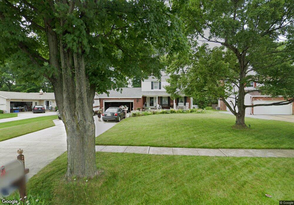
20675 Chestnut Dr Strongsville, OH 44149
Estimated Value: $305,000 - $351,000
3
Beds
2
Baths
1,848
Sq Ft
$175/Sq Ft
Est. Value
About This Home
This home is located at 20675 Chestnut Dr, Strongsville, OH 44149 and is currently estimated at $324,108, approximately $175 per square foot. 20675 Chestnut Dr is a home located in Cuyahoga County with nearby schools including Strongsville High School and St Mary School.
Ownership History
Date
Name
Owned For
Owner Type
Purchase Details
Closed on
Jun 30, 1988
Sold by
Ebright Bruce A
Bought by
Schaeffer David R
Current Estimated Value
Purchase Details
Closed on
Aug 9, 1985
Sold by
Hughes Gerld M and Hughes Elizabeth A
Bought by
Ebright Bruce A
Purchase Details
Closed on
Apr 12, 1979
Sold by
Smith Florence A
Bought by
Hughes Gerld M and Hughes Elizabeth A
Purchase Details
Closed on
Jan 1, 1975
Bought by
Smith Florence A
Create a Home Valuation Report for This Property
The Home Valuation Report is an in-depth analysis detailing your home's value as well as a comparison with similar homes in the area
Home Values in the Area
Average Home Value in this Area
Purchase History
| Date | Buyer | Sale Price | Title Company |
|---|---|---|---|
| Schaeffer David R | $102,900 | -- | |
| Ebright Bruce A | $89,300 | -- | |
| Hughes Gerld M | $78,000 | -- | |
| Smith Florence A | -- | -- |
Source: Public Records
Tax History Compared to Growth
Tax History
| Year | Tax Paid | Tax Assessment Tax Assessment Total Assessment is a certain percentage of the fair market value that is determined by local assessors to be the total taxable value of land and additions on the property. | Land | Improvement |
|---|---|---|---|---|
| 2024 | $3,627 | $87,045 | $18,865 | $68,180 |
| 2023 | $3,585 | $66,430 | $15,960 | $50,470 |
| 2022 | $3,803 | $69,930 | $15,960 | $53,970 |
| 2021 | $3,773 | $69,930 | $15,960 | $53,970 |
| 2020 | $3,387 | $57,330 | $13,090 | $44,240 |
| 2019 | $3,287 | $163,800 | $37,400 | $126,400 |
| 2018 | $1,492 | $57,330 | $13,090 | $44,240 |
| 2017 | $3,030 | $54,430 | $11,940 | $42,490 |
| 2016 | $3,006 | $54,430 | $11,940 | $42,490 |
| 2015 | $2,943 | $54,430 | $11,940 | $42,490 |
| 2014 | $2,943 | $52,860 | $11,590 | $41,270 |
Source: Public Records
Map
Nearby Homes
- 20424 Scotch Pine Way
- 20684 Albion Rd
- 10839 Prospect Rd
- 20050 Idlewood Trail
- 21176 Hickory Branch Trail
- 19890 Idlewood Trail
- 9401 Pheasant Run Place
- 19997 Idlewood Trail
- 21355 Hickory Branch Trail
- 10986 Fawn Meadow Ln
- 10353 Oak Branch Trail
- 11179 Fawn Meadow Ln
- 19240 Briarwood Ln
- 0 Priem Rd
- 9829 Plum Brook Ln
- 8627 Courtland Dr
- 22300 Rock Creek Cir
- 11432 Pearl Rd
- 11499 Pearl Rd Unit A106
- 12647 Edgepark Cir
- 20677 Chestnut Dr
- 20673 Chestnut Dr
- 20679 Chestnut Dr
- 20671 Chestnut Dr
- 20434 Prairie Meadows Place
- 20430 Prairie Meadows Place
- 20438 Prairie Meadows Place
- 20681 Chestnut Dr
- 20669 Chestnut Dr
- 20426 Prairie Meadows Place
- 20674 Chestnut Dr
- 20676 Chestnut Dr
- 20678 Chestnut Dr
- 10141 Peachtree Dr
- 20680 Chestnut Dr
- 20683 Chestnut Dr
- 20442 Prairie Meadows Place
- 20416 Scotch Pine Way
- 20682 Chestnut Dr
- 10139 Peachtree Dr