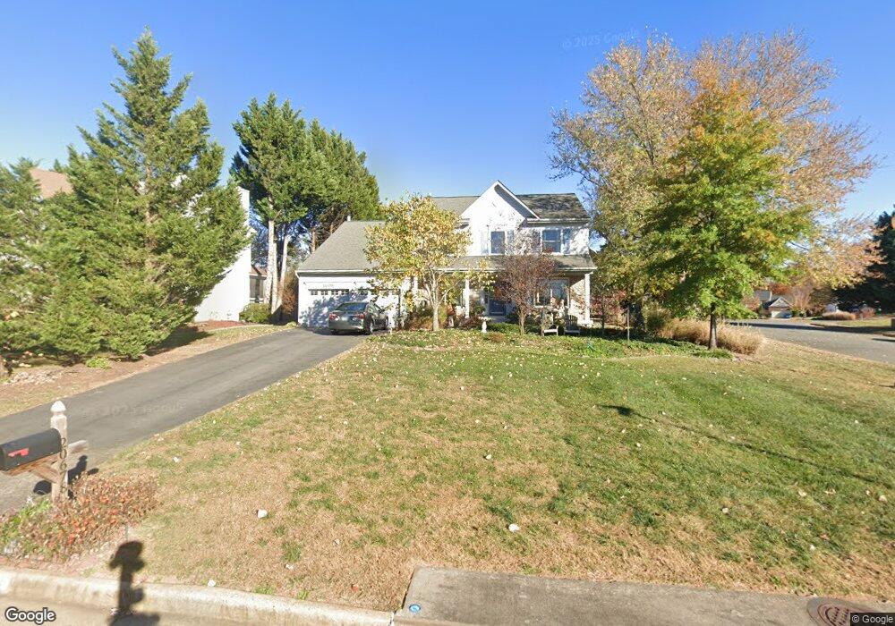
20678 Stillpond Ct Ashburn, VA 20147
Estimated Value: $928,000 - $942,000
4
Beds
4
Baths
2,408
Sq Ft
$387/Sq Ft
Est. Value
About This Home
This home is located at 20678 Stillpond Ct, Ashburn, VA 20147 and is currently estimated at $931,816, approximately $386 per square foot. 20678 Stillpond Ct is a home located in Loudoun County with nearby schools including Dominion Trail Elementary School, Farmwell Station Middle School, and Broad Run High School.
Ownership History
Date
Name
Owned For
Owner Type
Purchase Details
Closed on
Mar 30, 1998
Sold by
Kelley Randy T and Kelley Teresa R
Bought by
Talley Charles G and Talley Christine C
Current Estimated Value
Home Financials for this Owner
Home Financials are based on the most recent Mortgage that was taken out on this home.
Original Mortgage
$198,400
Outstanding Balance
$37,202
Interest Rate
6.96%
Mortgage Type
New Conventional
Estimated Equity
$894,614
Create a Home Valuation Report for This Property
The Home Valuation Report is an in-depth analysis detailing your home's value as well as a comparison with similar homes in the area
Home Values in the Area
Average Home Value in this Area
Purchase History
| Date | Buyer | Sale Price | Title Company |
|---|---|---|---|
| Talley Charles G | $248,000 | -- |
Source: Public Records
Mortgage History
| Date | Status | Borrower | Loan Amount |
|---|---|---|---|
| Open | Talley Charles G | $198,400 |
Source: Public Records
Tax History Compared to Growth
Tax History
| Year | Tax Paid | Tax Assessment Tax Assessment Total Assessment is a certain percentage of the fair market value that is determined by local assessors to be the total taxable value of land and additions on the property. | Land | Improvement |
|---|---|---|---|---|
| 2025 | $6,921 | $859,700 | $300,600 | $559,100 |
| 2024 | $6,968 | $805,520 | $295,600 | $509,920 |
| 2023 | $6,922 | $791,040 | $295,600 | $495,440 |
| 2022 | $6,710 | $753,950 | $270,600 | $483,350 |
| 2021 | $6,484 | $661,650 | $220,600 | $441,050 |
| 2020 | $6,455 | $623,710 | $201,800 | $421,910 |
| 2019 | $6,397 | $612,180 | $201,800 | $410,380 |
| 2018 | $6,057 | $558,260 | $181,800 | $376,460 |
| 2017 | $6,133 | $545,130 | $181,800 | $363,330 |
| 2016 | $6,292 | $549,510 | $0 | $0 |
| 2015 | $5,947 | $342,200 | $0 | $342,200 |
| 2014 | $5,905 | $329,430 | $0 | $329,430 |
Source: Public Records
Map
Nearby Homes
- 20624 Camptown Ct
- 43834 Jenkins Ln
- 20857 Ashburn Rd
- 20576 Ashburn Rd
- 44092 Natalie Terrace Unit 302
- 43669 Hay Rd
- 20600 Cornstalk Terrace Unit 202
- 44004 Florence Terrace
- 43709 Raleigh Place
- 44152 Natalie Terrace Unit 201
- 43949 Bruceton Mills Cir
- 20314 Snowpoint Place
- 44180 Shady Glen Terrace
- 20402 Cool Fern Square
- 20471 Rolling Water Terrace
- 20432 Cool Fern Square
- 20331 Susan Leslie Dr
- 20278 Glenrobin Terrace
- 44202 Bristow Cir
- 44135 Tippecanoe Terrace
- 20674 Stillpond Ct
- 20699 Tally Ho Ct
- 20670 Stillpond Ct
- 20695 Tally Ho Ct
- 43919 Glenhazel Dr
- 20679 Stillpond Ct
- 20675 Stillpond Ct
- 20691 Tally Ho Ct
- 43915 Glenhazel Dr
- 20666 Stillpond Ct
- 20671 Stillpond Ct
- 43911 Glenhazel Dr
- 20667 Stillpond Ct
- 20698 Tally Ho Ct
- 43923 Glenhazel Dr
- 43880 Glenhazel Dr
- 20687 Tally Ho Ct
- 20694 Tally Ho Ct
- 43939 Glenhazel Dr
- 20662 Stillpond Ct