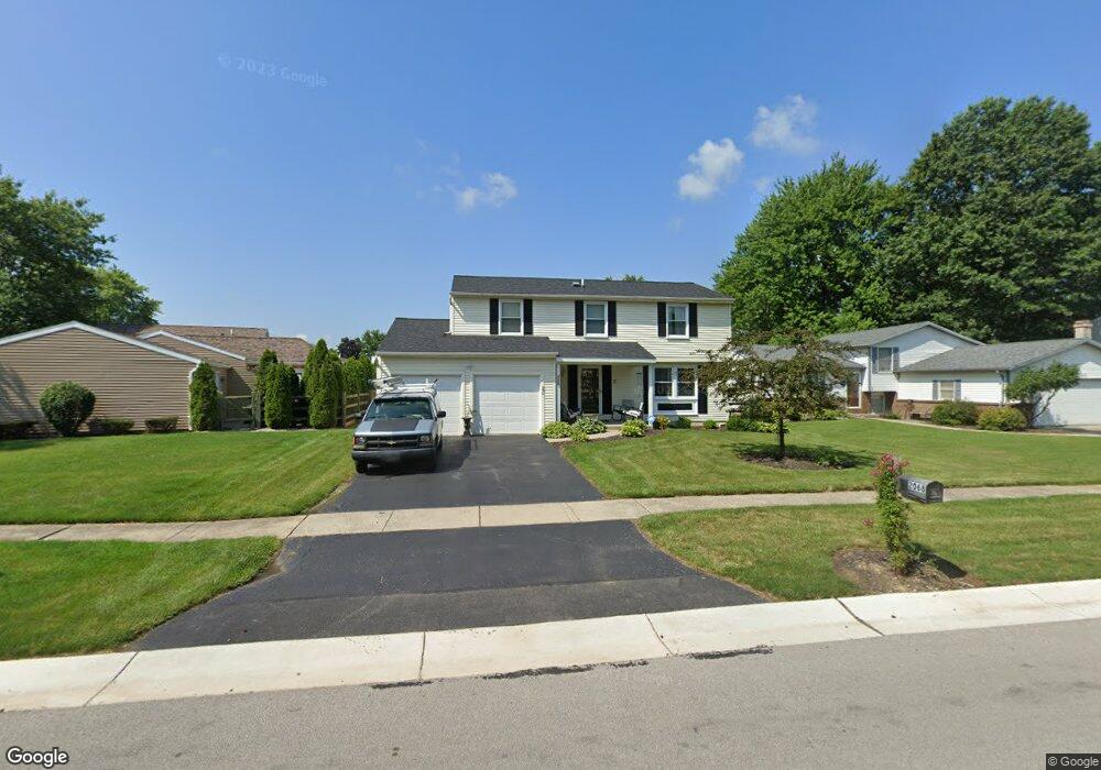
2068 Kellerston Rd Maumee, OH 43537
Estimated Value: $248,218 - $276,000
4
Beds
2
Baths
1,852
Sq Ft
$142/Sq Ft
Est. Value
About This Home
This home is located at 2068 Kellerston Rd, Maumee, OH 43537 and is currently estimated at $263,305, approximately $142 per square foot. 2068 Kellerston Rd is a home located in Lucas County with nearby schools including Holloway Elementary School, Springfield Middle School, and Springfield High School.
Ownership History
Date
Name
Owned For
Owner Type
Purchase Details
Closed on
Sep 16, 1996
Sold by
Wackley Marvin L
Bought by
Gulliod Eric E and Gulliod Angelica
Current Estimated Value
Home Financials for this Owner
Home Financials are based on the most recent Mortgage that was taken out on this home.
Original Mortgage
$111,000
Outstanding Balance
$9,607
Interest Rate
8.29%
Mortgage Type
New Conventional
Estimated Equity
$253,698
Create a Home Valuation Report for This Property
The Home Valuation Report is an in-depth analysis detailing your home's value as well as a comparison with similar homes in the area
Home Values in the Area
Average Home Value in this Area
Purchase History
| Date | Buyer | Sale Price | Title Company |
|---|---|---|---|
| Gulliod Eric E | $120,700 | -- |
Source: Public Records
Mortgage History
| Date | Status | Borrower | Loan Amount |
|---|---|---|---|
| Open | Gulliod Eric E | $111,000 |
Source: Public Records
Tax History Compared to Growth
Tax History
| Year | Tax Paid | Tax Assessment Tax Assessment Total Assessment is a certain percentage of the fair market value that is determined by local assessors to be the total taxable value of land and additions on the property. | Land | Improvement |
|---|---|---|---|---|
| 2024 | $1,860 | $61,285 | $10,745 | $50,540 |
| 2023 | $4,086 | $59,045 | $9,030 | $50,015 |
| 2022 | $4,084 | $59,045 | $9,030 | $50,015 |
| 2021 | $3,839 | $59,045 | $9,030 | $50,015 |
| 2020 | $3,701 | $51,625 | $7,560 | $44,065 |
| 2019 | $3,614 | $51,625 | $7,560 | $44,065 |
| 2018 | $3,461 | $51,625 | $7,560 | $44,065 |
| 2017 | $3,336 | $44,415 | $10,080 | $34,335 |
| 2016 | $3,367 | $126,900 | $28,800 | $98,100 |
| 2015 | $3,361 | $126,900 | $28,800 | $98,100 |
| 2014 | $2,997 | $42,710 | $9,700 | $33,010 |
| 2013 | $2,997 | $42,710 | $9,700 | $33,010 |
Source: Public Records
Map
Nearby Homes
- 2001 Perrysburg Holland Rd Unit 118
- 6620 Pilliod Rd
- 6666 Inglewood Rd
- 6325 Millbrook Rd
- 6524 Glenhurst Dr
- 6505 Airport Hwy
- 1705 Henthorne Dr
- 6705 Garden Rd Unit 6705
- 6652 Sue Ln
- 6949 Nightingale Dr
- 6833 Greentree Ln
- 6053 Suffolk Ln Unit 6053
- 6917 Greentree Ln
- 8939 Airport Hwy
- 2258 Tanglewood Dr
- 2437 Knights Hill Ln
- 5844 Swan Creek Dr
- 2425 Winding Creek Dr
- 6627 Embassy Ct Unit I38
- 6696 Embassy Ct Unit C11
- 2060 Kellerston Rd
- 2108 Longport Dr
- 2052 Kellerston Rd
- 2113 Bromford Rd
- 2120 Longport Dr
- 2107 Bromford Rd
- 2069 Kellerston Rd
- 2048 Kellerston Rd
- 2061 Kellerston Rd
- 2077 Bromford Rd
- 2053 Kellerston Rd
- 2081 Kellerston Rd
- 2107 Longport Dr
- 2113 Longport Dr
- 2040 Kellerston Rd
- 2121 Longport Dr
- 2047 Kellerston Rd
- 2101 Kellerston Rd
- 2069 Bromford Rd
- 2124 Bromford Rd