Estimated Value: $83,000 - $137,000
3
Beds
1
Bath
992
Sq Ft
$106/Sq Ft
Est. Value
About This Home
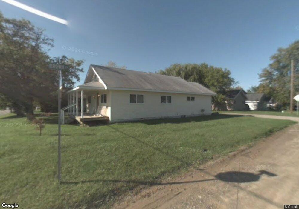
This home is located at 2068 Utley Rd, Flint, MI 48532 and is currently estimated at $105,113, approximately $105 per square foot. 2068 Utley Rd is a home located in Genesee County with nearby schools including Carman-Ainsworth High School, St. Paul Lutheran School, and First Flint Seventh-day Adventist Christian School.
Ownership History
Date
Name
Owned For
Owner Type
Purchase Details
Closed on
Aug 7, 2013
Sold by
Cawood Sandra
Bought by
Cawood Kyle Lee and Cawood Sandra
Current Estimated Value
Purchase Details
Closed on
Sep 8, 2003
Sold by
Wells Fargo Bank Minnesota Na
Bought by
Cawood Sandra
Purchase Details
Closed on
Oct 2, 2002
Sold by
Davis Thomas S
Bought by
Wells Fargo Bank Minnesota Na
Purchase Details
Closed on
Aug 18, 2000
Sold by
Davis Carolyn R
Bought by
Davis Thomas S
Purchase Details
Closed on
Feb 17, 2000
Sold by
Davis Thomas S and Davis Carolyn R
Bought by
Michigan State Hsng Development Authorit
Create a Home Valuation Report for This Property
The Home Valuation Report is an in-depth analysis detailing your home's value as well as a comparison with similar homes in the area
Home Values in the Area
Average Home Value in this Area
Purchase History
| Date | Buyer | Sale Price | Title Company |
|---|---|---|---|
| Cawood Kyle Lee | -- | None Available | |
| Cawood Sandra | $16,000 | -- | |
| Wells Fargo Bank Minnesota Na | $39,950 | -- | |
| Davis Thomas S | -- | Titlequest Agency | |
| Michigan State Hsng Development Authorit | $28,662 | -- |
Source: Public Records
Tax History
| Year | Tax Paid | Tax Assessment Tax Assessment Total Assessment is a certain percentage of the fair market value that is determined by local assessors to be the total taxable value of land and additions on the property. | Land | Improvement |
|---|---|---|---|---|
| 2025 | $1,587 | $53,500 | $0 | $0 |
| 2024 | $1,005 | $47,000 | $0 | $0 |
| 2023 | $950 | $43,500 | $0 | $0 |
| 2022 | $519 | $31,600 | $0 | $0 |
| 2021 | $509 | $26,800 | $0 | $0 |
| 2020 | $858 | $25,300 | $0 | $0 |
| 2019 | $848 | $22,600 | $0 | $0 |
| 2018 | $1,301 | $22,600 | $0 | $0 |
| 2017 | $1,262 | $22,600 | $0 | $0 |
| 2016 | $1,280 | $22,400 | $0 | $0 |
| 2015 | $788 | $20,500 | $0 | $0 |
| 2014 | $468 | $19,600 | $0 | $0 |
| 2012 | -- | $23,000 | $23,000 | $0 |
Source: Public Records
Map
Nearby Homes
- 3277 Whitney Ave
- VL Clairmont St
- 2033 Eberly Rd
- 3365 Ridgecliffe Dr
- 3825 Arlene Ave
- 3918 Larchmont St
- 1512 Crescent Lane Dr Lot#46
- 3805 Brown St
- 3801 Augusta St
- 3722 Larchmont St
- 3320 Timberview St
- 874 Tacken St
- 870 Tacken St
- 1412 S Ballenger Hwy
- 3493 Ridgecliffe Dr
- 18.41 Taft Rd
- 863 Tacken St
- 3288 Tall Oaks Ct
- 3522 Ridgecliffe Dr
- 4199 Sheraton Dr
- 2074 Utley Rd
- 3407 Brown St
- 3413 Brown St
- 1409 Brown St
- 2051 Westover Dr
- 2044 Utley Rd
- 2045 Westover Dr
- 2032 Utley Rd
- 2041 Westover Dr
- 2035 Westover Dr
- 2031 Westover Dr
- 2020 Utley Rd
- 3456 Corbin Dr
- 2056 Hoover Rd
- 3391 Augusta St
- 2046 Hoover Rd
- 3461 Brown St
- 2079 Kenova Dr
- 2034 Hoover Rd
- 3464 Brown St
Your Personal Tour Guide
Ask me questions while you tour the home.