Estimated Value: $410,811 - $440,000
3
Beds
3
Baths
2,010
Sq Ft
$212/Sq Ft
Est. Value
About This Home
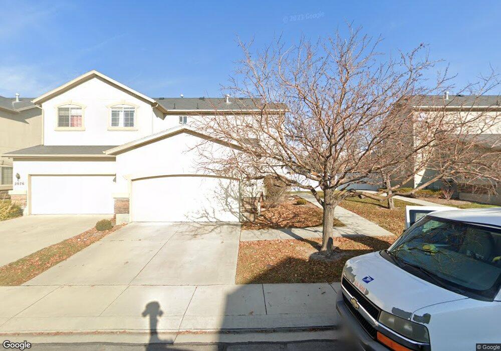
This home is located at 2068 W 2180 N, Lehi, UT 84043 and is currently estimated at $425,703, approximately $211 per square foot. 2068 W 2180 N is a home located in Utah County with nearby schools including Liberty Hills Elementary School, Skyridge High School, and Ascent Academies of Utah - Lehi Campus.
Ownership History
Date
Name
Owned For
Owner Type
Purchase Details
Closed on
Oct 3, 2023
Sold by
Sanders Robert V
Bought by
Robert Sanders Family Revocable Trust and Sanders
Current Estimated Value
Purchase Details
Closed on
Aug 9, 2019
Sold by
Wood Jason D
Bought by
Sanders Robert V and Sanders Cathryn
Home Financials for this Owner
Home Financials are based on the most recent Mortgage that was taken out on this home.
Original Mortgage
$205,500
Interest Rate
3.73%
Mortgage Type
New Conventional
Purchase Details
Closed on
Mar 15, 2005
Sold by
Pointe Meadows Townhomes Llc
Bought by
Wood Jason D
Home Financials for this Owner
Home Financials are based on the most recent Mortgage that was taken out on this home.
Original Mortgage
$153,983
Interest Rate
5.61%
Mortgage Type
Purchase Money Mortgage
Create a Home Valuation Report for This Property
The Home Valuation Report is an in-depth analysis detailing your home's value as well as a comparison with similar homes in the area
Home Values in the Area
Average Home Value in this Area
Purchase History
| Date | Buyer | Sale Price | Title Company |
|---|---|---|---|
| Robert Sanders Family Revocable Trust | -- | None Listed On Document | |
| Sanders Robert V | -- | First American American Fork | |
| Wood Jason D | -- | Cottonwood Title Insurance |
Source: Public Records
Mortgage History
| Date | Status | Borrower | Loan Amount |
|---|---|---|---|
| Previous Owner | Sanders Robert V | $205,500 | |
| Previous Owner | Wood Jason D | $153,983 |
Source: Public Records
Tax History Compared to Growth
Tax History
| Year | Tax Paid | Tax Assessment Tax Assessment Total Assessment is a certain percentage of the fair market value that is determined by local assessors to be the total taxable value of land and additions on the property. | Land | Improvement |
|---|---|---|---|---|
| 2025 | $1,865 | $216,755 | $57,900 | $336,200 |
| 2024 | $1,865 | $218,295 | $0 | $0 |
| 2023 | $1,688 | $214,445 | $0 | $0 |
| 2022 | $1,698 | $209,220 | $0 | $0 |
| 2021 | $1,536 | $286,000 | $42,900 | $243,100 |
| 2020 | $1,464 | $269,500 | $40,400 | $229,100 |
| 2019 | $1,249 | $239,100 | $35,900 | $203,200 |
| 2018 | $1,161 | $210,000 | $31,500 | $178,500 |
| 2017 | $1,058 | $101,805 | $0 | $0 |
| 2016 | $1,141 | $101,805 | $0 | $0 |
| 2015 | $1,201 | $101,750 | $0 | $0 |
| 2014 | $1,012 | $85,250 | $0 | $0 |
Source: Public Records
Map
Nearby Homes
- 1968 N 2040 W Unit 40
- 1969 N 2040 St W
- 2013 N 2040 W
- 1990 N 2040 W
- 1990 N 2040 W Unit 41
- 1912 W 2250 N
- 1898 W Pointe Meadow Loop
- 1970 N 2090 St W
- 1882 N 2230 St W Unit 24
- 2191 W Swift Fox Dr Unit 274
- 999 Empire St
- 2184 W Cape Fox Way N Unit 220
- 1920 N 2230 St W Unit 27
- 1060 N Canvasback Dr Unit 405
- 500 S Center St E
- 1672 S 70 W
- 2209 W Swift Fox Way Unit 271
- 2179 W Swift Fox Way Unit 276
- 2178 W Cape Fox Way Unit 221
- 2196 N 2350 W
- 2068 W 2180 N Unit 20D
- 2076 W 2180 N Unit 20C
- 2062 W 2180 N
- 2062 W 2180 N Unit 21A
- 2084 W 2180 N
- 2084 W 2180 N Unit 20B
- 2058 W 2180 N
- 2058 W 2180 N Unit 21B
- 2088 W 2180 N
- 2088 W 2180 N Unit 20A
- 2178 N 2080 W
- 2052 W 2180 N Unit 21C
- 2048 W 2180 N
- 2048 W 2180 N Unit 21D
- 2172 N 2080 W
- 2173 N 2040 W
- 2094 W 2180 N
- 2173 N 2080 W Unit 14D
- 2168 N 2080 W
- 2167 N 2040 W