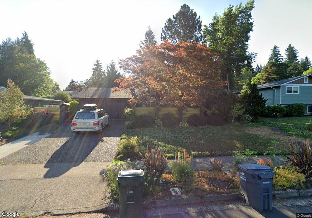
2069 Brittany St Eugene, OR 97405
Churchill NeighborhoodEstimated Value: $500,000 - $551,000
3
Beds
2
Baths
1,682
Sq Ft
$307/Sq Ft
Est. Value
About This Home
This home is located at 2069 Brittany St, Eugene, OR 97405 and is currently estimated at $515,987, approximately $306 per square foot. 2069 Brittany St is a home located in Lane County with nearby schools including McCornack Elementary School, Kennedy Middle School, and Churchill High School.
Ownership History
Date
Name
Owned For
Owner Type
Purchase Details
Closed on
Apr 14, 2010
Sold by
Howlan Kristie L and Gunderson Janice E
Bought by
Snortland Dale R and Ring Theresa J
Current Estimated Value
Home Financials for this Owner
Home Financials are based on the most recent Mortgage that was taken out on this home.
Original Mortgage
$125,000
Outstanding Balance
$82,723
Interest Rate
4.95%
Mortgage Type
New Conventional
Estimated Equity
$433,264
Create a Home Valuation Report for This Property
The Home Valuation Report is an in-depth analysis detailing your home's value as well as a comparison with similar homes in the area
Home Values in the Area
Average Home Value in this Area
Purchase History
| Date | Buyer | Sale Price | Title Company |
|---|---|---|---|
| Snortland Dale R | $235,000 | Western Title & Escrow Co |
Source: Public Records
Mortgage History
| Date | Status | Borrower | Loan Amount |
|---|---|---|---|
| Open | Snortland Dale R | $125,000 |
Source: Public Records
Tax History
| Year | Tax Paid | Tax Assessment Tax Assessment Total Assessment is a certain percentage of the fair market value that is determined by local assessors to be the total taxable value of land and additions on the property. | Land | Improvement |
|---|---|---|---|---|
| 2025 | $5,746 | $294,905 | -- | -- |
| 2024 | $5,674 | $286,316 | -- | -- |
| 2023 | $5,674 | $277,977 | $0 | $0 |
| 2022 | $5,316 | $269,881 | $0 | $0 |
| 2021 | $4,993 | $262,021 | $0 | $0 |
| 2020 | $4,886 | $254,390 | $0 | $0 |
| 2019 | $4,649 | $246,981 | $0 | $0 |
| 2018 | $4,325 | $232,804 | $0 | $0 |
| 2017 | $4,049 | $232,804 | $0 | $0 |
| 2016 | $3,939 | $226,023 | $0 | $0 |
| 2015 | $3,810 | $219,440 | $0 | $0 |
| 2014 | $3,715 | $213,049 | $0 | $0 |
Source: Public Records
Map
Nearby Homes
- 3685 Westleigh St
- 3534 Westleigh St
- 2055 Broadview St
- 2239 Hawkins Ln
- 3837 Kevington Ave
- 2111 Hawkins Ln Unit 45
- 2085 Trillium St
- 1999 Hawkins Ln
- 1910 Hawkins Ln
- 1438 Quaker St
- 3823 Wilshire Ln
- 1326 Quaker St
- 2665 E Wilshire Dr
- 3732 Peppertree Dr
- 2953 W 15th Ave
- 2610 Park Forest Dr
- 1432 Fetters Loop
- 1474 Fetters Loop
- 3574 Colony Oaks Dr Unit 6
- 3586 Colony Oaks Dr Unit 5
- 2047 Brittany St
- 2091 Brittany St
- 3221 Strathmore Place
- 3215 Strathmore Place
- 2080 Brittany St
- 2085 Coventry Way
- 3225 Strathmore Place
- 3365 Strathmore Place
- 2069 Coventry Way
- 2115 Brittany St
- 3425 Strathmore Place
- 3241 Strathmore Place
- 2120 Brittany St
- 3245 Strathmore Place
- 3350 Strathmore Place
- 2045 Coventry Way
- 3231 Strathmore Place
- 3235 Strathmore Place
- 2070 Coventry Way
- 3251 Strathmore Place
Your Personal Tour Guide
Ask me questions while you tour the home.