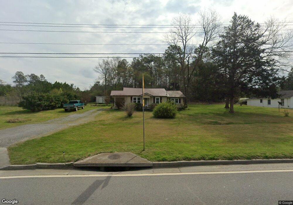
2069 Buchanan Hwy Cedartown, GA 30125
Estimated Value: $130,465 - $168,000
2
Beds
1
Bath
1,028
Sq Ft
$146/Sq Ft
Est. Value
About This Home
This home is located at 2069 Buchanan Hwy, Cedartown, GA 30125 and is currently estimated at $150,116, approximately $146 per square foot. 2069 Buchanan Hwy is a home located in Polk County with nearby schools including Cedar Christian School.
Ownership History
Date
Name
Owned For
Owner Type
Purchase Details
Closed on
Jun 22, 1999
Sold by
Allen Linda W
Bought by
Wiggins Anthony G and Wiggins Diane
Current Estimated Value
Purchase Details
Closed on
Aug 5, 1994
Sold by
Johnson Annie Lou
Bought by
Lankford James W and Lankford Otis R
Purchase Details
Closed on
Jul 3, 1990
Sold by
Smith Noel E
Bought by
Finley Linda W
Purchase Details
Closed on
May 15, 1989
Sold by
Knight Charles C
Bought by
Smith Noel E
Purchase Details
Closed on
Jan 9, 1989
Sold by
Timms Paul
Bought by
Knight Charles C
Purchase Details
Closed on
Aug 20, 1987
Sold by
Timms Joann
Bought by
Timms Paul
Purchase Details
Closed on
Jul 23, 1986
Sold by
Timms Paul
Bought by
Timms Joann
Purchase Details
Closed on
Jan 6, 1983
Sold by
Knight B P
Bought by
Timms Paul
Purchase Details
Closed on
Sep 11, 1974
Sold by
Parish Winfred S
Bought by
Knight B P
Purchase Details
Closed on
Feb 25, 1964
Sold by
Kuglar Willie O
Bought by
Parish Winfred S
Purchase Details
Closed on
Jun 3, 1942
Bought by
Kuglar Willie O
Create a Home Valuation Report for This Property
The Home Valuation Report is an in-depth analysis detailing your home's value as well as a comparison with similar homes in the area
Home Values in the Area
Average Home Value in this Area
Purchase History
| Date | Buyer | Sale Price | Title Company |
|---|---|---|---|
| Wiggins Anthony G | -- | -- | |
| Lankford James W | $7,000 | -- | |
| Finley Linda W | $18,700 | -- | |
| Smith Noel E | $25,000 | -- | |
| Knight Charles C | $18,000 | -- | |
| Timms Paul | -- | -- | |
| Timms Joann | -- | -- | |
| Timms Paul | -- | -- | |
| Knight B P | -- | -- | |
| Parish Winfred S | -- | -- | |
| Kuglar Willie O | -- | -- |
Source: Public Records
Tax History Compared to Growth
Tax History
| Year | Tax Paid | Tax Assessment Tax Assessment Total Assessment is a certain percentage of the fair market value that is determined by local assessors to be the total taxable value of land and additions on the property. | Land | Improvement |
|---|---|---|---|---|
| 2024 | $465 | $36,965 | $2,541 | $34,424 |
| 2023 | $245 | $23,693 | $2,541 | $21,152 |
| 2022 | $152 | $19,534 | $1,694 | $17,840 |
| 2021 | $154 | $19,534 | $1,694 | $17,840 |
| 2020 | $155 | $19,534 | $1,694 | $17,840 |
| 2019 | $95 | $12,503 | $1,694 | $10,809 |
| 2018 | $94 | $12,151 | $1,694 | $10,457 |
Source: Public Records
Map
Nearby Homes
- 00 Buchanan Hwy
- 1987 Buchanan Hwy
- 240 Benedict Loop
- 35 Old Mill Rd
- 142 Acres On Judkin Mill Rd
- 255 Mildred Dr
- 95 Wieuca Way
- 000 Wieuca Way
- 0 Wieuca Way Unit 10614129
- 480 Cason Rd
- 766 Antioch Rd
- 9236 Tallapoosa Hwy
- 0 Old Esom Hill Loop Unit 10611077
- 0 Old Esom Hill Loop Unit 7654342
- 203 Cason Rd
- 117 Cason Rd
- 1789 Johnson Lake Rd
- 1003 Fairview Ave
- 149 Irwin St
- 0 Judkin Mill Rd Unit LotWP001 19369404
- 2081 Buchanan Hwy
- 2041 Buchanan Hwy
- 37 Saw Mill Rd
- 2031 Buchanan Hwy
- 41 Saw Mill Rd
- 2023 Buchanan Hwy
- 2020 Buchanan Hwy
- 30 Morton Springs Rd
- 55 Saw Mill Rd
- 23 Morton Springs Rd
- 46 Morton Springs Rd
- 39 Morton Springs Rd
- 125 Benedict Loop
- 80 Morton Springs Rd
- 81 Benedict Loop
- 51 Morton Springs Rd
- 0 Mildred Dr
- 0 Mildred Dr Unit 7319843
- 0 Mildred Dr Unit 8173274
- 0 Mildred Dr Unit 8280406