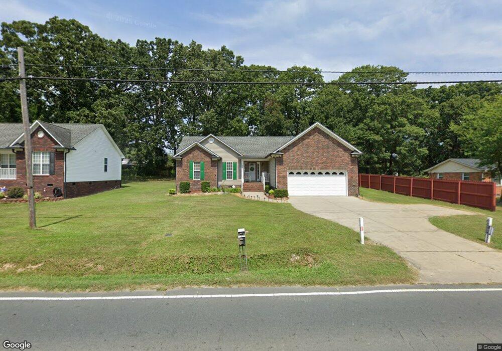
2069 Centergrove Rd Kannapolis, NC 28083
Estimated Value: $297,133 - $327,000
3
Beds
2
Baths
1,362
Sq Ft
$229/Sq Ft
Est. Value
About This Home
This home is located at 2069 Centergrove Rd, Kannapolis, NC 28083 and is currently estimated at $312,033, approximately $229 per square foot. 2069 Centergrove Rd is a home located in Cabarrus County with nearby schools including Forest Park Elementary School, Kannapolis Middle, and A.L. Brown High School.
Ownership History
Date
Name
Owned For
Owner Type
Purchase Details
Closed on
Apr 23, 2013
Sold by
Federal Home Loan Mortgage Corporation
Bought by
Convers Martin and Convers Carmen
Current Estimated Value
Home Financials for this Owner
Home Financials are based on the most recent Mortgage that was taken out on this home.
Original Mortgage
$94,320
Interest Rate
3.37%
Mortgage Type
New Conventional
Purchase Details
Closed on
Dec 8, 2012
Sold by
Emery Alonzo and Emery Tina Lynn
Bought by
Federal Home Loan Mortgage Corporation
Purchase Details
Closed on
Nov 1, 2006
Sold by
Gary W Laton Llc
Bought by
Emery Alonzo and Emery Tina Lynn
Home Financials for this Owner
Home Financials are based on the most recent Mortgage that was taken out on this home.
Original Mortgage
$142,110
Interest Rate
9.5%
Mortgage Type
Purchase Money Mortgage
Create a Home Valuation Report for This Property
The Home Valuation Report is an in-depth analysis detailing your home's value as well as a comparison with similar homes in the area
Home Values in the Area
Average Home Value in this Area
Purchase History
| Date | Buyer | Sale Price | Title Company |
|---|---|---|---|
| Convers Martin | -- | Chicago Title Insurance Co | |
| Federal Home Loan Mortgage Corporation | $73,360 | None Available | |
| Emery Alonzo | $158,000 | None Available |
Source: Public Records
Mortgage History
| Date | Status | Borrower | Loan Amount |
|---|---|---|---|
| Previous Owner | Convers Martin | $94,320 | |
| Previous Owner | Emery Alonzo | $142,110 |
Source: Public Records
Tax History Compared to Growth
Tax History
| Year | Tax Paid | Tax Assessment Tax Assessment Total Assessment is a certain percentage of the fair market value that is determined by local assessors to be the total taxable value of land and additions on the property. | Land | Improvement |
|---|---|---|---|---|
| 2025 | $1,661 | $292,600 | $50,000 | $242,600 |
| 2024 | $3,322 | $292,600 | $50,000 | $242,600 |
| 2023 | $2,454 | $179,160 | $35,000 | $144,160 |
| 2022 | $2,454 | $179,160 | $35,000 | $144,160 |
| 2021 | $2,454 | $179,160 | $35,000 | $144,160 |
| 2020 | $2,454 | $179,160 | $35,000 | $144,160 |
| 2019 | $1,883 | $137,480 | $20,400 | $117,080 |
| 2018 | $1,856 | $137,480 | $20,400 | $117,080 |
| 2017 | $1,828 | $137,480 | $20,400 | $117,080 |
| 2016 | $1,828 | $140,310 | $24,000 | $116,310 |
| 2015 | $1,768 | $140,310 | $24,000 | $116,310 |
| 2014 | $1,768 | $140,310 | $24,000 | $116,310 |
Source: Public Records
Map
Nearby Homes
- 512 Villa St
- 2245 Heritage Ct Unit 2
- 1365 Eagle Claw Dr
- 2405 Forrestbrook Dr
- 2416 Forrestbrook Dr
- 1013 Kansas St Unit B
- 1013 Kansas St Unit A
- 1768 Concord Lake Rd
- 14 Knowles St
- 00 Dixie Dr
- 1050 Mclain Rd
- 1052 Mclain Rd
- 2990 Dale Earnhardt Blvd
- 1200 Grace Ave
- 1010 Tennessee St
- 621 Norland Ave
- 1422 Mitchell Glen St
- 614 Breckenridge Rd Unit 17
- 803 Irene Ave
- 108 S Little Texas Rd
- 2065 Centergrove Rd
- 2115 Centergrove Rd
- 2061 Centergrove Rd
- 2057 Centergrove Rd
- 2114 Centergrove Rd
- 2117 Centergrove Rd
- 515 Villa St
- 517 Villa St
- 2116 Centergrove Rd
- 2111 Centergrove Rd
- 2049 Centergrove Rd
- 2049 Centergrove Rd Unit 2
- 2112 Centergrove Rd
- 1604 Cambridge St
- 513 Villa St
- 519 Villa St
- 2119 Centergrove Rd
- 2118 Centergrove Rd
- 1606 Cambridge St
- 2041 Centergrove Rd Unit 3