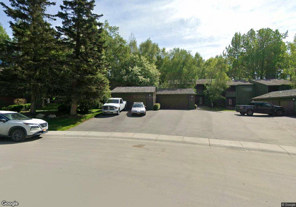
2069 Eastridge Dr Unit 34B7 Anchorage, AK 99501
Airport Heights NeighborhoodEstimated Value: $240,000 - $376,000
3
Beds
3
Baths
1,600
Sq Ft
$201/Sq Ft
Est. Value
About This Home
This home is located at 2069 Eastridge Dr Unit 34B7, Anchorage, AK 99501 and is currently estimated at $321,349, approximately $200 per square foot. 2069 Eastridge Dr Unit 34B7 is a home located in Anchorage Municipality with nearby schools including Airport Heights Elementary School, Wendler Middle School, and Bettye Davis East Anchorage High School.
Ownership History
Date
Name
Owned For
Owner Type
Purchase Details
Closed on
Mar 4, 2004
Sold by
Danner Frank A
Bought by
Fletcher R Steven
Current Estimated Value
Home Financials for this Owner
Home Financials are based on the most recent Mortgage that was taken out on this home.
Original Mortgage
$142,000
Outstanding Balance
$66,086
Interest Rate
5.61%
Mortgage Type
Purchase Money Mortgage
Estimated Equity
$255,263
Purchase Details
Closed on
Oct 11, 2001
Sold by
Danner Frank A and France Danner Marie J
Bought by
Danner Frank A
Home Financials for this Owner
Home Financials are based on the most recent Mortgage that was taken out on this home.
Original Mortgage
$131,200
Interest Rate
6.47%
Mortgage Type
Purchase Money Mortgage
Create a Home Valuation Report for This Property
The Home Valuation Report is an in-depth analysis detailing your home's value as well as a comparison with similar homes in the area
Home Values in the Area
Average Home Value in this Area
Purchase History
| Date | Buyer | Sale Price | Title Company |
|---|---|---|---|
| Fletcher R Steven | -- | -- | |
| Danner Frank A | -- | -- |
Source: Public Records
Mortgage History
| Date | Status | Borrower | Loan Amount |
|---|---|---|---|
| Open | Fletcher R Steven | $142,000 | |
| Previous Owner | Danner Frank A | $131,200 |
Source: Public Records
Tax History Compared to Growth
Tax History
| Year | Tax Paid | Tax Assessment Tax Assessment Total Assessment is a certain percentage of the fair market value that is determined by local assessors to be the total taxable value of land and additions on the property. | Land | Improvement |
|---|---|---|---|---|
| 2025 | $5,147 | $309,500 | -- | $309,500 |
| 2024 | $5,147 | $318,800 | $0 | $318,800 |
| 2023 | $4,508 | $264,700 | $0 | $264,700 |
| 2022 | $756 | $243,600 | $0 | $243,600 |
| 2021 | $4,345 | $241,100 | $0 | $241,100 |
| 2020 | $719 | $241,800 | $0 | $241,800 |
| 2019 | $1,027 | $262,800 | $0 | $262,800 |
| 2018 | $529 | $227,800 | $0 | $227,800 |
| 2017 | $1,239 | $249,100 | $0 | $249,100 |
| 2016 | $3,220 | $267,100 | $0 | $267,100 |
| 2015 | $3,220 | $263,700 | $0 | $263,700 |
| 2014 | $3,220 | $248,000 | $0 | $248,000 |
Source: Public Records
Map
Nearby Homes
- 2068 Cliffside Dr Unit 11
- 2124 Sorbus Way
- 1833 Parkside Dr
- 1760 Eastridge Dr
- 1803 Parkside Dr
- 2215 Sunburst Cir
- 1811 Talkeetna St
- 2028 Shepherdia Dr
- 1625 Sitka St Unit 103
- 2553 Lovejoy Dr
- 1826 E 27th Ave
- 1701 Aleutian St
- 2624 Darby Cir
- 2456 Cottonwood St
- 1421 E 17th Ave Unit 3
- 000 Tr A Thurston
- 1201 Elegante Ln
- 1220 E 16th Ave Unit 15
- 1403 Nelchina St
- 1504 Medfra St
- 2067 Eastridge Dr Unit 35
- 2069 Eastridge Dr Unit 34
- 2071 Eastridge Dr Unit 33
- 2075 Eastridge Dr Unit 31
- 2071 Eastridge Dr Unit 33B-7
- 2075 Eastridge Dr Unit 1
- 2075 Eastridge Dr Unit 31B-7
- 2075 Eastridge Dr Unit B7
- 2067 Eastridge Dr Unit 35B7
- 2073 Eastridge Dr Unit 32
- 2073 Eastridge Dr Unit 23
- 2039 Eastridge Dr Unit 43
- 2041 Eastridge Dr Unit 42
- 2043 Eastridge Dr Unit 41
- 2045 Eastridge Dr Unit 40
- 2089 Cliffside Dr Unit 29
- 2087 Cliffside Dr Unit 28
- 2085 Cliffside Dr Unit 27
- 2083 Cliffside Dr Unit 26
- 2081 Cliffside Dr Unit 25