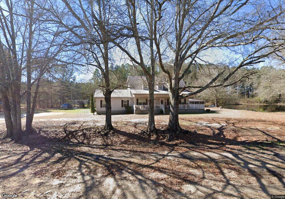
2069 Ga Highway 29 S East Dublin, GA 31027
Estimated Value: $212,000 - $318,000
2
Beds
1
Bath
2,334
Sq Ft
$107/Sq Ft
Est. Value
About This Home
This home is located at 2069 Ga Highway 29 S, East Dublin, GA 31027 and is currently estimated at $250,885, approximately $107 per square foot. 2069 Ga Highway 29 S is a home located in Laurens County with nearby schools including Southwest Laurens Elementary School, Northwest Laurens Elementary School, and East Laurens Primary School.
Ownership History
Date
Name
Owned For
Owner Type
Purchase Details
Closed on
Apr 3, 2017
Sold by
Altman Glenn
Bought by
Altman Glenn and Snelgrove Natasha
Current Estimated Value
Home Financials for this Owner
Home Financials are based on the most recent Mortgage that was taken out on this home.
Original Mortgage
$163,840
Outstanding Balance
$135,600
Interest Rate
4.1%
Mortgage Type
VA
Estimated Equity
$115,285
Create a Home Valuation Report for This Property
The Home Valuation Report is an in-depth analysis detailing your home's value as well as a comparison with similar homes in the area
Home Values in the Area
Average Home Value in this Area
Purchase History
| Date | Buyer | Sale Price | Title Company |
|---|---|---|---|
| Altman Glenn | $160,000 | -- | |
| Altman Glenn | $160,000 | -- |
Source: Public Records
Mortgage History
| Date | Status | Borrower | Loan Amount |
|---|---|---|---|
| Open | Altman Glenn | $163,840 | |
| Closed | Altman Glenn | $163,840 |
Source: Public Records
Tax History Compared to Growth
Tax History
| Year | Tax Paid | Tax Assessment Tax Assessment Total Assessment is a certain percentage of the fair market value that is determined by local assessors to be the total taxable value of land and additions on the property. | Land | Improvement |
|---|---|---|---|---|
| 2024 | $1,620 | $78,979 | $2,487 | $76,492 |
| 2023 | $1,464 | $70,909 | $2,487 | $68,422 |
| 2022 | $1,512 | $70,836 | $2,414 | $68,422 |
| 2021 | $1,445 | $65,985 | $2,776 | $63,209 |
| 2020 | $1,447 | $65,985 | $2,776 | $63,209 |
| 2019 | $1,448 | $65,985 | $2,776 | $63,209 |
| 2018 | $1,450 | $65,985 | $2,776 | $63,209 |
| 2017 | $1,492 | $65,985 | $2,776 | $63,209 |
| 2016 | $1,493 | $65,985 | $2,776 | $63,209 |
| 2015 | $1,494 | $65,984 | $2,776 | $63,209 |
| 2014 | $930 | $39,220 | $3,251 | $35,969 |
Source: Public Records
Map
Nearby Homes
- 1005 Pleasant Springs Church Rd
- 859 Silver Rd
- 843 Daniel Mimbs Rd
- 1613 Georgia 29
- 520 Kenneth Hilburn Cir
- 437 Mccord Rd
- 461 Mccord Rd
- 0 Ralph Keen Rd Unit 21905127
- 644 Blue Jay Dr
- 532 Ned Collins Rd
- 844 Windward Way
- LOT 4 Wind Song Dr
- 335 Windsong Dr
- 509 Maddox Rd
- 132 Shaddock Creek Cir
- 907 Orianna Rd
- NA Rd
- 445 Saint Charles Dr
- 0 Mamie Graham Rd Unit 257372
- 0 Mamie Graham Rd Unit 10647192
- 2069 Georgia 29
- 2062 Ga Highway 29 S
- 2055 Ga Highway 29 S
- 2055 Georgia 29
- 1617 Crisp Ln
- 1001 Arthur Graham Rd
- 1649 Crisp Ln
- 1637 Crisp Ln
- 1655 Crisp Ln
- 1622 Crisp Ln
- 2109 Ga Highway 29 S
- 1011 Arthur Graham Rd
- 953 Arthur Graham Rd
- 2031 Ga Highway 29 S
- 2111 Ga Highway 29 S
- 933 Arthur Graham Rd
- 2124 Ga Highway 29 S
- 923 Arthur Graham Rd
- 922 Arthur Graham Rd
- 915 Arthur Graham Rd