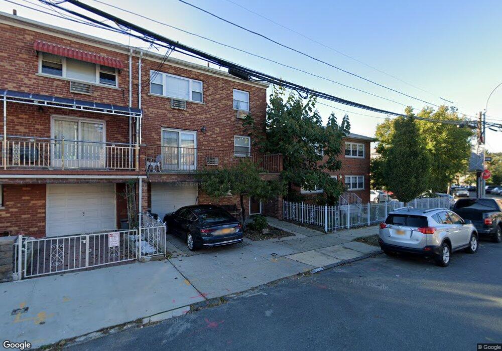
2069 Hobart Ave Bronx, NY 10461
Middletown-Pelham Bay NeighborhoodEstimated Value: $1,077,704 - $1,202,000
--
Bed
--
Bath
2,944
Sq Ft
$386/Sq Ft
Est. Value
About This Home
This home is located at 2069 Hobart Ave, Bronx, NY 10461 and is currently estimated at $1,135,676, approximately $385 per square foot. 2069 Hobart Ave is a home located in Bronx County with nearby schools including P.S. 71 Rose E Scala, Herbert H Lehman High School, and Equality Charter School.
Ownership History
Date
Name
Owned For
Owner Type
Purchase Details
Closed on
May 29, 2020
Sold by
Khalil Ghassan and Khalil Issam
Bought by
Khalil Ghassan
Current Estimated Value
Purchase Details
Closed on
Feb 28, 2014
Sold by
Khalil Ghassan
Bought by
Khalil Ghassan and Khalil Issam
Purchase Details
Closed on
Sep 12, 2013
Sold by
Milani Milani Margherita Margherita
Bought by
Khalil Ghassan
Home Financials for this Owner
Home Financials are based on the most recent Mortgage that was taken out on this home.
Original Mortgage
$484,000
Interest Rate
4.36%
Mortgage Type
New Conventional
Create a Home Valuation Report for This Property
The Home Valuation Report is an in-depth analysis detailing your home's value as well as a comparison with similar homes in the area
Home Values in the Area
Average Home Value in this Area
Purchase History
| Date | Buyer | Sale Price | Title Company |
|---|---|---|---|
| Khalil Ghassan | -- | -- | |
| Khalil Ghassan | -- | -- | |
| Khalil Ghassan | $605,000 | -- |
Source: Public Records
Mortgage History
| Date | Status | Borrower | Loan Amount |
|---|---|---|---|
| Previous Owner | Khalil Ghassan | $484,000 |
Source: Public Records
Tax History Compared to Growth
Tax History
| Year | Tax Paid | Tax Assessment Tax Assessment Total Assessment is a certain percentage of the fair market value that is determined by local assessors to be the total taxable value of land and additions on the property. | Land | Improvement |
|---|---|---|---|---|
| 2025 | $9,069 | $49,348 | $8,494 | $40,854 |
| 2024 | $9,069 | $46,555 | $8,851 | $37,704 |
| 2023 | $8,635 | $43,920 | $9,746 | $34,174 |
| 2022 | $8,323 | $63,300 | $13,860 | $49,440 |
| 2021 | $8,773 | $55,080 | $13,860 | $41,220 |
| 2020 | $8,409 | $47,640 | $13,860 | $33,780 |
| 2019 | $7,823 | $48,720 | $13,860 | $34,860 |
| 2018 | $7,163 | $36,600 | $13,860 | $22,740 |
| 2017 | $7,027 | $35,940 | $13,860 | $22,080 |
| 2016 | $7,295 | $38,040 | $13,860 | $24,180 |
| 2015 | $4,502 | $35,940 | $13,440 | $22,500 |
| 2014 | $4,502 | $35,400 | $13,440 | $21,960 |
Source: Public Records
Map
Nearby Homes
- 1874 Pelham Pkwy S Unit 6E
- 1874 Pelham Pkwy S Unit 6M
- 1874 Pelham Pkwy S Unit 4R
- 2032 Hobart Ave
- 2024 Continental Ave
- 1910 Pelham Pkwy S Unit 5C
- 2871 E 194th St
- 2015 Saint Paul Ave Unit 6B
- 2015 St Paul Ave Unit 3G
- 2015 Saint Paul Ave Unit 3H
- 2010 Hobart Ave
- 1959B Edison Ave
- 1950 Pilgrim Ave
- 1932 Pilgrim Ave
- 1926 Hutchinson River Pkwy E Unit E
- 2884 Saint Theresa Ave
- 1856 Edison Ave
- 1815 Mahan Ave
- 1865 Mulford Ave
- 2211 de Reimer Ave
- 2065 Hobart Ave
- 2063 Hobart Ave
- 2892 E 196th St
- 2890 E 196th St
- 2103 Continental Ave
- 2059 Hobart Ave
- 2105 Continental Ave
- 2105 Continental Ave Unit walk-in level
- 2105 Continental Ave Unit walk-in
- 2888 E 196th St
- 2889 E 195th St
- 2107 Continental Ave
- 2041 Hobart Ave
- 2921 E 196th St
- 2060 Continental Ave
- 2887 E 195th St
- 2050 Hobart Ave
- 2889 E 196th St
- 2923 E 196th St
- 2109 Continental Ave