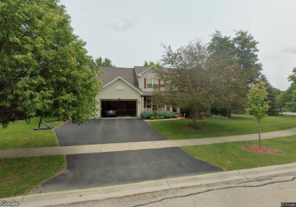
2069 Mark Cir Bolingbrook, IL 60490
West Bolingbrook NeighborhoodEstimated Value: $541,000 - $572,000
4
Beds
3
Baths
2,840
Sq Ft
$195/Sq Ft
Est. Value
About This Home
This home is located at 2069 Mark Cir, Bolingbrook, IL 60490 and is currently estimated at $553,138, approximately $194 per square foot. 2069 Mark Cir is a home located in Will County with nearby schools including Liberty Elementary School, John F Kennedy Middle School, and Plainfield East High School.
Ownership History
Date
Name
Owned For
Owner Type
Purchase Details
Closed on
Oct 23, 2009
Sold by
Sayre Teri
Bought by
Ghani Assad and Uddin Sumbul
Current Estimated Value
Home Financials for this Owner
Home Financials are based on the most recent Mortgage that was taken out on this home.
Original Mortgage
$249,600
Outstanding Balance
$163,234
Interest Rate
5.11%
Mortgage Type
New Conventional
Estimated Equity
$389,904
Purchase Details
Closed on
Jan 30, 2002
Sold by
Bolingbrook Ltd Partnership
Bought by
Sayre Roger and Sayre Teri
Home Financials for this Owner
Home Financials are based on the most recent Mortgage that was taken out on this home.
Original Mortgage
$233,000
Interest Rate
6.25%
Create a Home Valuation Report for This Property
The Home Valuation Report is an in-depth analysis detailing your home's value as well as a comparison with similar homes in the area
Home Values in the Area
Average Home Value in this Area
Purchase History
| Date | Buyer | Sale Price | Title Company |
|---|---|---|---|
| Ghani Assad | $312,000 | Ticor Title | |
| Sayre Roger | $309,500 | Stewart Title Company |
Source: Public Records
Mortgage History
| Date | Status | Borrower | Loan Amount |
|---|---|---|---|
| Open | Ghani Assad | $249,600 | |
| Previous Owner | Sayre Roger | $233,000 |
Source: Public Records
Tax History
| Year | Tax Paid | Tax Assessment Tax Assessment Total Assessment is a certain percentage of the fair market value that is determined by local assessors to be the total taxable value of land and additions on the property. | Land | Improvement |
|---|---|---|---|---|
| 2024 | $10,526 | $156,846 | $41,067 | $115,779 |
| 2023 | $10,526 | $138,556 | $36,278 | $102,278 |
| 2022 | $8,869 | $120,221 | $34,318 | $85,903 |
| 2021 | $8,527 | $114,496 | $32,684 | $81,812 |
| 2020 | $8,502 | $112,682 | $32,166 | $80,516 |
| 2019 | $8,467 | $109,506 | $31,259 | $78,247 |
| 2018 | $8,152 | $103,886 | $30,571 | $73,315 |
| 2017 | $8,175 | $101,204 | $29,782 | $71,422 |
| 2016 | $8,314 | $99,026 | $29,141 | $69,885 |
| 2015 | $8,343 | $95,217 | $28,020 | $67,197 |
| 2014 | $8,343 | $95,217 | $28,020 | $67,197 |
| 2013 | $8,343 | $95,217 | $28,020 | $67,197 |
Source: Public Records
Map
Nearby Homes
- 1209 John Hancock Dr
- 1194 John Hancock Dr
- 1184 Patrick Henry Pkwy Unit 2001
- 2380 River Hills Ln
- 2405 River Hills Ln
- 13150 Lake Mary Dr
- 22743 Marina Dr
- 2101 Samantha Joy Ln
- 12844 Scoter Ct
- 23152 W Sweetwater Ln
- 12811 S Slate Ln
- 12825 S Slate Ln
- 23148 W Sweetwater Ln
- 12845 S Slate Ln
- 12817 S Slate Ln
- 23159 W Kennebec Dr
- 23165 W Kennebec Dr
- 12905 S Slate Ln
- 23209 W Kennebec Dr
- 23213 W Kennebec Dr
- 2073 Mark Cir Unit 1
- 2065 Mark Cir Unit 1
- 2155 Muirfield Trail
- 2077 Mark Cir
- 2061 Mark Cir Unit 1
- 2159 Muirfield Trail
- 2056 Mark Cir
- 2068 Mark Cir Unit 1
- 2052 Mark Cir
- 2072 Mark Cir
- 2151 Muirfield Trail
- 2076 Mark Cir Unit 1
- 2081 Mark Cir Unit 1
- 2163 Muirfield Trail
- 2057 Mark Cir
- 2064 Mark Cir Unit 1
- 2048 Mark Cir Unit 1
- 2060 Mark Cir
- 2080 Mark Cir
- 2085 Mark Cir Unit 1
Your Personal Tour Guide
Ask me questions while you tour the home.