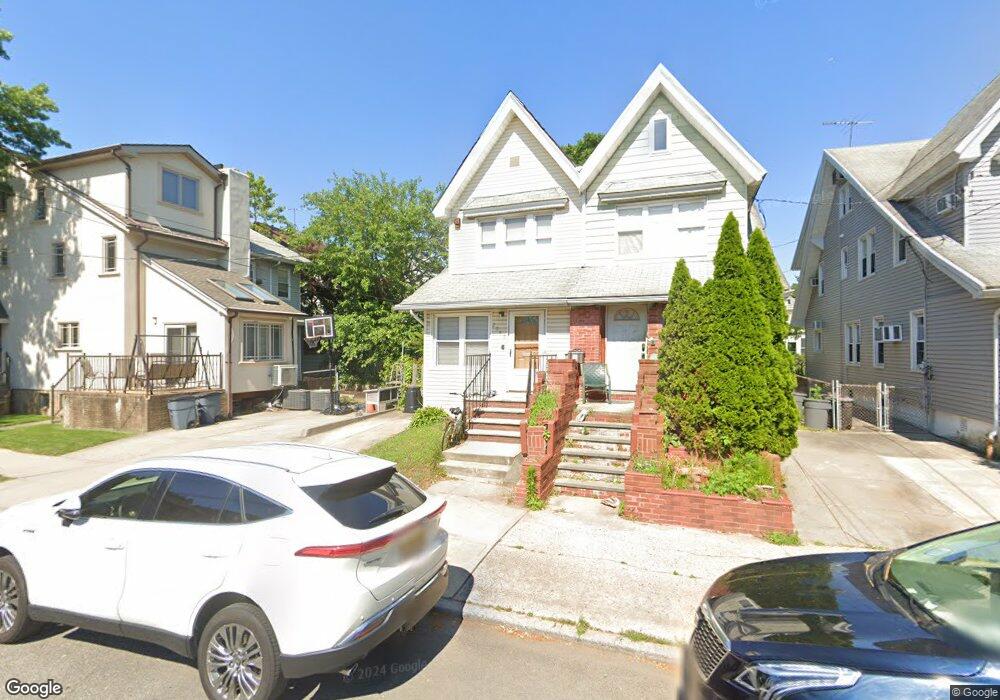
2069 New York Ave Brooklyn, NY 11210
Flatlands NeighborhoodEstimated Value: $896,000 - $1,060,000
--
Bed
--
Bath
1,274
Sq Ft
$743/Sq Ft
Est. Value
About This Home
This home is located at 2069 New York Ave, Brooklyn, NY 11210 and is currently estimated at $946,343, approximately $742 per square foot. 2069 New York Ave is a home located in Kings County with nearby schools including P.S. 193 Gil Hodges, Andries Hudde School, and Yeshivat Lev Torah.
Ownership History
Date
Name
Owned For
Owner Type
Purchase Details
Closed on
Jul 5, 2023
Sold by
Rosenberg Helen and Rosenberg Israel Zvi
Bought by
Horovitz Yocheved and Schwartz Tzvi
Current Estimated Value
Home Financials for this Owner
Home Financials are based on the most recent Mortgage that was taken out on this home.
Original Mortgage
$612,500
Outstanding Balance
$597,889
Interest Rate
6.79%
Mortgage Type
Purchase Money Mortgage
Estimated Equity
$348,454
Create a Home Valuation Report for This Property
The Home Valuation Report is an in-depth analysis detailing your home's value as well as a comparison with similar homes in the area
Home Values in the Area
Average Home Value in this Area
Purchase History
| Date | Buyer | Sale Price | Title Company |
|---|---|---|---|
| Horovitz Yocheved | $875,000 | -- |
Source: Public Records
Mortgage History
| Date | Status | Borrower | Loan Amount |
|---|---|---|---|
| Open | Horovitz Yocheved | $612,500 |
Source: Public Records
Tax History Compared to Growth
Tax History
| Year | Tax Paid | Tax Assessment Tax Assessment Total Assessment is a certain percentage of the fair market value that is determined by local assessors to be the total taxable value of land and additions on the property. | Land | Improvement |
|---|---|---|---|---|
| 2025 | $6,746 | $55,740 | $10,500 | $45,240 |
| 2024 | $6,746 | $44,040 | $10,500 | $33,540 |
| 2023 | $6,151 | $45,360 | $10,500 | $34,860 |
| 2022 | $6,039 | $46,740 | $10,500 | $36,240 |
| 2021 | $6,322 | $38,880 | $10,500 | $28,380 |
| 2020 | $6,322 | $45,540 | $10,500 | $35,040 |
| 2019 | $5,562 | $45,540 | $10,500 | $35,040 |
| 2018 | $5,085 | $26,407 | $5,776 | $20,631 |
| 2017 | $5,083 | $26,407 | $6,427 | $19,980 |
| 2016 | $4,929 | $26,207 | $6,980 | $19,227 |
| 2015 | $2,785 | $24,724 | $8,753 | $15,971 |
| 2014 | $2,785 | $23,325 | $8,635 | $14,690 |
Source: Public Records
Map
Nearby Homes
- 1328 E 35th St
- 1327 E 34th St
- 1358 E 35th St
- 2525 Nostrand Ave Unit 5S
- 2525 Nostrand Ave Unit 3R
- 2525 Nostrand Ave Unit 7S
- 2525 Nostrand Ave Unit 3F
- 2525 Nostrand Ave Unit 7E
- 3206 Avenue K
- 3402 Kings Hwy
- 3626 Kings Hwy
- 3626 Kings Hwy Unit 6C
- 1074 E 36th St
- 1329 E 37th St
- 1272 E 38th St
- 3622 Avenue M
- 3222 Kings Hwy
- 3708 Avenue M
- 3117 Kings Hwy
- 1046 E 32nd St
- 2071 New York Ave
- 2073 New York Ave
- 3308 Avenue L
- 2075 New York Ave
- 3304 Avenue L
- 3310 Avenue L
- 3310 Avenue L Unit 5KJ
- 3302 Avenue L
- 3312 Avenue L
- 2077 New York Ave
- 1372 E 34th St
- 1374 E 34th St
- 3316 Avenue L
- 1376 E 34th St
- 1380 E 34th St
- 2083 New York Ave
- 3224 Avenue L
- 3224 Avenue L Unit Building
- 1384 E 34th St
- 3320 Avenue L