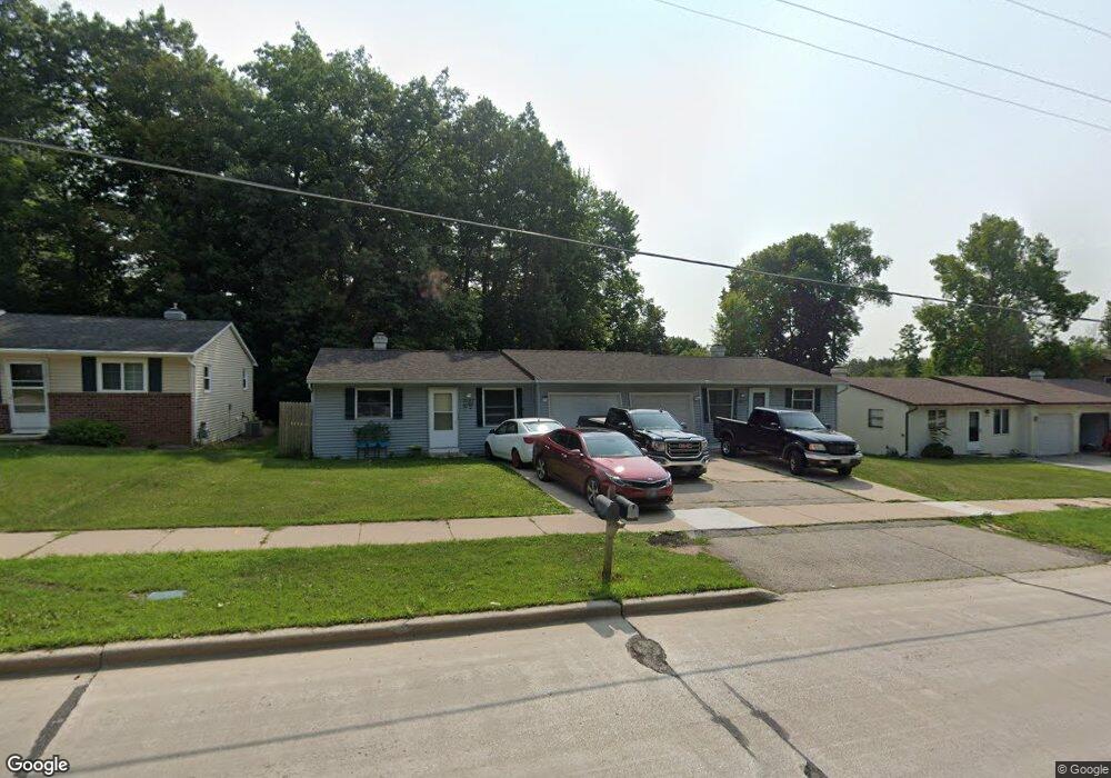
2069 Packerland Dr Unit 2071 Green Bay, WI 54304
Westside NeighborhoodEstimated Value: $331,000 - $350,000
--
Bed
--
Bath
--
Sq Ft
9,845
Sq Ft Lot
About This Home
This home is located at 2069 Packerland Dr Unit 2071, Green Bay, WI 54304 and is currently estimated at $343,333. 2069 Packerland Dr Unit 2071 is a home located in Brown County with nearby schools including MacArthur Elementary School, Lombardi Middle School, and Southwest High School.
Ownership History
Date
Name
Owned For
Owner Type
Purchase Details
Closed on
Aug 7, 2006
Sold by
Swille Randall D and Swille Anne E
Bought by
The Oneida Tribe Of Indians Of Wisconsin
Current Estimated Value
Purchase Details
Closed on
Sep 26, 1997
Sold by
Gupta Jwala P and Gupta Meena
Bought by
Swille Randall D and Swille Anne E
Home Financials for this Owner
Home Financials are based on the most recent Mortgage that was taken out on this home.
Original Mortgage
$112,500
Interest Rate
7.54%
Create a Home Valuation Report for This Property
The Home Valuation Report is an in-depth analysis detailing your home's value as well as a comparison with similar homes in the area
Home Values in the Area
Average Home Value in this Area
Purchase History
| Date | Buyer | Sale Price | Title Company |
|---|---|---|---|
| The Oneida Tribe Of Indians Of Wisconsin | $133,800 | None Available | |
| Swille Randall D | $125,000 | -- |
Source: Public Records
Mortgage History
| Date | Status | Borrower | Loan Amount |
|---|---|---|---|
| Previous Owner | Swille Randall D | $112,500 |
Source: Public Records
Tax History Compared to Growth
Tax History
| Year | Tax Paid | Tax Assessment Tax Assessment Total Assessment is a certain percentage of the fair market value that is determined by local assessors to be the total taxable value of land and additions on the property. | Land | Improvement |
|---|---|---|---|---|
| 2024 | $4,424 | $221,700 | $41,900 | $179,800 |
| 2023 | $4,289 | $221,700 | $41,900 | $179,800 |
| 2022 | $4,074 | $221,700 | $41,900 | $179,800 |
| 2021 | $3,804 | $156,100 | $33,300 | $122,800 |
| 2020 | $3,774 | $156,100 | $33,300 | $122,800 |
| 2019 | $3,725 | $156,100 | $33,300 | $122,800 |
| 2018 | $3,580 | $156,100 | $33,300 | $122,800 |
| 2017 | $3,488 | $156,100 | $33,300 | $122,800 |
| 2016 | $3,443 | $156,100 | $33,300 | $122,800 |
| 2015 | $3,413 | $156,100 | $33,300 | $122,800 |
| 2014 | $3,838 | $156,100 | $33,300 | $122,800 |
| 2013 | $3,838 | $156,100 | $33,300 | $122,800 |
Source: Public Records
Map
Nearby Homes
- 2060 Wintergreen Ct
- 2044 Ann Ln
- 1680 Cormier Rd
- 2060 Trissino Way
- 2466 Parkwood Dr
- 1570 Mesa Dr
- 2768 Independence Dr
- 1514 Ashley Ct
- 1973 Knotty Pine Dr
- 2640 He Nis Ra Ln
- 2550 He Nis Ra Ln
- 2441 Matchwood Ln
- 2031 Bradbury Ln
- 1471 Parkway Dr
- 1450 Woodmont Way
- 2439 W Point Rd
- 1433 Baumgart Rd Unit 1435
- 1445 Cormier Rd
- 1439 Cormier Rd
- 1921 Beech Tree Dr
- 2075 Packerland Dr Unit 2077
- 2070 Sandalwood Ct
- 2078 Sandalwood Ct
- 2087 Packerland Dr Unit 2
- 2085 Packerland Dr
- 2055 Packerland Dr Unit 2057
- 2062 Sandalwood Ct
- 2084 Sandalwood Ct
- 2056 Sandalwood Ct
- 2049 Packerland Dr Unit 2051
- 2596 Parkwood Dr Unit 2598
- 2594 Parkwood Dr
- 2100 Packerland Dr Unit BLOCK
- 2075 Sandalwood Ct
- 2079 Sandalwood Ct
- 2060 Packerland Dr
- 2065 Sandalwood Ct
- 2039 Packerland Dr Unit 2041
- 2041 Packerland Dr
- 2085 Sandalwood Ct