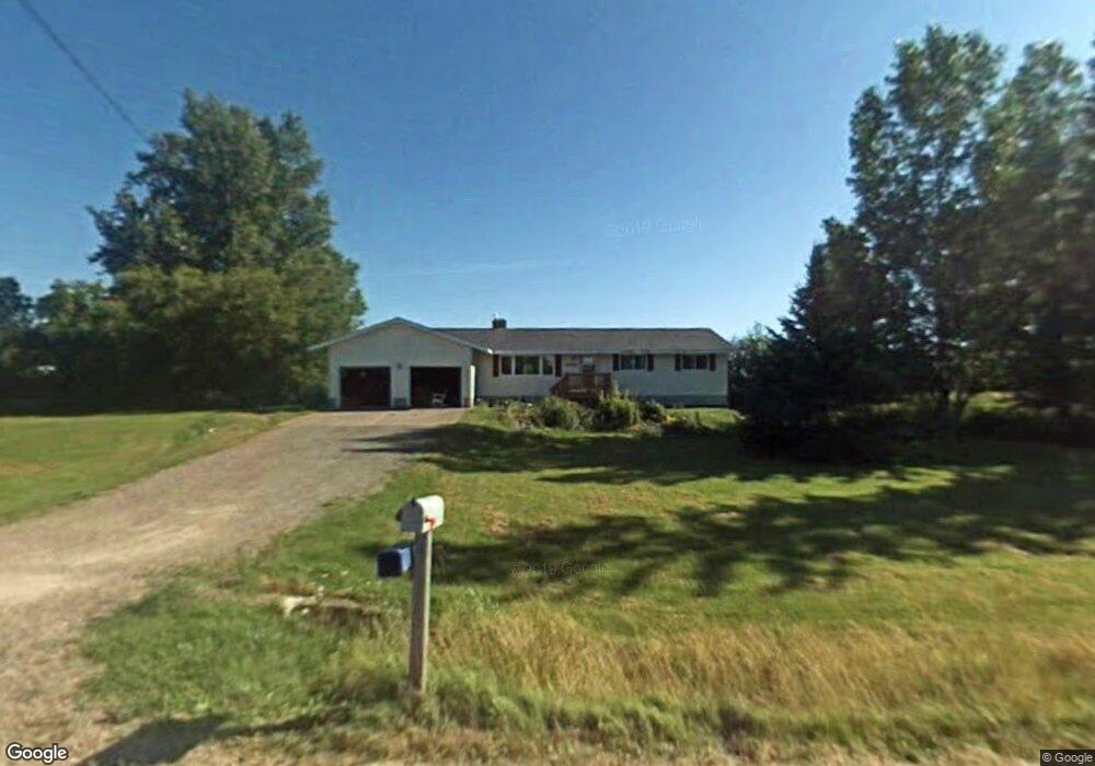
2069 W 3 Mile Rd Sault Sainte Marie, MI 49783
Estimated Value: $242,756 - $381,000
3
Beds
3
Baths
1,652
Sq Ft
$188/Sq Ft
Est. Value
About This Home
This home is located at 2069 W 3 Mile Rd, Sault Sainte Marie, MI 49783 and is currently estimated at $310,919, approximately $188 per square foot. 2069 W 3 Mile Rd is a home located in Chippewa County with nearby schools including Sault Area Middle School, Sault Area High School, and Joseph K. Lumsden Bahweting Anishnabe Academy.
Ownership History
Date
Name
Owned For
Owner Type
Purchase Details
Closed on
Aug 19, 2013
Sold by
Mcculligh Kenneth H and Mcculligh Jeanne M
Bought by
Howell Brian M and Howell Catherine A
Current Estimated Value
Home Financials for this Owner
Home Financials are based on the most recent Mortgage that was taken out on this home.
Original Mortgage
$113,400
Outstanding Balance
$84,129
Interest Rate
4.33%
Estimated Equity
$226,790
Purchase Details
Closed on
Jul 11, 2008
Sold by
Alford Kevin J and Alford Kimberly A
Bought by
Mcculligh Kenneth H and Mcculligh Jeanne M
Home Financials for this Owner
Home Financials are based on the most recent Mortgage that was taken out on this home.
Original Mortgage
$145,360
Interest Rate
6.36%
Create a Home Valuation Report for This Property
The Home Valuation Report is an in-depth analysis detailing your home's value as well as a comparison with similar homes in the area
Home Values in the Area
Average Home Value in this Area
Purchase History
| Date | Buyer | Sale Price | Title Company |
|---|---|---|---|
| Howell Brian M | $126,000 | -- | |
| Mcculligh Kenneth H | $180,000 | -- |
Source: Public Records
Mortgage History
| Date | Status | Borrower | Loan Amount |
|---|---|---|---|
| Open | Howell Brian M | $113,400 | |
| Previous Owner | Mcculligh Kenneth H | $145,360 |
Source: Public Records
Tax History Compared to Growth
Tax History
| Year | Tax Paid | Tax Assessment Tax Assessment Total Assessment is a certain percentage of the fair market value that is determined by local assessors to be the total taxable value of land and additions on the property. | Land | Improvement |
|---|---|---|---|---|
| 2025 | $3,033 | $108,200 | $0 | $0 |
| 2024 | $929 | $95,600 | $0 | $0 |
| 2023 | $841 | $82,700 | $0 | $0 |
| 2022 | $841 | $73,200 | $0 | $0 |
| 2021 | $1,453 | $67,200 | $0 | $0 |
| 2020 | $1,428 | $68,000 | $0 | $0 |
| 2019 | $1,402 | $68,000 | $0 | $0 |
| 2018 | $775 | $63,800 | $0 | $0 |
| 2017 | $774 | $63,700 | $0 | $0 |
| 2016 | $786 | $64,700 | $0 | $0 |
| 2011 | $815 | $66,400 | $0 | $0 |
Source: Public Records
Map
Nearby Homes
- 1605 S Mulligan Row
- 1605 S Mulligan Row Unit 1605
- 3601 S Radar Rd
- 3438 S Reynolds Ln
- 3546 S Radar Rd
- 2550 W 14th St
- 647 W Ford Dr Unit 647
- 0000 W 11th Ave
- 0000 W 11th Ave
- 0 W 24th St
- 3805 I 75 Business Spur
- 00 W 16th Ave
- 1811 Chestnut St
- 4538 S Baker Side Rd
- 1427 W 14th St
- 2245 W 5th Ave
- 0 W 24th Ave
- 3105 Sherman Park Dr
- 3220 Sherman Park Dr
- 3325 Lakeshore Dr
- 1729 W 3 Mile Rd
- 1713 W 3 Mile Rd
- 1644 W 3 Mile Rd
- 1937 W 3 Mile Rd
- 1959 W 3 Mile Rd
- 1683 W 3 Mile Rd
- 1679 W 3 Mile Rd
- 1795 W 3 Mile Rd
- 1687 W 3 Mile Rd
- 1691 W 3 Mile Rd
- 2120 W 3 Mile Rd
- 2120 W 3 Mile Rd
- 2337 W 3 Mile Rd
- 2337 W 3 Mile Rd
- 2337 W 3 Mile Rd
- 1570 W 3 Mile Rd
- 3137 S Baker Side Rd
- 1500 W 3 Mile Rd
- 3034 S Baker Side Rd
- 2034 W 3 Mile Rd