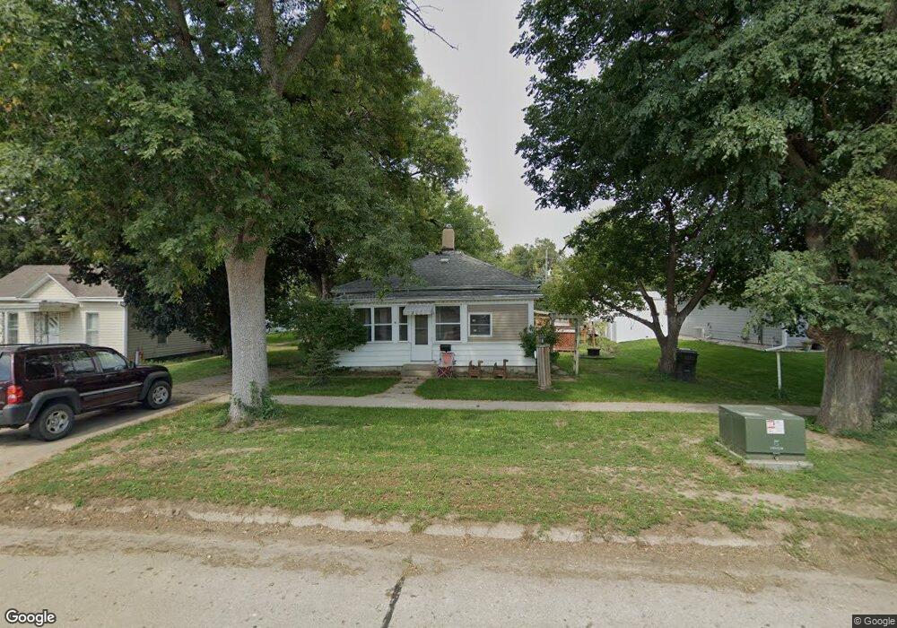
207 5th St Sergeant Bluff, IA 51054
Estimated Value: $115,000 - $272,000
2
Beds
1
Bath
1,110
Sq Ft
$169/Sq Ft
Est. Value
About This Home
This home is located at 207 5th St, Sergeant Bluff, IA 51054 and is currently estimated at $188,038, approximately $169 per square foot. 207 5th St is a home located in Woodbury County with nearby schools including Sergeant Bluff-Luton Primary School, Sergeant Bluff-Luton Elementary School, and Sergeant Bluff-Luton Middle School.
Ownership History
Date
Name
Owned For
Owner Type
Purchase Details
Closed on
Jan 12, 2007
Sold by
Resel Kay A
Bought by
Deroin Bradley P and Deroin Angela J
Current Estimated Value
Home Financials for this Owner
Home Financials are based on the most recent Mortgage that was taken out on this home.
Original Mortgage
$55,500
Outstanding Balance
$33,167
Interest Rate
6.21%
Mortgage Type
New Conventional
Estimated Equity
$154,871
Create a Home Valuation Report for This Property
The Home Valuation Report is an in-depth analysis detailing your home's value as well as a comparison with similar homes in the area
Home Values in the Area
Average Home Value in this Area
Purchase History
| Date | Buyer | Sale Price | Title Company |
|---|---|---|---|
| Deroin Bradley P | $55,500 | -- |
Source: Public Records
Mortgage History
| Date | Status | Borrower | Loan Amount |
|---|---|---|---|
| Open | Deroin Bradley P | $55,500 |
Source: Public Records
Tax History
| Year | Tax Paid | Tax Assessment Tax Assessment Total Assessment is a certain percentage of the fair market value that is determined by local assessors to be the total taxable value of land and additions on the property. | Land | Improvement |
|---|---|---|---|---|
| 2025 | $1,542 | $103,280 | $12,670 | $90,610 |
| 2024 | $15 | $99,940 | $11,310 | $88,630 |
| 2023 | $1,316 | $99,940 | $11,310 | $88,630 |
| 2022 | $1,306 | $74,920 | $11,310 | $63,610 |
| 2021 | $1,306 | $74,920 | $11,310 | $63,610 |
| 2020 | $1,190 | $68,860 | $12,100 | $56,760 |
| 2019 | $1,138 | $66,990 | $12,100 | $54,890 |
| 2018 | $1,110 | $63,170 | $12,100 | $51,070 |
| 2017 | $1,204 | $63,170 | $12,100 | $51,070 |
| 2016 | $1,226 | $63,170 | $0 | $0 |
| 2015 | $1,084 | $59,040 | $11,310 | $47,730 |
| 2014 | $1,023 | $54,260 | $11,310 | $42,950 |
Source: Public Records
Map
Nearby Homes
Your Personal Tour Guide
Ask me questions while you tour the home.