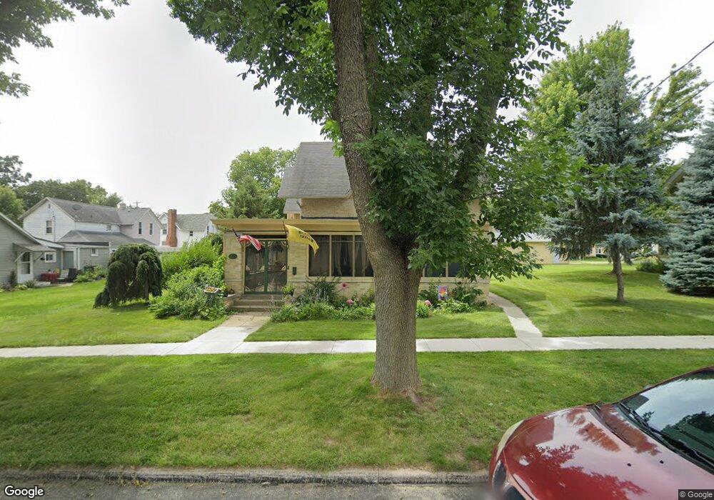
207 Adams St Fort Atkinson, WI 53538
Estimated Value: $273,000 - $314,000
--
Bed
--
Bath
--
Sq Ft
8,625
Sq Ft Lot
About This Home
This home is located at 207 Adams St, Fort Atkinson, WI 53538 and is currently estimated at $297,892. 207 Adams St is a home located in Jefferson County with nearby schools including Barrie Elementary School, Fort Atkinson Middle School, and Fort Atkinson High School.
Ownership History
Date
Name
Owned For
Owner Type
Purchase Details
Closed on
Dec 8, 2015
Sold by
Schroeder Margaret Mcfarlane and Schroeder Paul Smyth
Bought by
Coons Douglas L and Coons Julie C
Current Estimated Value
Home Financials for this Owner
Home Financials are based on the most recent Mortgage that was taken out on this home.
Original Mortgage
$95,400
Outstanding Balance
$75,142
Interest Rate
3.75%
Mortgage Type
New Conventional
Estimated Equity
$222,750
Purchase Details
Closed on
Jul 1, 2005
Sold by
Schroeder Margaret Mcfarlane
Bought by
Schroeder Margaret Mcfarlane and Schroeder Paul Smyth
Home Financials for this Owner
Home Financials are based on the most recent Mortgage that was taken out on this home.
Original Mortgage
$131,650
Interest Rate
5.68%
Mortgage Type
New Conventional
Create a Home Valuation Report for This Property
The Home Valuation Report is an in-depth analysis detailing your home's value as well as a comparison with similar homes in the area
Home Values in the Area
Average Home Value in this Area
Purchase History
| Date | Buyer | Sale Price | Title Company |
|---|---|---|---|
| Coons Douglas L | $156,700 | None Available | |
| Schroeder Margaret Mcfarlane | -- | None Available |
Source: Public Records
Mortgage History
| Date | Status | Borrower | Loan Amount |
|---|---|---|---|
| Open | Coons Douglas L | $95,400 | |
| Previous Owner | Schroeder Margaret Mcfarlane | $131,650 |
Source: Public Records
Tax History Compared to Growth
Tax History
| Year | Tax Paid | Tax Assessment Tax Assessment Total Assessment is a certain percentage of the fair market value that is determined by local assessors to be the total taxable value of land and additions on the property. | Land | Improvement |
|---|---|---|---|---|
| 2024 | $4,090 | $219,200 | $42,500 | $176,700 |
| 2023 | $3,732 | $219,200 | $42,500 | $176,700 |
| 2022 | $4,076 | $156,900 | $29,500 | $127,400 |
| 2021 | $3,597 | $156,900 | $29,500 | $127,400 |
| 2020 | $3,525 | $156,900 | $29,500 | $127,400 |
| 2019 | $3,583 | $156,900 | $29,500 | $127,400 |
| 2018 | $3,419 | $156,900 | $29,500 | $127,400 |
| 2017 | $3,186 | $156,400 | $29,500 | $126,900 |
| 2016 | $3,235 | $153,000 | $28,400 | $124,600 |
| 2015 | $3,354 | $153,000 | $28,400 | $124,600 |
| 2014 | $3,239 | $153,000 | $28,400 | $124,600 |
| 2013 | $3,324 | $153,000 | $28,400 | $124,600 |
Source: Public Records
Map
Nearby Homes
- 125 Monroe St
- 311 N Main St
- 715 Madison Ave
- 234 S Main St
- 336 Jones Ave
- 520 Edward St
- 233 S Water St E
- 426 Jefferson St
- 605 Nelson St
- 214 Hickory St
- 916 Madison Ave
- 416 N 3rd St
- 1120 Van Buren St
- 42 Wilson Ave
- 609 Cloute St
- 845 Messmer St
- 1220 Sherman Ave W
- 1222 Sherman Ave W Unit P
- 702 Florence St
- 707 N Fourth St
- 213 Adams St
- 304 Sherman Ave W
- 300 Sherman Ave W
- 213 Barrie St
- 206 Adams St
- 308 Sherman Ave W
- 313 Barrie St
- 202 Adams St
- 209 Barrie St
- 314 Sherman Ave W
- 212 Barrie St
- 300 Riverside Dr
- 208 Barrie St
- 219 Sherman Ave W Unit 221
- 223 Sherman Ave W
- 213 Sherman Ave W
- 306 Riverside Dr
- 307 Riverside Dr
- 308 Adams St
- 315 Adams St