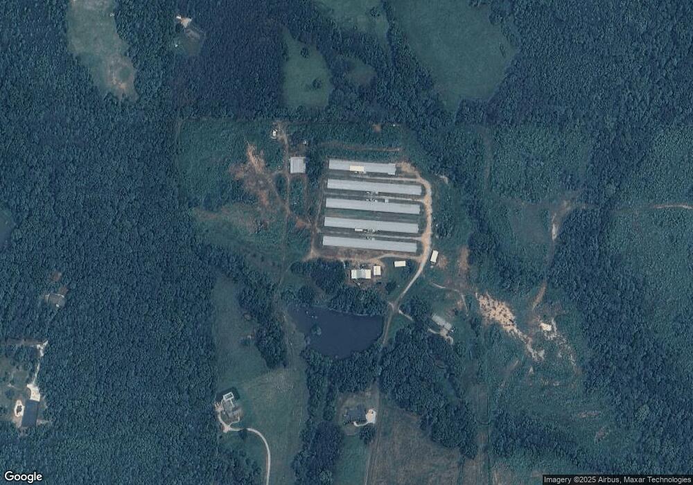
207 Armstrong Rd Carrollton, GA 30117
Abilene NeighborhoodEstimated Value: $298,000 - $841,951
2
Beds
1
Bath
1,852
Sq Ft
$287/Sq Ft
Est. Value
About This Home
This home is located at 207 Armstrong Rd, Carrollton, GA 30117 and is currently estimated at $530,988, approximately $286 per square foot. 207 Armstrong Rd is a home located in Carroll County with nearby schools including Sharp Creek Elementary School, Temple Middle School, and Temple High School.
Ownership History
Date
Name
Owned For
Owner Type
Purchase Details
Closed on
Aug 2, 2019
Sold by
Armstrong John P
Bought by
Armstrong Nathaniel Adam and Almon Ashley Armstrong
Current Estimated Value
Purchase Details
Closed on
Jul 22, 1996
Sold by
Stovall
Bought by
Armstrong John P
Purchase Details
Closed on
Feb 11, 1976
Bought by
Armstrong John P
Create a Home Valuation Report for This Property
The Home Valuation Report is an in-depth analysis detailing your home's value as well as a comparison with similar homes in the area
Home Values in the Area
Average Home Value in this Area
Purchase History
| Date | Buyer | Sale Price | Title Company |
|---|---|---|---|
| Armstrong Nathaniel Adam | -- | -- | |
| Armstrong John P | -- | -- | |
| Armstrong John P | -- | -- |
Source: Public Records
Tax History Compared to Growth
Tax History
| Year | Tax Paid | Tax Assessment Tax Assessment Total Assessment is a certain percentage of the fair market value that is determined by local assessors to be the total taxable value of land and additions on the property. | Land | Improvement |
|---|---|---|---|---|
| 2024 | -- | $301,550 | $185,128 | $116,422 |
| 2023 | $141 | $256,752 | $148,102 | $108,650 |
| 2022 | $493 | $192,592 | $98,734 | $93,858 |
| 2021 | $637 | $164,189 | $78,987 | $85,202 |
| 2020 | $676 | $151,232 | $71,806 | $79,426 |
| 2019 | $2,378 | $158,536 | $78,583 | $79,953 |
| 2018 | $2,699 | $157,819 | $68,332 | $89,487 |
| 2017 | $2,772 | $162,264 | $68,332 | $93,932 |
| 2016 | $2,954 | $146,210 | $47,834 | $98,376 |
| 2015 | $3,171 | $152,921 | $52,740 | $100,182 |
| 2014 | $3,296 | $157,366 | $52,740 | $104,626 |
Source: Public Records
Map
Nearby Homes
- 446 McGukin Rd
- 549 McGukin Rd
- 1800 Mandeville Rd
- 0 Old Center Point Rd Unit 10576496
- 0 Old Center Point Rd Unit 147359
- 177 Garnett Point Dr
- 650 N Raburn Rd
- 2930 Hog Liver Rd
- Plan 1709 at Saddle Ridge
- Plan 3119 at Saddle Ridge
- Plan 1902 at Saddle Ridge
- Plan 2131 at Saddle Ridge
- Plan 2307 at Saddle Ridge
- Plan 2604 at Saddle Ridge
- 2519 Hog Liver Rd
- 539 Saddle Chase Dr
- 1249 Center Point Rd
- 1549 Georgia Ave S
- 25 Adalee Rd
- 0000 Hog Liver Rd
- 255 Armstrong Rd
- 221 Armstrong Rd
- 482 McGukin Rd
- 0 McGukin Rd Unit VTR2 7391350
- 454 McGukin Rd
- 346 McGukin Rd
- 346 McGukin Rd Unit 2
- 548 McGukin Rd
- 472 McGukin Rd
- 0 McGukin Rd
- 534 McGukin Rd
- 407 McGukin Rd
- 282 McGukin Rd
- 465 McGukin Rd
- 0 Armstrong Rd Unit 8726586
- 0 Armstrong Rd Unit 8951282
- 0 Armstrong Rd
- 566 McGukin Rd
- 281 Armstrong Rd
- 427 McGukin Rd
