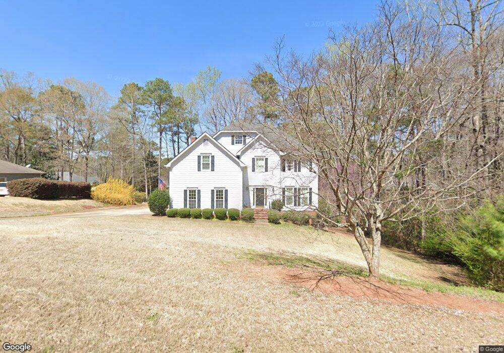
207 Ashford Cir Lagrange, GA 30240
Estimated Value: $368,379 - $450,000
4
Beds
3
Baths
2,904
Sq Ft
$141/Sq Ft
Est. Value
About This Home
This home is located at 207 Ashford Cir, Lagrange, GA 30240 and is currently estimated at $410,345, approximately $141 per square foot. 207 Ashford Cir is a home located in Troup County with nearby schools including Franklin Forest Elementary School, Hollis Hand Elementary School, and Ethel W. Kight Elementary School.
Ownership History
Date
Name
Owned For
Owner Type
Purchase Details
Closed on
Jan 22, 2019
Sold by
Bryant Carole W
Bought by
Bryant Bretley H
Current Estimated Value
Purchase Details
Closed on
Sep 4, 2002
Sold by
Anne Rod M and Anne Duraski
Bought by
Bryant Bretley H and Bryant Carole W
Purchase Details
Closed on
Feb 24, 1995
Sold by
West Ga Estates Inc
Bought by
Anne Rod M and Anne Duraski
Purchase Details
Closed on
Jun 14, 1985
Sold by
Heinrich J Boggess
Bought by
West Ga Estates Inc
Create a Home Valuation Report for This Property
The Home Valuation Report is an in-depth analysis detailing your home's value as well as a comparison with similar homes in the area
Home Values in the Area
Average Home Value in this Area
Purchase History
| Date | Buyer | Sale Price | Title Company |
|---|---|---|---|
| Bryant Bretley H | -- | -- | |
| Bryant Bretley H | $230,000 | -- | |
| Anne Rod M | $172,000 | -- | |
| West Ga Estates Inc | -- | -- |
Source: Public Records
Tax History Compared to Growth
Tax History
| Year | Tax Paid | Tax Assessment Tax Assessment Total Assessment is a certain percentage of the fair market value that is determined by local assessors to be the total taxable value of land and additions on the property. | Land | Improvement |
|---|---|---|---|---|
| 2024 | $3,565 | $132,720 | $18,000 | $114,720 |
| 2023 | $3,261 | $121,560 | $14,000 | $107,560 |
| 2022 | $3,134 | $114,280 | $14,000 | $100,280 |
| 2021 | $3,013 | $101,880 | $14,000 | $87,880 |
| 2020 | $3,013 | $101,880 | $14,000 | $87,880 |
| 2019 | $2,950 | $99,800 | $14,000 | $85,800 |
| 2018 | $2,950 | $99,800 | $14,000 | $85,800 |
| 2017 | $2,950 | $99,800 | $14,000 | $85,800 |
| 2016 | $2,925 | $98,967 | $14,000 | $84,967 |
| 2015 | $2,930 | $98,967 | $14,000 | $84,967 |
| 2014 | $2,882 | $97,216 | $14,000 | $83,216 |
| 2013 | -- | $97,880 | $14,000 | $83,880 |
Source: Public Records
Map
Nearby Homes
- 118 Moss Creek Dr
- 117 Woodchase
- 107 Windridge
- 129 Sunny Point Cir
- 109 Windridge
- 105 Ridgeview Dr
- LOT 106 River Oaks Dr
- 104 Hidden Branches Ln
- 209 River Oaks Dr
- 127 Oakmont Dr
- 127 Ashling Dr
- 91 Richmond Dr
- 1784 New Franklin Rd
- 100 Creekside Dr Unit LOT 60A
- 107 Dixie Creek Dr
- 89 Chase Rd
- 106 Highland Park
- 203 S Chilton Crescent
- 201 S Chilton Crescent
- 106 S Chilton Crescent
- 205 Ashford Cir
- 209 Ashford Cir
- 106 Moss Creek Dr
- 206 Ashford Cir
- 104 Moss Creek Dr
- 108 Moss Creek Dr
- 208 Ashford Cir
- 203 Ashford Cir
- 204 Ashford Cir
- 102 Moss Creek Dr
- 211 Ashford Cir
- 110 Moss Creek Dr Unit 40
- 110 Moss Creek Unit 40
- 210 Ashford Cir
- 0 Moss Creek Dr Unit 7316855
- 0 Moss Creek Dr Unit 3277309
- 0 Moss Creek Dr Unit 3232736
- 0 Moss Creek Dr Unit 8613800
- 0 Moss Creek Dr Unit 8038815
- 0 Moss Creek Dr Unit 8239616