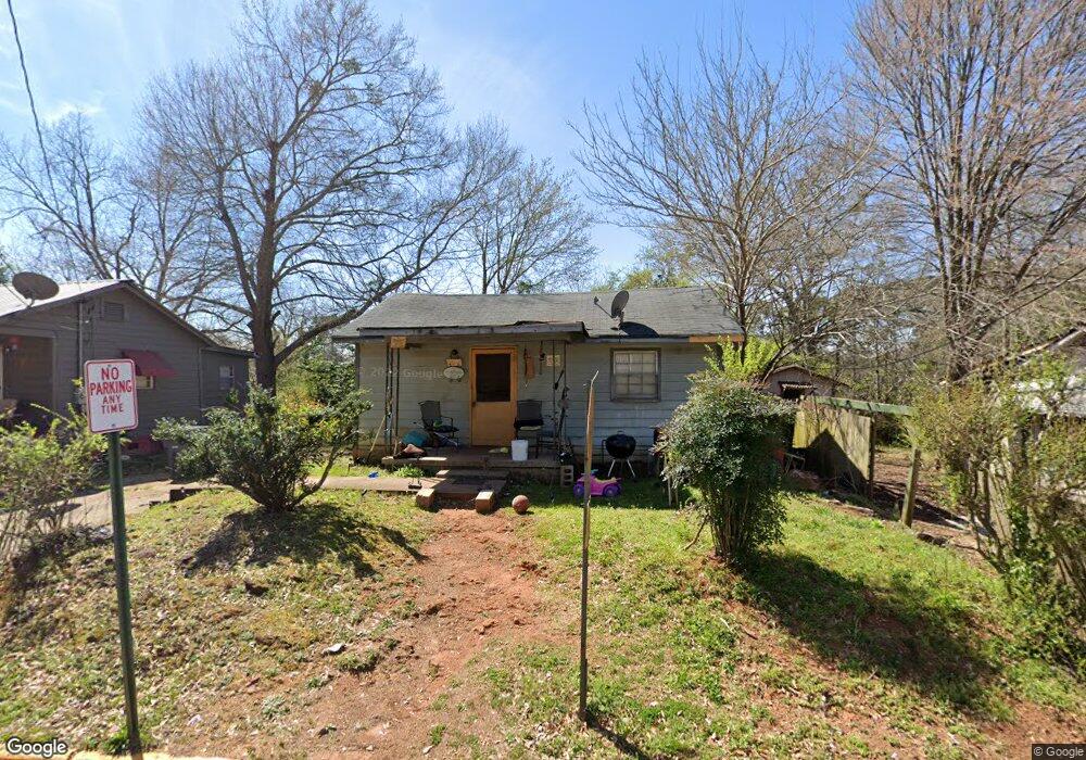
207 Banks St Lagrange, GA 30240
Estimated Value: $55,014 - $108,000
2
Beds
1
Bath
752
Sq Ft
$97/Sq Ft
Est. Value
About This Home
This home is located at 207 Banks St, Lagrange, GA 30240 and is currently estimated at $72,754, approximately $96 per square foot. 207 Banks St is a home located in Troup County with nearby schools including Franklin Forest Elementary School, Hollis Hand Elementary School, and Ethel W. Kight Elementary School.
Ownership History
Date
Name
Owned For
Owner Type
Purchase Details
Closed on
Sep 18, 2020
Sold by
Landstuhl Proeprties Llc
Bought by
Harvey Noel Mark
Current Estimated Value
Purchase Details
Closed on
Mar 8, 1984
Sold by
Lancaster Virginia Emory
Bought by
Mallory Richard H
Purchase Details
Closed on
Dec 1, 1982
Sold by
Lancaster B A
Bought by
Lancaster Virginia Emory
Purchase Details
Closed on
Jan 1, 1950
Sold by
Mrs Georgia A Bradfield
Bought by
Lancaster B A
Create a Home Valuation Report for This Property
The Home Valuation Report is an in-depth analysis detailing your home's value as well as a comparison with similar homes in the area
Home Values in the Area
Average Home Value in this Area
Purchase History
| Date | Buyer | Sale Price | Title Company |
|---|---|---|---|
| Harvey Noel Mark | $41,900 | -- | |
| Mallory Richard H | $15,000 | -- | |
| Lancaster Virginia Emory | -- | -- | |
| Lancaster B A | -- | -- |
Source: Public Records
Tax History Compared to Growth
Tax History
| Year | Tax Paid | Tax Assessment Tax Assessment Total Assessment is a certain percentage of the fair market value that is determined by local assessors to be the total taxable value of land and additions on the property. | Land | Improvement |
|---|---|---|---|---|
| 2024 | $351 | $12,880 | $720 | $12,160 |
| 2023 | $235 | $8,600 | $720 | $7,880 |
| 2022 | $219 | $7,840 | $720 | $7,120 |
| 2021 | $150 | $5,360 | $720 | $4,640 |
| 2020 | $182 | $6,040 | $720 | $5,320 |
| 2019 | $129 | $4,270 | $750 | $3,520 |
| 2018 | $129 | $4,270 | $750 | $3,520 |
| 2017 | $129 | $4,270 | $750 | $3,520 |
| 2016 | $128 | $4,233 | $750 | $3,483 |
| 2015 | $122 | $4,032 | $549 | $3,483 |
| 2014 | $122 | $4,032 | $549 | $3,483 |
| 2013 | -- | $4,582 | $732 | $3,850 |
Source: Public Records
Map
Nearby Homes
- 219 Banks St
- 109 Thomas St
- 0 Ridley Ave Unit 10550104
- 609 Ridley Ave
- 707 Ridley Ave
- 611 Ridley Ave
- 615 Ridley Ave
- 709 Ridley Ave
- 900 North St
- 301 E Bacon St
- 110 Russell St
- 109 Dogwood Dr
- 145 Turner St
- 408 Gordon St
- 204 Colonial St
- 600,606,608,616 S Harlem
- 105 Saynor Cir
- 806 New Franklin Rd
- 102 Ewing St
- 706 N Harlem Cir